2000-2009 Maps of Arizona
Explore 117 historic maps of Arizona from 2000-2009. These maps offer a rare glimpse into what life looked like during the 2000s — showing old roads, neighborhoods, homes, and landmarks that have changed or disappeared over time.
Whether you're researching your family's past, planning a metal detecting trip, or studying how Arizona's landscape evolved across the 2000s, these high-resolution maps are a powerful tool for exploring the history of this region.
- Focus on a specific era: All maps on this page are from the 2000s, giving you a focused view of this time period.
- See what’s changed: Compare century-old streets, trails, and buildings to today's modern landscape using overlays and satellite layers.
- Research with precision: Use these maps for genealogy, historical research, land use analysis, or educational projects.
- View, download, or print: Maps are fully viewable online in high resolution, and can be downloaded or printed for your own records.
Start exploring Arizona's history through authentic maps from the 2000s. This is your window into the past.
Arizona maps
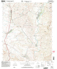
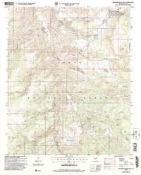
(117)- 2004 Map of Kayler Butte, 2006 Print
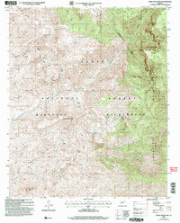
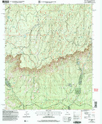
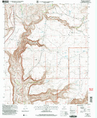
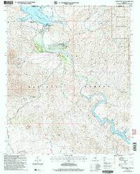
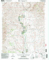 2004 Kayler Butte2006 Print · USGSCentral Arizona's Gila County backcountry is captured here in the early 2000s, showcasing a landscape of high desert basins and springs. Researchers can trace the Old Fort Reno (Site), locate the Branson Ranch, or find the small Cem near the valley floor.
 - 2004 Map of Dane Canyon, 2006 Print
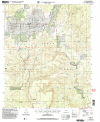
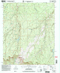
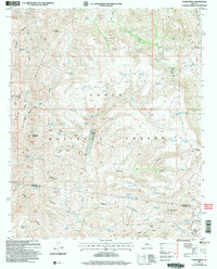
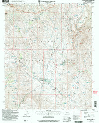
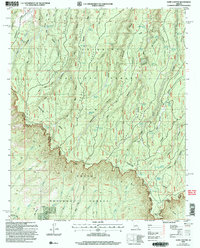 2004 Dane Canyon2006 Print · USGSThe dramatic Mogollon Rim country in the early 2000s shows a landscape of deep canyons and historic trails. Trace the path of the General George Crook Trail or locate remote sites like the Holder Cabin (Site) and Myrtle L.
 - 2004 Map of Daisy Mountain, 2006 Print
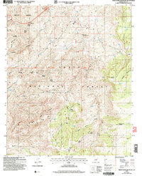
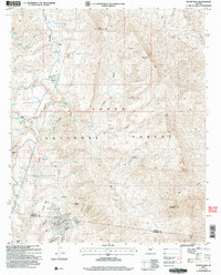
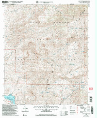
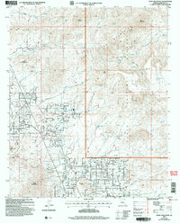 2004 Daisy Mountain2006 Print · USGSMaricopa County's northern desert frontier is captured here at a moment of rapid change in the early 2000s. Researchers can trace the legacy of mining and ranching through landmarks like the Daisy Mine and King Well alongside newer developments near Gavilan Peak.
 - 2004 Map of Copper Mountain, 2006 Print
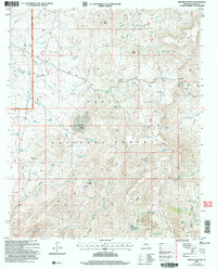
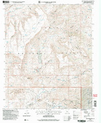
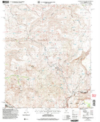
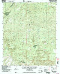 2004 Copper Mountain2006 Print · USGSThe Sierra Ancha and Tonto Basin country in the early 2000s remain a landscape of remote cattle operations and deep wilderness. Researchers can trace historic grazing boundaries and find isolated landmarks like Z T Ranch, Dupont Cabin, and Indian Camp Reservoir.
 - 2004 Map of Table Mountain, 2006 Print
 2004 Table Mountain2006 Print · USGSThe high Mazatzal range in central Arizona is captured here as it appeared in the early 2000s, showing a landscape preserved for its wild character. Hikers and historians can trace the paths of the Mazatzal Trail and Deadman Trail past remote sites like Table Mountain.
 - 2004 Map of Young, 2006 Print
 2004 Young2006 Print · USGSPleasant Valley at the start of the twenty-first century remains a resilient ranching and forest community. Genealogists and historians can trace the foundations of Young and its rural outskirts, from the Pleasant Valley Sch to the remote Grave at the edge of the forest.
 - 2004 Map of Rock House, 2006 Print
 2004 Rock House2006 Print · USGSGila County ranching and mining lands are captured here in the early 2000s, showing the intersection of forest and reservation boundaries. Researchers can trace land use through features like the Rock House settlement, the Horse Camp Windmill, and numerous prospects near Brushy Top Mountain.
 - 2004 Map of Green Valley, 2006 Print
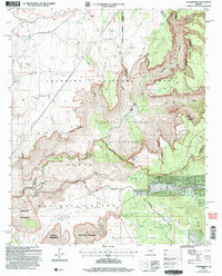
 2004 Green Valley2006 Print · USGSGreen Valley and Continental expand into the Pima County desert during the early 2000s as residential subdivisions meet managed wilderness. Researchers can trace the development of Madera Shadows and locate landmarks like Continental Sch or the Cem near the river.
 - 2004 Map of Gisela, 2006 Print
 2004 Gisela2006 Print · USGSThe Tonto Basin ranching landscape is captured here in the early 2000s, showing the intersection of forest management and creek-side settlement. Genealogists and historians can trace family locations at Seventy Six Ranch, Gisela, and the Cem near Haycox Mountain.
 - 2004 Map of Strawberry, 2006 Print
 2004 Strawberry2006 Print · USGSStrawberry sits tucked beneath the dramatic Mogollon Rim during the early 2000s, where high plateau ranching meets deep canyon wilderness. Genealogists and historians can trace family-named water sources and historic routes like the Lazy T-7 Ranch and the General George Crook National Recreation Trail.
 - 2004 Map of Diamond Butte, 2006 Print
 2004 Diamond Butte2006 Print · USGSGila County ranching and mining history come into focus in this mid-2000s survey of the Tonto National Forest. Genealogists and researchers can trace family-named sites like Ellinwood Ranch, the Ellison Mine, and Marsh Creek Ranch among the canyons.
 - 2004 Map of Amado, 2006 Print
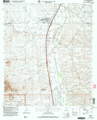 2004 Amado2006 Print · USGSThe Santa Cruz River valley comes into focus during the early 2000s, showing a mix of historic ranching and modern residential growth. Genealogists and researchers can trace family-named sites like Sopori Ranch and Rex Ranch or locate the Sopori Sch near Arivaca Junction.
 - 2004 Map of Kehl Ridge, 2006 Print
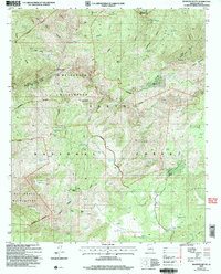
 2004 Kehl Ridge2006 Print · USGSThe high rim country of Gila County is documented here in the early 2000s, showing the intersection of two national forests. Researchers can trace historic access routes like the Highline Trail and locate isolated settlements including Washington Park and Rim Trail Mountain Club Estates.
 - 2004 Map of Knoll Lake, 2006 Print
 2004 Knoll Lake2006 Print · USGSThe high Mogollon Rim country comes into focus in the early 2000s, where three national forests meet along deep canyon drainages. Researchers can trace historic forest infrastructure and water sources like the O'Haco Lookout, Knoll Lake, and the Tonto State Fish Hatchery.
 - 2004 Map of Sheep Basin Mountain, 2006 Print
 2004 Sheep Basin Mountain2006 Print · USGSThe high country of Gila County is seen here during the mid-2000s, showing a rugged landscape of ranching outposts and forest service infrastructure. You can trace early corridors like Pleasant Valley Road and locate remote camps and springs including Soldier Camp and Conway Spring.
 - 2004 Map of Brooklyn Peak, 2006 Print
 2004 Brooklyn Peak2006 Print · USGSArizona's high-country ranching and mining history is preserved here at the start of the new millennium within the Tonto National Forest. Genealogists and historians can trace isolated landmarks like the Rosalie Mine, Six Bar Ranch, and Hogan Cabin.
 - 2004 Map of Joes Hill, 2006 Print
 2004 Joes Hill2006 Print · USGSThe high mesas and river canyons of Yavapai County are shown in detail here just after the turn of the century. Trace the historic Richinbar Mine and find isolated water sources like Ruins Tank and Lousy Tank across Perry Mesa.
 - 2004 Map of Cooks Mesa, 2006 Print
 2004 Cooks Mesa2006 Print · USGSThe arid canyons of the Arizona backcountry are captured here in the mid-2000s, showing a landscape defined by water and terrain. Traces of ranching life and mining prospects appear alongside Upper Ranch, Tin Trough Spring, and Six Bar Hole.
 - 2004 Map of Rover Peak, 2006 Print
 2004 Rover Peak2006 Print · USGSYavapai and Maricopa County ranchlands and mining claims are surveyed here in the early 2000s. Genealogists and historians can trace old homesteads at Holmes and the 51 Ranch, or locate the historic Red Rover Mine and the archaeological site at Indian Ruin Tank.
 - 2004 Map of New River Mesa, 2006 Print
 2004 New River Mesa2006 Print · USGSThe high mesas of Maricopa County are shown here in the early 2000s, documenting a landscape of mining claims and forest land. Trace the history of desert prospecting at the Phoenix Mine or follow old routes like the Skunk Cave Trail past Elephant Mountain.
 - 2004 Map of Horseshoe Dam, 2006 Print
 2004 Horseshoe Dam2006 Print · USGSThe Verde River canyon at the Yavapai and Maricopa county line is shown here in the early 2000s, defined by its massive reservoirs and remote wilderness. Researchers can locate ranching history at K A Ranch, recreation at the Ocotillo Boating Site, and backcountry routes like the Davenport Trail.
 - 2004 Map of Bloody Basin, 2006 Print
 2004 Bloody Basin2006 Print · USGSCentral Arizona's high-desert ranching and wilderness areas are mapped here as they appeared in the early 2000s. Researchers can locate remote outposts like LX Bar Ranch and Red Creek Ranch alongside landmarks like Turret Peak and the Marbles Mine.
 - 2004 Map of Lion Mountain, 2006 Print
 2004 Lion Mountain2006 Print · USGSThe Mazatzal Mountains and Tonto National Forest appear here during the early 2000s, showing a rugged landscape of springs and old mining claims. Genealogists and historians can trace remote sites like the S B Cabin, the Story Mine, and the waters of Bartlett Reservoir.
 - 2004 Map of Hackberry Mountain, 2006 Print
 2004 Hackberry Mountain2006 Print · USGSArizona's high desert and national forest lands are captured in the early 2000s before modern developments reshaped the backcountry. Researchers can trace the historic General George Crook National Recreation Trail and locate remote water sources like Tenmile Tank and Sycamore Spring.
 - 2004 Map of Buzzard Roost Mesa, 2006 Print
 2004 Buzzard Roost Mesa2006 Print · USGSIn the early 2000s, this pocket of Gila County shows a high-country landscape dominated by ranching and forest service management. Researchers can trace historic grazing sites and water improvements like Flying W Ranch, Spring Creek Ranch, and the Cabin Trail.
Showing maps 1-25 of 117
Top cities of Arizona
- Phoenix historical maps
- Tucson historical maps
- Mesa historical maps
- Chandler historical maps
- Glendale historical maps
- Scottsdale historical maps
See more
Top counties of Arizona
- Maricopa County historical maps
- Pima County historical maps
- Pinal County historical maps
- Yavapai County historical maps
- Mohave County historical maps
- Coconino County historical maps
See more
Frequently asked questions
- What are the different types of historical maps available for Arizona?
- What is the oldest map of Arizona?
- Where can I purchase historical maps of Arizona for my home or office?
- Where can I download high-res historical maps of Arizona?
- Are there historical topographic maps available for Arizona?
- Is there historical aerial imagery available for Arizona?
- Where are historical maps of Arizona sourced from?