1960s Maps of Arizona
Explore 650 historic maps of Arizona from the 1960s. These maps offer a rare glimpse into what life looked like during the 1960s — showing old roads, neighborhoods, homes, and landmarks that have changed or disappeared over time.
Whether you're researching your family's past, planning a metal detecting trip, or studying how Arizona's landscape evolved across the 1960s, these high-resolution maps are a powerful tool for exploring the history of this region.
- Focus on a specific era: All maps on this page are from the 1960s, giving you a focused view of this time period.
- See what’s changed: Compare century-old streets, trails, and buildings to today's modern landscape using overlays and satellite layers.
- Research with precision: Use these maps for genealogy, historical research, land use analysis, or educational projects.
- View, download, or print: Maps are fully viewable online in high resolution, and can be downloaded or printed for your own records.
Start exploring Arizona's history through authentic maps from the 1960s. This is your window into the past.
Arizona maps
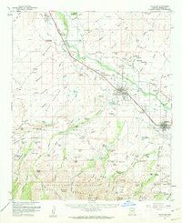
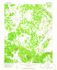
(650)- 1960 Map of Williams
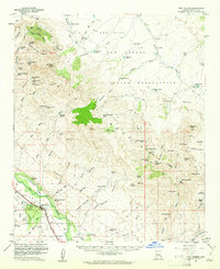
 1960 Williams1960 Print · USGSNorthern Arizona in the mid-twentieth century was defined by its massive canyons and the vital rail line connecting its remote ranches. Genealogists and historians can trace the development of Peach Springs, the high-altitude Bill Williams Mountain, and isolated outposts like Diamond Bar Ranch.
 - 1960 Map of Grand Canyon
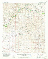
 1960 Grand Canyon1960 Print · USGSThe Arizona strip and the Colorado River corridor appear in the 1950s as a vast network of isolated plateaus and remote outposts. Researchers can trace historic ranching and tribal lands including Supai, the Kaibab Indian Reservation, and the Mt Trumbull Post Office.
 - 1960 Map of Prescott
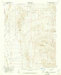
 1960 Prescott1960 Print · USGSYavapai County and the surrounding high-desert mining districts are captured here during a period of steady industrial and rail activity. Researchers can trace the routes of the Atchison Topeka and Santa Fe Railway and locate historic sites like the United Verde Mine and Bland School.2 unique versions available
 - 1960 Map of Thatcher
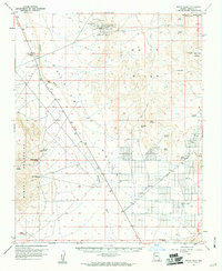
 1960 Thatcher1960 Print · USGSThe Gila River valley is a dense corridor of Arizona agricultural history in the early sixties, anchored by the Southern Pacific railroad. Genealogists and historians can trace local families through the many burial grounds, including Glenbar Cem and Hubbard Cem, or locate landmarks like the Eastern Arizona Jr College.2 unique versions available
 - 1960 Map of Flagstaff
 1960 Flagstaff1960 Print · USGSNorthern Arizona at the dawn of the sixties shows a landscape defined by mesa-top Hopi villages and the burgeoning railroad hub of Flagstaff. Trace the path of U.S. 66 past Meteor Crater or locate historic trading posts like Gray Mountain Trading Post.2 unique versions available
 - 1960 Map of Holbrook
 1960 Holbrook1960 Print · USGSNorthern Arizona is captured here just as modern highways began to reshape the cattle and timber country of the Colorado Plateau. Genealogists and historians can trace the early footprints of Snowflake, Sedona, and Payson, alongside the Atchison Topeka & Santa Fe RR rail line.
 - 1960 Map of Escalante
 1960 Escalante1960 Print · USGSSouthern Utah and northern Arizona appear at a historic turning point in the late fifties as Lake Powell begins to reshape the canyons. Researchers can trace remote sites like Goulding Trading Post, a lonely Uranium Mine, and Coyote Ranches before the reservoir's rise.
 - 1960 Map of Kingman
 1960 Kingman1960 Print · USGSThe high desert landscape of the Arizona-Nevada border comes alive in the mid-twentieth century, showcasing the rise of recreation alongside deep-rooted mining history. Genealogists and historians can trace the roots of towns like Kingman and Oatman, or locate remote sites like the Lucky Dutchman Mine and Santa Claus.3 unique versions available
 - 1960 Map of Mesa
 1960 Mesa1960 Print · USGSThe Salt River Valley and Superstition wilderness are captured here during a era of rapid post-war growth. Researchers can trace the mid-century footprints of Williams AF Base and Arizona State College or locate the deep-rock shafts of the Old Dominion Mine and Magma Mine.
 - 1960 Map of Phoenix
 1960 Phoenix1960 Print · USGSCentral Arizona in the mid-fifties reveals a landscape of rapid suburban growth alongside enduring desert mining and ranching. Genealogists and historians can trace rail-side settlements like Vicksburg Junction and Waddell, or locate the Vulture Mine and early sites like Agua Fria School.
 - 1960 Map of Guthrie, 1961 Print
 1960 Guthrie1961 Print · USGSGraham County ranching and mining come into sharp focus in the early sixties at the confluence of the Gila River and San Francisco River. Researchers can trace the Southern Pacific rail line to Guthrie and locate remote sites like the Ash Peak Mine and Gillespie Ranch.2 unique versions available
 - 1960 Map of Senator Mountain, 1961 Print
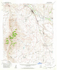
 1960 Senator Mountain1961 Print · USGSMohave County's arid mining and ranching frontiers are captured here at the start of the 1960s. Researchers can trace the desert infrastructure of the era, from remote workings like Senator Mine and Owens Mine to local landmarks such as Spear Ranch.3 unique versions available
 - 1960 Map of White Hills, 1961 Print
 1960 White Hills1961 Print · USGSArizona's mining and ranching legacy is preserved here in the early sixties, centered on the old White Hills (Site) and its surrounding silver claims. Researchers can trace dozens of individual mines like the Bonanza Mine alongside remote outposts including Kemple Camp and Turkeytrack Ranch.3 unique versions available
 - 1960 Map of Ebert Mtn, 1961 Print
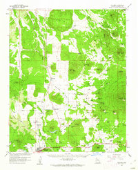
 1960 Ebert Mtn1961 Print · USGSCoconino County ranching life in the early sixties was defined by a rugged reliance on water tanks and isolated outposts. Researchers can trace the heritage of the Dent and Sayer Ranch or locate the remote Pearl Harbor Tank and Babbitt Lake.3 unique versions available
 - 1960 Map of Duncan, 1961 Print
 1960 Duncan1961 Print · USGSThe Gila River valley along the Arizona-New Mexico border is captured here in the early 1960s as a thriving corridor of rail and irrigation. Researchers can trace the Southern Pacific line through Duncan and Franklin, or locate family sites like Cox Ranch and Rainville Ranch.4 unique versions available
 - 1960 Map of Bylas, 1961 Print
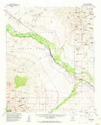 1960 Bylas1961 Print · USGSIn the early 1960s, the Gila River corridor through the San Carlos Indian Reservation remained a vital link for rail and highway travel. Genealogists and historians can trace family locations through Bylas and Geronimo, alongside the Fort Thomas Ward Cemetery and Mescal Pit.2 unique versions available
 - 1960 Map of Garnet Mtn., 1961 Print
 1960 Garnet Mtn.1961 Print · USGSThe mining camps and remote ranchlands of Mohave County come into focus in this early 1960s survey of the Gold Basin area. Researchers can trace the desert's industrial and agricultural history through labels like the King Tut Placer Mine, Burnt Mill Ranch, and Patterson Well.3 unique versions available
 - 1960 Map of Fort Thomas, 1961 Print
 1960 Fort Thomas1961 Print · USGSGraham County ranching and rail infrastructure are on full display in the early sixties. Researchers can trace family history through the Fort Thomas Cem and McEuen Cem or locate old outposts like Slaughter Camp and the Day Mine Windmill.2 unique versions available
 - 1960 Map of Safford, 1961 Print
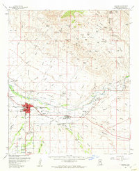 1960 Safford1961 Print · USGSThe Gila River valley is captured here during a period of steady growth in the early sixties, showing the vital irrigation network that sustained the local economy. Researchers can trace the path of the Southern Pacific railroad and locate landmarks like the Solomonsville Cemetery and Lafe Nelson School.3 unique versions available
 - 1960 Map of Williams, 1961 Print
 1960 Williams1961 Print · USGSNorthern Arizona's high country is captured here in the early sixties, showing the vital rail and forest infrastructure surrounding the gateway to the canyon. Researchers can trace historic landmarks like the Grand Canyon Trading Post, Kaibab Lake, and the Atchison Topeka and Santa Fe railroad.2 unique versions available
 - 1961 Map of Marble Canyon
 1961 Marble Canyon1961 Print · USGSThe northern Arizona desert in the early sixties reveals a landscape of tribal lands and canyon crossings. Trace the old river life at Lees Ferry, find the Uranium mill at Tuba City, and locate the iconic Elephant Feet landmarks.
 - 1961 Map of Douglas
 1961 Douglas1961 Print · USGSThe Arizona-Mexico borderlands come into focus at mid-century, detailing the vital mining and ranching hubs of Cochise County and southwest New Mexico. Genealogists and historians can trace the Southern Pacific Railroad through Bisbee and Douglas, or locate early sites like the Old Hachita Mine and Rucker School.
 - 1961 Map of Williams
 1961 Williams1961 Print · USGSNorthern Arizona in the mid-fifties reveals a high-desert landscape of rail towns and deep canyons along the Atchison Topeka and Santa Fe. Researchers can trace old Route 66 through Peach Springs, Seligman, and Ash Fork, or find remote sites like Music Mountain Mine.
 - 1961 Map of El Centro
 1961 El Centro1961 Print · USGSThe California-Arizona borderlands come alive in this early sixties record of desert irrigation and military expansion. Genealogists and researchers can trace the engineering of the All American Canal and locate vanished sites like Araz and the Imperial County Tuberculosis Sanatorium.
 - 1961 Map of Salome, 1962 Print
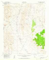
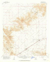 1961 Salome1962 Print · USGSThe McMullen Valley comes to life in the early sixties, centered on the railroad towns of Salome and Wenden. Genealogists and historians can trace local landmarks like the Salome High Sch, the town Cemetery, and numerous mining claims such as the Bonanza Mine.3 unique versions available
Showing maps 1-25 of 650
Top cities of Arizona
- Phoenix historical maps
- Tucson historical maps
- Mesa historical maps
- Chandler historical maps
- Glendale historical maps
- Scottsdale historical maps
See more
Top counties of Arizona
- Maricopa County historical maps
- Pima County historical maps
- Pinal County historical maps
- Yavapai County historical maps
- Mohave County historical maps
- Coconino County historical maps
See more
Frequently asked questions
- What are the different types of historical maps available for Arizona?
- What is the oldest map of Arizona?
- Where can I purchase historical maps of Arizona for my home or office?
- Where can I download high-res historical maps of Arizona?
- Are there historical topographic maps available for Arizona?
- Is there historical aerial imagery available for Arizona?
- Where are historical maps of Arizona sourced from?