1950s Maps of Arizona
Explore 525 historic maps of Arizona from the 1950s. These maps offer a rare glimpse into what life looked like during the 1950s — showing old roads, neighborhoods, homes, and landmarks that have changed or disappeared over time.
Whether you're researching your family's past, planning a metal detecting trip, or studying how Arizona's landscape evolved across the 1950s, these high-resolution maps are a powerful tool for exploring the history of this region.
- Focus on a specific era: All maps on this page are from the 1950s, giving you a focused view of this time period.
- See what’s changed: Compare century-old streets, trails, and buildings to today's modern landscape using overlays and satellite layers.
- Research with precision: Use these maps for genealogy, historical research, land use analysis, or educational projects.
- View, download, or print: Maps are fully viewable online in high resolution, and can be downloaded or printed for your own records.
Start exploring Arizona's history through authentic maps from the 1950s. This is your window into the past.
Arizona maps
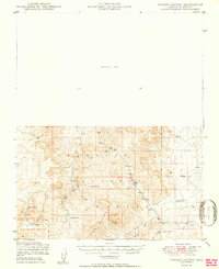
(525)- 1950 Map of Paulden
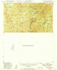
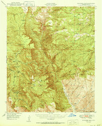
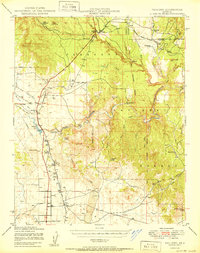 1950 Paulden1950 Print · USGSYavapai County ranching and rail infrastructure are captured here in the mid-twentieth century as the high desert settlements expanded. Researchers can trace the path of the Atchison Topeka and Santa Fe through Drake and locate family landmarks like Stewart Ranch and Hubbel Ranch.2 unique versions available
 - 1950 Map of Sheridan Mountain
 1950 Sheridan Mountain1950 Print · USGSYavapai County's high mesa ranching country is captured here during the post-war era within the Prescott National Forest. Genealogists and historians can locate established livestock operations like Spider Ranch, Dumbbell Ranch, and the Yolo Cabin.2 unique versions available
 - 1950 Map of Wagoner
 1950 Wagoner1950 Print · USGSYavapai County ranching life is preserved in this mid-century survey of the Arizona interior as it appeared just after the war. Researchers can trace the layout of the Diamond 2 Ranch, the isolated settlement of Minnehaha, and the winding course of the Hassayampa River.2 unique versions available
 - 1950 Map of Parker Dam Area
 1950 Parker Dam Area1950 Print · USGSThe California-Arizona borderlands come into focus at the mid-century mark, centered on the engineering of the Parker Dam. Trace the river economy through the Colorado River Indian Reservation and remote landmarks like Bandit Pass and Cienega Springs.2 unique versions available
 - 1950 Map of Turkey Canyon
 1950 Turkey Canyon1950 Print · USGSThe Juniper Mountains and Prescott National Forest appear in the mid-century as a land of ranching outposts and massive land grants. Researchers can trace the layout of the Luis Maria Baca Float No 5 and locate local sites like Happy Camp and Lower Corrals.2 unique versions available
 - 1950 Map of Crozier Peak
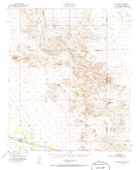
 1950 Crozier Peak1950 Print · USGSThe Tortilla Mountains of Pinal County are shown in the mid-twentieth century as a landscape of isolated ranches and active mineral prospects. Researchers can trace the footprints of the Silver Queen Mine, the Tony Lopez Ranch, and the Ripsey Ranch ruins.
 - 1950 Map of Rockinstraw Mtn
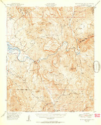 1950 Rockinstraw Mtn1950 Print · USGSGila County's high desert and river canyons are captured here in the mid-century, featuring the dramatic shoreline of the Roosevelt Reservoir. Genealogists and historians can trace old forest outposts like A-Cross Ranger Sta and mining sites near Richmond Basin.2 unique versions available
 - 1950 Map of San Simon
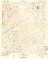
 1950 San Simon1950 Print · USGSThe high desert borderlands of Arizona and New Mexico are captured here at mid-century, following the line of the Southern Pacific railroad. Researchers can locate remote cattle operations and early landmarks like the Braidfoot Ranch, the Old Stage Station (Ruins), and the lonely Giddings Grave.2 unique versions available
 - 1950 Map of Bowie
 1950 Bowie1950 Print · USGSSoutheast Arizona ranching and rail life at mid-century are centered here on the town of Bowie and the Southern Pacific line. Researchers can trace historic property sites like Posey Ranch and Garrett Ranch or locate the Yellow Hammer Mill.
 - 1950 Map of Lookout Mtn
 1950 Lookout Mtn1950 Print · USGSPinal County ranching and military history converge in this mid-century survey of the San Pedro River valley. Researchers can trace the boundaries of the Old Camp Grant Military Reservation (Aban'd) or locate the PZ Ranch and Mine near the rugged slopes of Lookout Mtn.
 - 1950 Map of Crown King
 1950 Crown King1950 Print · USGSThe high Bradshaw Mountains come to life in this mid-century survey of the Arizona interior. Genealogists and mining historians can trace dozens of mountain claims like the Crown King Mine and Algonquin Mine, alongside camps like Fort Misery.
 - 1950 Map of Putnam Wash
 1950 Putnam Wash1950 Print · USGSArizona ranching and water infrastructure are captured here at the mid-century, long before modern development altered this Pinal County landscape. Researchers can trace the layout of remote outposts like Cactus Hill Ranch and vital water points such as Yellowjacket Well and Cowhead Tank.
 - 1950 Map of Parker
 1950 Parker1950 Print · USGSThe Lower Colorado River valley in the mid-century shows a landscape defined by massive water projects and tribal lands. Researchers can trace the Colorado River Indian Reservation boundary, the Headgate Rock Dam, and desert mining at the Blue Cloud Mine.2 unique versions available
 - 1950 Map of Kirkland
 1950 Kirkland1950 Print · USGSYavapai County ranching and mining operations are captured in detail at mid-century as the region's rural economy transitioned. Trace family history at the Walnut Grove School or locate old diggings like the Climax Mine and Cooper Crown Mine.
 - 1950 Map of Picacho Butte
 1950 Picacho Butte1950 Print · USGSYavapai County ranching and forest lands are captured here at mid-century, before modernization altered the high-desert range. Researchers can trace historic operations at the K4 Farm and CV Ranch or locate the old Stone Quarry and Mexican Dam.
 - 1950 Map of McFadden Peak
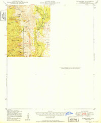
 1950 McFadden Peak1950 Print · USGSThe high Sierra Ancha of Gila County comes into focus mid-century, showing a landscape defined by ranching, mining, and forest management. Genealogists and researchers can locate historic family holdings like Circle Ranch and Tanner Ranch, or trace early operations at the Pueblo Mine.2 unique versions available
 - 1950 Map of Black Mountain
 1950 Black Mountain1950 Print · USGSPinal County ranching life in the late 1940s is centered around isolated water sources and livestock outposts among the high ridges. Genealogists and historians can trace the foundations of Barkerville (Site) and name-bearing landmarks like Haydon Ranch and Jewell Well.
 - 1950 Map of Saddle Mtn.
 1950 Saddle Mtn.1950 Print · USGSArizona's copper and cattle country comes into focus in the early post-war years, centered on the high desert terrain of Pinal County. Historians and genealogists can trace family footprints at Eskiminzin Ranch, find the site of the Finch Sch (Aban'd), or locate the Gypsum Mines.
 - 1950 Map of Winkelman
 1950 Winkelman1950 Print · USGSThe confluence of the Gila and San Pedro Rivers comes alive in this mid-century survey of Gila and Pinal Counties. Researchers can trace the industrial footprint of Hayden and Winkelman, or locate remote sites like Antelope Mine and Flying UW Ranch.2 unique versions available
 - 1950 Map of Brandenburg Mtn
 1950 Brandenburg Mtn1950 Print · USGSArizona ranching and canyon life are well-documented in this 1950s survey of the Aravaipa region. Researchers can trace the footprints of family outposts like Painted Cave Ranch, Wagner Ranch, and the high-elevation Lion Camp.
 - 1950 Map of Bumblebee
 1950 Bumblebee1950 Print · USGSMining operations and remote settlements define this central Arizona landscape during the late nineteen-forties. Researchers can trace the era's mineral wealth through sites like the Thunderbolt Mine and Howard Copper Mine, or locate family landmarks near Bumblebee and Poland.
 - 1950 Map of Simmons
 1950 Simmons1950 Print · USGSYavapai County ranching country is captured here during the post-war era of the late 1940s. Genealogists and historians can trace significant family holdings like Seven V Ranch and Las Vegas Ranch or locate landmarks such as Inscription Canyon.2 unique versions available
 - 1950 Map of Holy Joe Peak
 1950 Holy Joe Peak1950 Print · USGSPinal County's high desert peaks and canyons are shown at the mid-century during a period of ranching and early mining transition. Genealogists and researchers can locate family outposts like Reese Ranch and Mounterest Ranch or the Vale District Sch (Aban'd).
 - 1950 Map of Sentinel
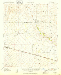
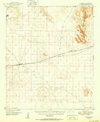 1950 Sentinel1950 Print · USGSMaricopa County's high desert reveals its mid-century transit network and military footprint as the Southern Pacific railroad cuts across the arid basin. Researchers can trace the railroad outposts of Sentinel and Midway Station alongside the Ajo Bend Military Reservation.
 - 1950 Map of Prescott, 1951 Print
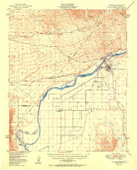
 1950 Prescott1951 Print · USGSArizona's mining and ranching frontiers were in full operation during the early fifties, from the vertical streets of Jerome to the remote western desert. Genealogists and researchers can trace rural life via the Bland School, the United Verde Mine, and stops along the Atchison Topeka and Santa Fe Railway.
Showing maps 1-25 of 525
Top cities of Arizona
- Phoenix historical maps
- Tucson historical maps
- Mesa historical maps
- Chandler historical maps
- Glendale historical maps
- Scottsdale historical maps
See more
Top counties of Arizona
- Maricopa County historical maps
- Pima County historical maps
- Pinal County historical maps
- Yavapai County historical maps
- Mohave County historical maps
- Coconino County historical maps
See more
Frequently asked questions
- What are the different types of historical maps available for Arizona?
- What is the oldest map of Arizona?
- Where can I purchase historical maps of Arizona for my home or office?
- Where can I download high-res historical maps of Arizona?
- Are there historical topographic maps available for Arizona?
- Is there historical aerial imagery available for Arizona?
- Where are historical maps of Arizona sourced from?