1920s Maps of Arizona
Explore 57 historic maps of Arizona from the 1920s. These maps offer a rare glimpse into what life looked like during the 1920s — showing old roads, neighborhoods, homes, and landmarks that have changed or disappeared over time.
Whether you're researching your family's past, planning a metal detecting trip, or studying how Arizona's landscape evolved across the 1920s, these high-resolution maps are a powerful tool for exploring the history of this region.
- Focus on a specific era: All maps on this page are from the 1920s, giving you a focused view of this time period.
- See what’s changed: Compare century-old streets, trails, and buildings to today's modern landscape using overlays and satellite layers.
- Research with precision: Use these maps for genealogy, historical research, land use analysis, or educational projects.
- View, download, or print: Maps are fully viewable online in high resolution, and can be downloaded or printed for your own records.
Start exploring Arizona's history through authentic maps from the 1920s. This is your window into the past.
Arizona maps
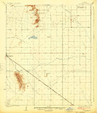
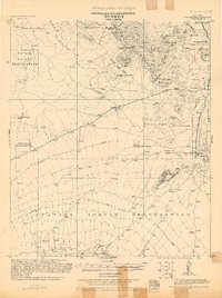
(57)- 1920 Map of Arivaca
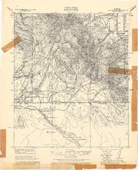
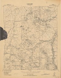 1920 Arivaca1920 Print · USGSSouthern Arizona ranching and mining country comes into focus in this post-World War I survey of the Santa Cruz Valley. Trace family roots and early industry near the Tumacacori Mission, Oceanic Mine, and the village of Arivaca.
 - 1921 Map of Old Glory
 1921 Old Glory1921 Print · USGSThe Arizona borderlands appear as a network of cattle ranches and mining outposts in this early twentieth-century military reconnaissance. Genealogists and historians can trace family operations like Lopez, Alamito Ranch, and the Old Glory Mine.2 unique versions available
 - 1922 Map of Willcox
 1922 Willcox1922 Print · USGSCochise County’s high-desert ranching and mining heartland is captured in the early 1920s as a thriving railroad hub. Genealogists can trace family holdings and rail stops across the basin, from Willcox and Servoss to the Mascot Mine and Circle I Ranch.
 - 1922 Map of Warm Creek
 1922 Warm Creek1922 Print · USGSSouthern Utah's canyon country appears here in the early twenties, just as the first formal topographic surveys reached the Colorado River. Researchers can trace the legendary Crossing of the Fathers and locate the remote Warm Creek Cabin near the Utah-Arizona Boundary Line.
 - 1922 Map of Red Rock No 2
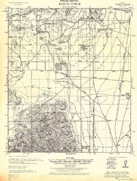
 1922 Red Rock No 21922 Print · USGSPinal County at the dawn of statehood reveals a desert landscape being transformed by irrigation and early highways. Researchers can trace the development of the Picacho Reservoir and early rural landmarks like the Kenilworth School.
 - 1922 Map of Chrysotile
 1922 Chrysotile1922 Print · USGSGila County's mining and ranching frontier is documented in the early twenties during a period of rapid reconnaissance mapping. Researchers can locate early outposts and water sources such as McMillanville, Chrysotile, and Ash Spring near the Fort Apache Reservation boundary.
 - 1922 Map of Nutrioso
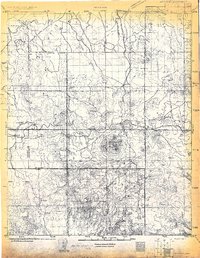
 1922 Nutrioso1922 Print · USGSHigh-altitude ranching and forest service outposts define the Arizona-New Mexico border in the early twenties. Researchers can trace remote family landmarks like Reservation Ranch and Colter's Res. or locate early settlements at Nutrioso and Alpine.
 - 1922 Map of Agus Caliente
 1922 Agus Caliente1922 Print · USGSThe Santa Rita Mountains of Southern Arizona appear here in the early twenties during a period of active mountain mining and ranching. Genealogists and historians can trace family sites like Wise's Ranch or find old operations at the Mansfield Mines and Montosa Mill.
 - 1922 Map of Williams
 1922 Williams1922 Print · USGSNorthern Arizona's high plateau during the early 1920s reveals a landscape of forestry and rail expansion. Trace early ranger stations and small rail stops like Fairview, Meath, and the Wood Spur logging line.
 - 1922 Map of Sunnyside, 1926 Print
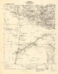
 1922 Sunnyside1926 Print · USGSThe Arizona-Mexico border comes alive in the 1920s, showing the high country of the Huachucas before modern development. Genealogists and researchers can locate remote outposts like Sunnyside, trace the Southern Pacific Railroad, and find the Carr Canyon School.
 - 1922 Map of Swisshelm, 1927 Print
 1922 Swisshelm1927 Print · USGSSulphur Spring Valley and the Swisshelm Mountains are captured here in the early 1920s as a thriving rail-and-ranching corridor. Genealogists and historians can trace the foundations of local life at Caliente Webb P O, the Leslie School, and the El Paso Southwestern line.
 - 1922 Map of St. David, 1928 Print
 1922 St. David1928 Print · USGSCochise County's river-and-rail economy is captured here in the 1920s, showing the settlement at St David and the industrial works of the Apache Powder Co. Researchers can trace the Southern Pacific line and family landmarks like Fourr Ranch or the landing at Boquillas.
 - 1922 Map of McDonald, 1928 Print
 1922 McDonald1928 Print · USGSThe Arizona and New Mexico borderlands meet the international boundary in the 1920s, showing a landscape defined by cattle ranching and desert springs. Researchers can trace historic family holdings like Hazelwood Ranch and remote landmarks such as the Cottonwood Creek School and Spring of Contention.
 - 1922 Map of Casa Grande, 1956 Print
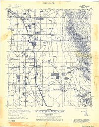
 1922 Casa Grande1956 Print · USGSPinal County in the early twenties shows a landscape shaped by tribal lands and the railroad. Genealogists and historians can trace the early layout of Casa Grande, the rail siding at Nunez, and the village of Chuichu.2 unique versions available
 - 1922 Map of Signal Peak, 1959 Print
 1922 Signal Peak1959 Print · USGSPinal County's desert corridor is captured in the early 1920s as the railroad and new canals began to transform the arid landscape. Genealogists and historians can trace the early footprints of Casa Grande, Arizola, and the American Boy Mine.2 unique versions available
 - 1923 Map of Camp Verde
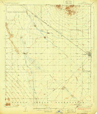
 1923 Camp Verde1923 Print · USGSCentral Arizona's river valleys and high plateaus appear here during the early twenties, showing the region's shift toward tourism and settlement. Trace the routes to Montezuma Castle Nat Monument or locate early sites like Cornville and Aultman.
 - 1923 Map of Signal
 1923 Signal1923 Print · USGSWestern Arizona in the early twenties was a landscape of isolated mining camps and vital desert springs. Genealogists and historians can trace the footprint of early settlements like Signal and Swansea or locate remote outposts such as Owen and Butler well.
 - 1924 Map of Signal Peak
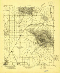
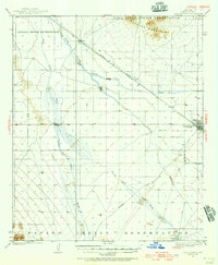
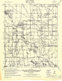
 1924 Signal Peak1924 Print · USGSPinal County in the early twenties shows a landscape of desert peaks and growing rail hubs along the Southern Pacific Railroad. Trace the early development of Casa Grande and Eloy near the American Boy Mine and rural Selma School.3 unique versions available
 - 1924 Map of Casa Grande
 1924 Casa Grande1924 Print · USGSThe Santa Cruz River valley in the early 1920s shows the convergence of rail travel and early desert irrigation. Genealogists and historians can trace the rail sidings of Bon and Nunez or locate the village of Chiu Chuischu within the Papago Indian Reservation.
 - 1925 Map of Samaniego Peak
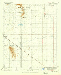
 1925 Samaniego Peak1925 Print · USGSIn the mid-twenties, this Pima County landscape was a mix of isolated desert homesteads and active mining operations. Genealogists and historians can trace family-named locations like Perones Ranch and Mendoza Ranch or explore the rail-and-ore history of the Southern Pacific Railroad.
 - 1925 Map of Douglas
 1925 Douglas1925 Print · USGSThe Arizona-Mexico borderlands in the mid-twenties were a mosaic of family-named ranches and early motor routes. Genealogists can trace individual homesteads like the Cross U Bar R. (Stephenson) or the Lakes Ranch alongside the historic Nacozari Railroad.
 - 1925 Map of San Xavier
 1925 San Xavier1925 Print · USGSThe Tucson area and the Papago Indian Reservation come to life in this mid-1920s survey. Researchers can trace family-named homesteads such as Kubils Ranch and Coronado Ranch alongside industrial sites like the Arizona Group Mines.
 - 1925 Map of Gleeson
 1925 Gleeson1925 Print · USGSThe mining town of Gleeson and its surrounding ranchlands appear here during the mid-1920s. Genealogists and researchers can trace family holdings like the 3-O Ranch and Potter Ranch alongside the Arizona Eastern rail line.
 - 1926 Map of Light
 1926 Light1926 Print · USGSCochise County ranching and rail transport are captured here during the mid-twenties, as the high desert landscape began to transition. Researchers can trace family ranch lands such as Moore Ranch and the site of Light, alongside the route of the Eastern Arizona Railroad.
 - 1926 Map of Cochise Head
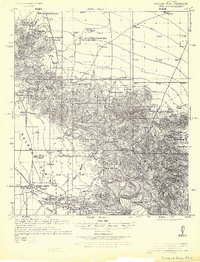 1926 Cochise Head1926 Print · USGSSoutheastern Arizona in the mid-twenties shows a landscape of isolated cattle ranches and historic military sites transitioning into managed forest lands. Genealogists and historians can trace family landholdings at Riggs Home Ranch and Faraway Ranch or locate the site of Old Fort Bowie.
Showing maps 1-25 of 57
Top cities of Arizona
- Phoenix historical maps
- Tucson historical maps
- Mesa historical maps
- Chandler historical maps
- Glendale historical maps
- Scottsdale historical maps
See more
Top counties of Arizona
- Maricopa County historical maps
- Pima County historical maps
- Pinal County historical maps
- Yavapai County historical maps
- Mohave County historical maps
- Coconino County historical maps
See more
Frequently asked questions
- What are the different types of historical maps available for Arizona?
- What is the oldest map of Arizona?
- Where can I purchase historical maps of Arizona for my home or office?
- Where can I download high-res historical maps of Arizona?
- Are there historical topographic maps available for Arizona?
- Is there historical aerial imagery available for Arizona?
- Where are historical maps of Arizona sourced from?