1900-1909 Maps of Colorado
Explore 50 historic maps of Colorado from 1900-1909. These maps offer a rare glimpse into what life looked like during the 1900s — showing old roads, neighborhoods, homes, and landmarks that have changed or disappeared over time.
Whether you're researching your family's past, planning a metal detecting trip, or studying how Colorado's landscape evolved across the 1900s, these high-resolution maps are a powerful tool for exploring the history of this region.
- Focus on a specific era: All maps on this page are from the 1900s, giving you a focused view of this time period.
- See what’s changed: Compare century-old streets, trails, and buildings to today's modern landscape using overlays and satellite layers.
- Research with precision: Use these maps for genealogy, historical research, land use analysis, or educational projects.
- View, download, or print: Maps are fully viewable online in high resolution, and can be downloaded or printed for your own records.
Start exploring Colorado's history through authentic maps from the 1900s. This is your window into the past.
Colorado maps
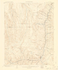
(50)- 1900 Map of Spanish Peaks
 1900 Spanish Peaks1900 Print · USGSSouthern Colorado at the turn of the century is a landscape of high peaks, Spanish land grants, and booming coal towns. Genealogists can trace family roots through traditional plazas like Trujillo Plaza or industrial centers like Aguilar and Starkville.
 - 1900 Map of Engineer Mountain
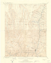
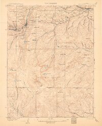
 1900 Engineer Mountain1900 Print · USGSHigh in the San Juan Mountains during the mining boom, this area served as a vital junction for four Colorado counties. Genealogists and historians can trace the Silverton Line railroad, find the Old Tollgate, and locate West Ranch.
 - 1900 Map of Chappell
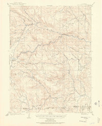
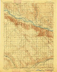 1900 Chappell1900 Print · USGSWestern Nebraska at the dawn of the new century is captured here as a landscape of early irrigation and historic pioneer trails. Trace the path of the Old California Trail past Ash Hollow or locate ranching outposts like Coombe's Ranch and Libbey's Ranch.3 unique versions available
 - 1900 Map of Walsenburg
 1900 Walsenburg1900 Print · USGSSouthern Colorado at the turn of the century shows a landscape being transformed by the arrival of the Denver and Rio Grande RR. Genealogists and historians can trace early settlements and transit points like Huerfano Sta. (Ute P.O.), the coal town of Rouse, and the landmark Huerfano Butte.
 - 1900 Map of Needle Mountains, 1955 Print
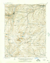
 1900 Needle Mountains1955 Print · USGSThe high San Juan wilderness comes alive at the turn of the century as the Denver and Rio Grande Railroad penetrates the mountains. Researchers can trace remote mining-era sites like Needleton, the Quartz Mill, and the high-altitude camp at Beartown.3 unique versions available
 - 1901 Map of Pikes Peak
 1901 Pikes Peak1901 Print · USGSThe Cripple Creek mining district is in its golden age on this turn-of-the-century sheet. Genealogists and historians can trace the rail lines and mountain camps that defined the rush, from Victor and Goldfield to the Fossil Beds at Florissant.6 unique versions available
 - 1901 Map of Pikes Peak, 1909 Print
 1901 Pikes Peak1909 Print · USGSThe mining district of Teller County is shown at its height, as rail lines threaded through high-altitude gold camps. Genealogists can trace family roots in Cripple Creek, Independence, and Altman or locate the historic Fossil Beds near Florissant.
 - 1901 Map of Silverton, 1957 Print
 1901 Silverton1957 Print · USGSSilverton was the bustling center of the San Juan silver boom when these mountain railroads were at their peak. Genealogists and historians can trace the high-altitude rail lines to remote camps like Animas Forks, Guston, and Red Mountain.
 - 1902 Map of Greeley
 1902 Greeley1902 Print · USGSThe northern Colorado plains come alive in this survey of the South Platte and Cache la Poudre river valleys. Researchers can trace early railroad expansion and irrigation networks while locating specific homesteads like Klugs Ranch and old coal operations such as the Black Prince Coal Mine.4 unique versions available
 - 1902 Map of Needle Mountains
 1902 Needle Mountains1902 Print · USGSThe San Juan high country comes alive in this turn-of-the-century survey of the Needle Mountains and the Animas River canyon. Trace the original Silverton Line to remote stops like Needleton or find high-altitude camps like Beartown.4 unique versions available
 - 1902 Map of Silverton
 1902 Silverton1902 Print · USGSSilverton and its surrounding high-country mining camps are captured here during the peak of the San Juan mountain silver boom. Genealogists and industrial historians can trace the paths of the Silverton Northern R.R. to remote outposts like Animas Forks, Eureka, and the Sunnyside Mill.4 unique versions available
 - 1902 Map of Boulder, 1957 Print
 1902 Boulder1957 Print · USGSThe Front Range foothills hum with mining and rail activity at the turn of the century. Genealogy researchers can trace families in old mining camps like Gold Hill, Wallstreet, and Sunshine, or follow the winding Colorado and Northwestern RR.
 - 1902 Map of Ouray, 1963 Print
 1902 Ouray1963 Print · USGSThe mountain town of Ouray and its surrounding peaks were surveyed at the start of the twentieth century. Genealogists and historians can trace the path of the Denver and Rio Grande R. R. through Bachelor Switch, Portland, and past the waters of Lake Lenore.
 - 1903 Map of Lake City, 1955 Print
 1903 Lake City1955 Print · USGSHinsdale County's mining heart is captured here at the turn of the century as industrial rail lines reached deep into the high country. Genealogists and historians can trace the foundations of Lake City and Capitol City, or locate specific industrial sites like the Hidden Treasure Mill and the Denver and Rio Grande R. R.2 unique versions available
 - 1903 Map of Georgetown, 1957 Print
 1903 Georgetown1957 Print · USGSMining operations and mountain railroads define the Clear Creek valley at the dawn of the twentieth century. Trace the iconic Georgetown Loop railroad and locate historic mining centers like Silver Plume, Lamartine, and the Stanley Mines.
 - 1904 Map of Nepesta
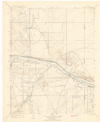 1904 Nepesta1904 Print · USGSEastern Colorado at the turn of the century shows a landscape transformed by water and rail. Trace the irrigation network of Excelsior Ditch and the lineage of family outposts like Skinner and Tabor Ranch and Tolle Ranch.3 unique versions available
 - 1904 Map of Niwot
 1904 Niwot1904 Print · USGSThe northern Colorado plains come alive in the early 1900s, showcasing a landscape shaped by coal mining and extensive irrigation. Genealogists and historians can trace family roots through settlements like Hygiene, Niwot, and Erie, or locate industrial sites such as Dixon Mill and the Gladstone Mine.3 unique versions available
 - 1904 Map of Ouray
 1904 Ouray1904 Print · USGSIn the early 1900s, the mining hub of Ouray was already a critical terminal for the Denver and Rio Grande RR. Historians can trace the industrial corridor from Portland down to Ouray, finding sites like the New York Tunnel and the Hot Springs as they appeared over a century ago.3 unique versions available
 - 1904 Map of Boulder
 1904 Boulder1904 Print · USGSThe Front Range foothills hum with mining activity at the start of the twentieth century, as narrow-gauge rails climb the canyons. Genealogists and historians can trace defunct rail stops and mining camps like Salina, Wallstreet, and Gold Hill Sta..6 unique versions available
 - 1904 Map of Telluride
 1904 Telluride1904 Print · USGSThe San Juan Mountains were at the height of their mining boom when this survey was conducted at the turn of the century. Genealogists and historians can trace the intricate rail network of the Rio Grande Southern R.R. and locate storied operations like the Smuggler Mine and the community at Ophir.2 unique versions available
 - 1905 Map of Lake City
 1905 Lake City1905 Print · USGSHinsdale County’s high-country mining district is captured here at the start of the twentieth century. Genealogists and historians can trace the rail route of the Rio Grande and Western, explore the streets of Lake City, and locate remote industrial sites like the Hidden Treasure Mill.2 unique versions available
 - 1905 Map of Central City
 1905 Central City1905 Print · USGSThe Colorado Front Range is captured here at the peak of its early mining era, showing the dense network of gulches and camps. Trace historic mining operations at Central City, follow the high-mountain route of the Denver Northwestern and Pacific RR, or locate vanished settlements like Baltimore and Perigo.
 - 1905 Map of Georgetown
 1905 Georgetown1905 Print · USGSThe Clear Creek valley was a hive of industrial activity at the start of the twentieth century, anchored by the rail connection between Georgetown and Silver Plume. Trace the famous Georgetown Loop and find high-altitude mining sites at Lamartine and Freeland.5 unique versions available
 - 1905 Map of Mount Olympus, 1955 Print
 1905 Mount Olympus1955 Print · USGSLarimer County mountain life is captured here at the turn of the century as early ranching and tourism began to define the canyons. Genealogists and historians can trace family-held lands such as Pflums Ranch, stay at the Rustic Hotel, or locate the now-submerged site of Pinewood.2 unique versions available
 - 1905 Map of San Cristobal, 1963 Print
 1905 San Cristobal1963 Print · USGSThe high peaks of the San Juan Mountains are recorded here just after the turn of the century as mining and high-altitude ranching shaped the area. Researchers can trace the layout of early settlements like Whitecross and Sherman or locate the Lakemans Fishponds near the Continental Divide.
Showing maps 1-25 of 50
Top cities of Colorado
- Denver historical maps
- Colorado Springs historical maps
- Aurora historical maps
- Fort Collins historical maps
- Lakewood historical maps
- Thornton historical maps
See more
Top counties of Colorado
- Denver historical maps
- El Paso County historical maps
- Arapahoe County historical maps
- Jefferson County historical maps
- Adams County historical maps
- Larimer County historical maps
See more
Frequently asked questions
- What are the different types of historical maps available for Colorado?
- What is the oldest map of Colorado?
- Where can I purchase historical maps of Colorado for my home or office?
- Where can I download high-res historical maps of Colorado?
- Are there historical topographic maps available for Colorado?
- Is there historical aerial imagery available for Colorado?
- Where are historical maps of Colorado sourced from?