1910s Maps of Colorado
Explore 40 historic maps of Colorado from the 1910s. These maps offer a rare glimpse into what life looked like during the 1910s — showing old roads, neighborhoods, homes, and landmarks that have changed or disappeared over time.
Whether you're researching your family's past, planning a metal detecting trip, or studying how Colorado's landscape evolved across the 1910s, these high-resolution maps are a powerful tool for exploring the history of this region.
- Focus on a specific era: All maps on this page are from the 1910s, giving you a focused view of this time period.
- See what’s changed: Compare century-old streets, trails, and buildings to today's modern landscape using overlays and satellite layers.
- Research with precision: Use these maps for genealogy, historical research, land use analysis, or educational projects.
- View, download, or print: Maps are fully viewable online in high resolution, and can be downloaded or printed for your own records.
Start exploring Colorado's history through authentic maps from the 1910s. This is your window into the past.
Colorado maps
(40)- 1910 Map of Danforth Hills
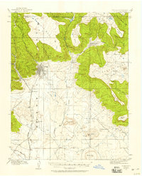
 1910 Danforth Hills1910 Print · USGSNorthwest Colorado is surveyed here in the early 1900s, showing a landscape defined by the rugged Danforth Hills and the early ranching outposts of Routt and Rio Blanco counties. Genealogists can locate family holdings like Edinger's Ranch and Maudlin's Ranch or trace the early post offices at Lay PO and Hamilton PO.
 - 1910 Map of Jensen
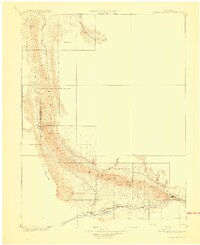
 1910 Jensen1910 Print · USGSThe Utah-Colorado borderlands come alive in the first decade of the twentieth century, showing the early development of the Uinta Basin. Genealogists and historians can locate early river crossings at the ferry sites near Jensen or trace the road to Dragon Stage Road.2 unique versions available
 - 1910 Map of Eaton
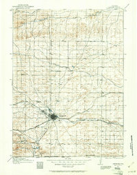
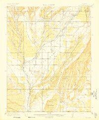
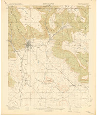
 1910 Eaton1910 Print · USGSNorthern Colorado at the turn of the century shows a landscape transformed by railroads and early irrigation projects. Genealogists can locate many family-named landmarks like Slaxton Ranch and rural schoolhouses including Abbot School and Birch School.3 unique versions available
 - 1910 Map of Grand Hogback
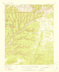
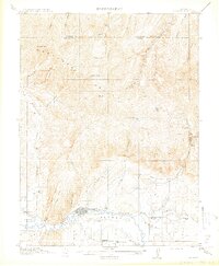
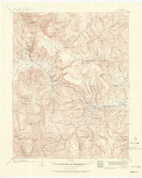
 1910 Grand Hogback1910 Print · USGSGarfield and Rio Blanco counties appear at the height of the early railroad era, defined by the towering spine of the Grand Hogback. Local historians can trace the early rail stops and river settlements like Rio Blanco, Antlers, and Dinner Sta.3 unique versions available
 - 1910 Map of White River
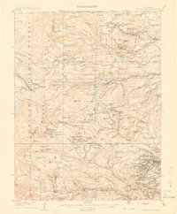
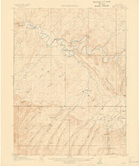
 1910 White River1910 Print · USGSNorthwest Colorado is captured here in the early twentieth century as a landscape of remote river valleys and high plateaus. Local historians can trace early crossings like Thornburgh Bridge and old outposts such as Maybell P O and Keystone Ranch.2 unique versions available
 - 1910 Map of Rangely
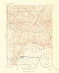
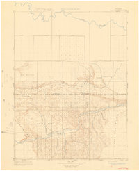 1910 Rangely1910 Print · USGSNorthwestern Colorado at the turn of the century reveals a landscape of isolated outposts and cattle country along the river basins. Genealogists and researchers can trace the early footprints of Rangely, Angora, and Boxelder near the White River.2 unique versions available
 - 1910 Map of Central City, 1957 Print
 1910 Central City1957 Print · USGSThe Colorado high country at the start of the century reveals a landscape defined by mining booms and engineering marvels. Trace the intricate rail networks of the Colorado Southern RR or locate family roots in the historic camps of Nevadaville and Central City.2 unique versions available
 - 1911 Map of Uncompahgre
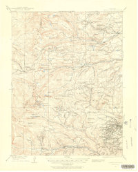
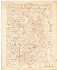
 1911 Uncompahgre1911 Print · USGSThe Colorado high country at the start of the twentieth century reveals a landscape of isolated mining camps and vital mountain railways. Genealogists and historians can trace the Denver and Rio Grande RR through Sapinero to remote operations like the Gunnison Mine and Capitol City.2 unique versions available
 - 1911 Map of Montrose
 1911 Montrose1911 Print · USGSThe Uncompahgre River valley and the Denver and Rio Grande RR define the landscape of this region before the First World War. Researchers can trace the early layout of Montrose, the mining influence at Blaine Mine, and the route through Ridgway.3 unique versions available
 - 1911 Map of Mount Jackson
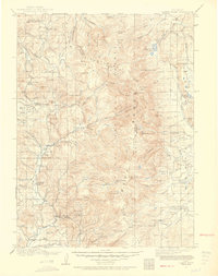
 1911 Mount Jackson1911 Print · USGSThe high Rockies of Pitkin and Eagle Counties are captured here at the peak of the mountain rail era. Researchers can trace the dual tracks of the Colorado Midland RR and the Denver and Rio Grande RR past Aspen and the Little Annie Mine.3 unique versions available
 - 1911 Map of Hahns Peak, 1954 Print
 1911 Hahns Peak1954 Print · USGSThe northern Park Range and the Continental Divide appear in great detail just after the first decade of the twentieth century. Researchers can locate remote schools and ranches like Moon Hill School, the Elkhorn Mine, and the settlement of Pearl.2 unique versions available
 - 1911 Map of Cheyenne, 1961 Print
 1911 Cheyenne1961 Print · USGSCheyenne was a bustling rail and military center in the years before the Great War. Genealogists and historians can trace the footprint of Fort D.A. Russell and find early rural sites like Campstool and Paola.
 - 1912 Map of Soda Canyon
 1912 Soda Canyon1912 Print · USGSMontezuma County at the dawn of modern archaeology reveals a landscape dotted with ancestral dwellings. Researchers can trace the early documentation of Cliff Palace, Sprucetree House, and Balcony House alongside the winding course of the Mancos River.7 unique versions available
 - 1912 Map of Central City
 1912 Central City1912 Print · USGSThe Colorado Front Range mining districts were in full operation during this era of deep-shaft extraction and mountain railroading. Researchers can trace the industrial footprint of Central City, locate the Boulder County Mine, and follow the path of the Colorado and Southern RR through the gulches.4 unique versions available
 - 1912 Map of Meeker, 1954 Print
 1912 Meeker1954 Print · USGSThe White River valley near Meeker comes alive in the early twentieth century, showing a landscape of pioneer ranching and early rural schooling. Researchers can locate family landmarks like the Uehlein Ranch and trace the footprints of the Powell Park School or Coal Creek School.2 unique versions available
 - 1912 Map of Raton, 1958 Print
 1912 Raton1958 Print · USGSRaton and the high mesas of the Colorado-New Mexico border are captured here just as the railroad era reached its peak. Researchers can trace the early industrial landscape of coal towns like Gardiner and Blossburg or locate the historic Clifton House and Raton Tunnel.2 unique versions available
 - 1912 Map of Axial, 1958 Print
 1912 Axial1958 Print · USGSRanching life on Colorado's western slope is captured here just before the First World War, centered on the winding Yampa River. Genealogists can trace early homesteads like K Diamond Ranch and the settlement at Axial.
 - 1913 Map of Castle Rock
 1913 Castle Rock1913 Print · USGSThe Colorado front range at the start of the twentieth century was a landscape of high-plains ranching and vital rail junctions. Genealogists can locate family homesteads near dozens of early schools like Rock Ridge School and churches such as Bethel Church.5 unique versions available
 - 1913 Map of Hahns Peak
 1913 Hahns Peak1913 Print · USGSRoutt County was a landscape of high-country mining and isolated homesteads in the early 1900s. Researchers can trace the era's rural infrastructure through old schoolhouses like Moon Hill School, the Elkhorn Mine, and settlements such as Columbine.2 unique versions available
 - 1913 Map of Red Mesa
 1913 Red Mesa1913 Print · USGSLa Plata County's high mesa country is captured here shortly after the turn of the century, showing a landscape of early homesteads and irrigation ditches. Researchers can locate the Mormon Church, several early schools like Rockville School, and the tracks of the Rio Grande Southern RR.4 unique versions available
 - 1913 Map of Summitville, 1962 Print
 1913 Summitville1962 Print · USGSThe high San Juan Mountains at the turn of the century are captured here, from the gold-mining district at Summitville to the ranchlands of the Navajo River valley. Genealogists and historians can trace early school sites like Blanco School and working mines including the Asiatic Mine and Forest King Mine.
 - 1914 Map of Meeker
 1914 Meeker1914 Print · USGSThe White River valley in northwestern Colorado appears here just before the First World War, when ranching and small rural schoolhouses defined the landscape. Researchers can trace early family homesteads like Valentine Ranch and James Ranch or locate the Powell Park School.
 - 1914 Map of Raton
 1914 Raton1914 Print · USGSRaton served as a vital mountain gateway during the early twentieth century as railroads and early highways crested the Colorado border. Researchers can trace the industrial spurs of the Wagon Mine or locate vanished stops like Blossburg, Gardiner, and Clifton House.5 unique versions available
 - 1914 Map of Creede
 1914 Creede1914 Print · USGSMineral County mining camps and silver-era infrastructure are preserved in this pre-war survey. Genealogists and historians can trace industrial landmarks like the Nelson Tunnel alongside early settlements including Bachelor, Sunnyside, and Spar City.3 unique versions available
 - 1914 Map of Axial
 1914 Axial1914 Print · USGSMoffat County ranching and river life are captured here just before the First World War. Local historians can trace the early Meeker-area landscape through landmarks like Axial, the Juniper Hot Springs, and Duffy Mountain.3 unique versions available
Showing maps 1-25 of 40
Top cities of Colorado
- Denver historical maps
- Colorado Springs historical maps
- Aurora historical maps
- Fort Collins historical maps
- Lakewood historical maps
- Thornton historical maps
See more
Top counties of Colorado
- Denver historical maps
- El Paso County historical maps
- Arapahoe County historical maps
- Jefferson County historical maps
- Adams County historical maps
- Larimer County historical maps
See more
Frequently asked questions
- What are the different types of historical maps available for Colorado?
- What is the oldest map of Colorado?
- Where can I purchase historical maps of Colorado for my home or office?
- Where can I download high-res historical maps of Colorado?
- Are there historical topographic maps available for Colorado?
- Is there historical aerial imagery available for Colorado?
- Where are historical maps of Colorado sourced from?