1980s Maps of Colorado
Explore 267 historic maps of Colorado from the 1980s. These maps offer a rare glimpse into what life looked like during the 1980s — showing old roads, neighborhoods, homes, and landmarks that have changed or disappeared over time.
Whether you're researching your family's past, planning a metal detecting trip, or studying how Colorado's landscape evolved across the 1980s, these high-resolution maps are a powerful tool for exploring the history of this region.
- Focus on a specific era: All maps on this page are from the 1980s, giving you a focused view of this time period.
- See what’s changed: Compare century-old streets, trails, and buildings to today's modern landscape using overlays and satellite layers.
- Research with precision: Use these maps for genealogy, historical research, land use analysis, or educational projects.
- View, download, or print: Maps are fully viewable online in high resolution, and can be downloaded or printed for your own records.
Start exploring Colorado's history through authentic maps from the 1980s. This is your window into the past.
Colorado maps
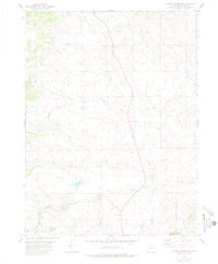
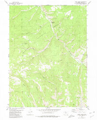
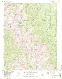
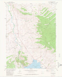
(267)- 1980 Map of Ute Peak
 1980 Ute Peak1980 Print · USGSHigh in the Colorado Rockies during the late seventies, this survey illustrates a landscape of heavy industry meeting mountain wilderness. You can trace the complex water systems serving the Henderson Mill alongside family-named landmarks like Trails End Ranch and the rugged Ute Pass.2 unique versions available
 - 1980 Map of Flagler Reservoir
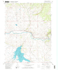
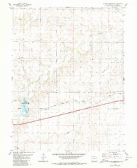 1980 Flagler Reservoir1980 Print · USGSEastern Colorado prairie life in the early eighties centers on the water and rail corridors of Kit Carson County. Researchers can trace the path of the Chicago Rock Island and Pacific railroad past Kipling Crossing and the Flagler Reservoir.
 - 1980 Map of Fort Morgan
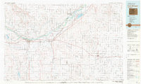 1980 Fort Morgan1980 Print · USGSNortheastern Colorado’s agricultural heartland is documented here in the early eighties, centered on the South Platte River corridor. Researchers can trace the progress of the Union Pacific and Burlington Northern railroads through ranching hubs like Brush, Akron, and Hillrose.
 - 1980 Map of Sheephorn Mountain
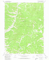
 1980 Sheephorn Mountain1980 Print · USGSThe high country of the Rockies in the late seventies is documented here as Grand, Eagle, and Summit counties meet among the peaks. You can trace early burial sites at Sheephorn Cem or follow water routes like Noonan Ditch and Gutzler Lakes.3 unique versions available
 - 1980 Map of Wellsville
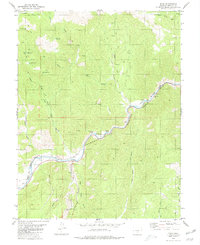
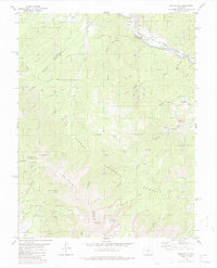 1980 Wellsville1980 Print · USGSNear the turn of the 1980s, this area of Fremont County shows the rugged intersection of the Arkansas River and high alpine forests. Researchers can trace the path of the Denver and Rio Grande Western through Wellsville or locate mountain landmarks like Simmons Peak and Salamander Lake.3 unique versions available
 - 1980 Map of Hinman Reservoir
 1980 Hinman Reservoir1980 Print · USGSGrand County ranching and water management are captured here during the late 1970s as high-country drainages were increasingly developed. Researchers can trace the path of the Mc Mahon Ditch, locate the small Cem, and see the footprint of Hinman Reservoir.2 unique versions available
 - 1980 Map of Whale Hill
 1980 Whale Hill1980 Print · USGSSaguache County's rugged mining history is preserved here in the late twentieth century, showing a landscape defined by industrial extraction and high peaks. Genealogists and researchers can trace dozens of individual claims, including the Stemwinder Mine, Oregon Mine, and the Old Railroad Grade along San Luis Creek.2 unique versions available
 - 1980 Map of Echo
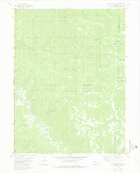
 1980 Echo1980 Print · USGSFremont County, Colorado, is shown in the early 1980s as a landscape of rugged canyons and rail corridors. Researchers can trace industrial footprints through quarries, remote prospects, and the path of the Denver and Rio Grande Western Railroad.
 - 1980 Map of Hugo
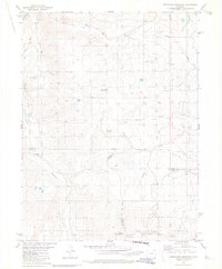
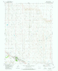 1980 Hugo1980 Print · USGSThe town of Hugo and its surrounding high plains are captured in the late 1970s as a vital rail and ranching hub. Genealogists and local historians can locate the Hugo Evergreen Cem, the Union Pacific rail corridor, and the County Fairground.
 - 1980 Map of Cabin Creek
 1980 Cabin Creek1980 Print · USGSGrand County ranching and recreation lands appear here in the early eighties as they transition into federal forest. Trace old family-named landmarks like Mc Queary Creek, find the Sawmill Gulch Campground, or follow the Jeep Trail through Drowsy Water Gulch.3 unique versions available
 - 1980 Map of Squaw Creek
 1980 Squaw Creek1980 Print · USGSSummit and Grand Counties in 1980 show a landscape shaped by the Blue River and the development of the Arapaho National Forest. Trace recreational history and early trails at Green Mountain Reservoir, Graveyards Campground Cem, and the Slate Creek Trail.2 unique versions available
 - 1980 Map of Cotopaxi
 1980 Cotopaxi1980 Print · USGSThe high mountain corridors of Fremont County are captured here in the late twentieth century, centered on the river and rail lines near Cotopaxi. Researchers can trace the Denver and Rio Grande Western railroad, old Mines in the gulches, and the high-elevation Rainbow Trail.2 unique versions available
 - 1980 Map of Delta
 1980 Delta1980 Print · USGSWestern Colorado during the 1980s reveals a rugged landscape of high mesas and deep canyons where the mining and ranching economy thrived. Genealogists and researchers can trace local landmarks like Peis Green Corner or locate mining operations including the Peach Mines and Yellowbird Mines.3 unique versions available
 - 1980 Map of Electric Peak
 1980 Electric Peak1980 Print · USGSThe Sangre de Cristo high country is captured here in the 1980s, where county lines follow the peaks of the Great Divide. Genealogists and researchers can trace remote mining sites like the Rita Alta Mine and Cloverdale Mine or locate alpine landmarks such as Lakes of the Clouds and Smith Park.2 unique versions available
 - 1980 Map of Corral Peaks
 1980 Corral Peaks1980 Print · USGSThe Arapaho National Forest high country of Grand County comes into focus during the late 1970s. Trace high-altitude ranching life at Wheatley Ranch, follow the Hay Park Trail (Pack), or locate landmarks like Black Mountain and the Musgrave Ditch.2 unique versions available
 - 1980 Map of Lava Creek
 1980 Lava Creek1980 Print · USGSEagle County’s high forest reaches are captured in the early eighties as a landscape of remote trails and river headwaters. Researchers can trace the paths of Pack Trails through Mc Cord Pass or locate high-country landmarks like Piney Guard Station and Lava Lake.4 unique versions available
 - 1980 Map of Seibert
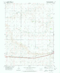
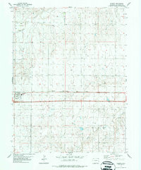 1980 Seibert1980 Print · USGSThe high plains of Kit Carson County come into focus during the late twentieth century, centered on the railroad town of Seibert. Researchers can trace the path of the Chicago Rock Island and Pacific and locate local landmarks like the Cem and the Water Tank.
 - 1980 Map of King Creek
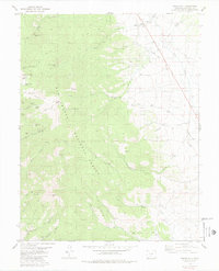
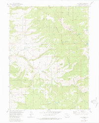
 1980 King Creek1980 Print · USGSThe High Rockies near the Grand and Summit County line come into focus during the early 1980s, centered on the Green Mountain Reservoir. Researchers can locate the settlement of Heeney, the Big Four Mine, and numerous high-altitude springs and prospects.3 unique versions available
 - 1980 Map of Piney Peak
 1980 Piney Peak1980 Print · USGSThe Eagle and Summit County line follows high ridges during the late 1970s, showing a landscape shaped by water and wilderness trails. You can trace remote backcountry routes through the National Forests to landmarks like Chimney Rock, Blue Lake, and Piney Peak.3 unique versions available
 - 1980 Map of Mount Powell
 1980 Mount Powell1980 Print · USGSThe Gore Range and Green Mountain Reservoir area come into focus in the 1980s, revealing a landscape defined by water and high-altitude wilderness. Hikers and historians can trace the paths of the Guthrie Trail and locate remote landmarks like Eagles Nest or the settlement of Heeney.3 unique versions available
 - 1980 Map of Lynx Pass
 1980 Lynx Pass1980 Print · USGSThe Colorado high country of the Routt National Forest is captured here in the early eighties, showcasing a landscape of high passes and timbered parks. Researchers can trace the Deadman Trail (Pack) and locate remote landmarks like the Guard Sta, Lagunita Lake, and Muddy Slide.4 unique versions available
 - 1980 Map of Parshall
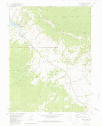
 1980 Parshall1980 Print · USGSGrand County life in the late seventies centered on the confluence of the Colorado River and Williams Fork. Here, researchers can trace the rail corridor of the Denver and Rio Grande Western, the expansive Williams Fork Reservoir, and the rugged passage of Byers Canyon.
 - 1980 Map of Genoa West
 1980 Genoa West1980 Print · USGSThe High Plains of Lincoln County are captured in the late seventies as the community of Genoa centers a landscape of prairie ranching and rail. You can trace the path of the Chicago Rock Island and Pacific railroad and find local water sources like Lickdab Creek and several isolated Well sites.
 - 1980 Map of Gore Mountain
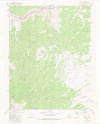
 1980 Gore Mountain1980 Print · USGSThe Colorado wilderness at the turn of the 1980s reveals a landscape of high peaks and hidden drainages along the Routt and Grand Co line. Trace old routes including a Pack Trail and Jeep Trail as they navigate the slopes of Gore Mountain.2 unique versions available
 - 1980 Map of Farmington, 1981 Print
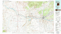 1980 Farmington1981 Print · USGSIn the San Juan Basin during the early 1980s, the energy economy was rapidly transforming the landscape around Farmington and Shiprock. Genealogists and historians can trace the growth of river towns like Kirtland or locate specific sites like the Navajo Mine and Aztec Ruins.2 unique versions available
Showing maps 1-25 of 267
Top cities of Colorado
- Denver historical maps
- Colorado Springs historical maps
- Aurora historical maps
- Fort Collins historical maps
- Lakewood historical maps
- Thornton historical maps
See more
Top counties of Colorado
- Denver historical maps
- El Paso County historical maps
- Arapahoe County historical maps
- Jefferson County historical maps
- Adams County historical maps
- Larimer County historical maps
See more
Frequently asked questions
- What are the different types of historical maps available for Colorado?
- What is the oldest map of Colorado?
- Where can I purchase historical maps of Colorado for my home or office?
- Where can I download high-res historical maps of Colorado?
- Are there historical topographic maps available for Colorado?
- Is there historical aerial imagery available for Colorado?
- Where are historical maps of Colorado sourced from?