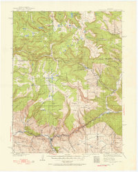
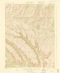
1920s Maps of Colorado
Explore 24 historic maps of Colorado from the 1920s. These maps offer a rare glimpse into what life looked like during the 1920s — showing old roads, neighborhoods, homes, and landmarks that have changed or disappeared over time.
Whether you're researching your family's past, planning a metal detecting trip, or studying how Colorado's landscape evolved across the 1920s, these high-resolution maps are a powerful tool for exploring the history of this region.
- Focus on a specific era: All maps on this page are from the 1920s, giving you a focused view of this time period.
- See what’s changed: Compare century-old streets, trails, and buildings to today's modern landscape using overlays and satellite layers.
- Research with precision: Use these maps for genealogy, historical research, land use analysis, or educational projects.
- View, download, or print: Maps are fully viewable online in high resolution, and can be downloaded or printed for your own records.
Start exploring Colorado's history through authentic maps from the 1920s. This is your window into the past.
Colorado maps
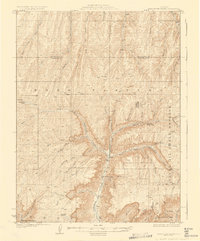
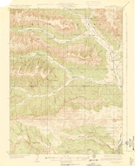
(24)- 1920 Map of Home
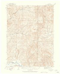
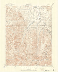
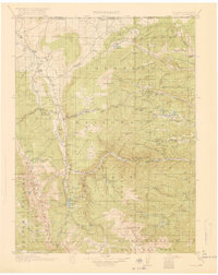 1920 Home1920 Print · USGSLarimer County at the end of the Great War was a landscape of high-country ranches and forest outposts. Genealogists and historians can locate family homesteads like Derby Ranch and Bennett Ranch or trace the early operations of the Black Mtn School and Manhattan.4 unique versions available
 - 1920 Map of Daton Peak
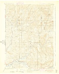
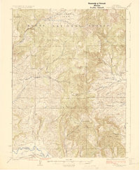
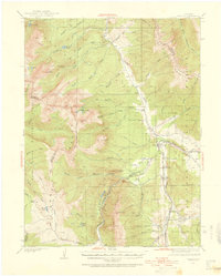
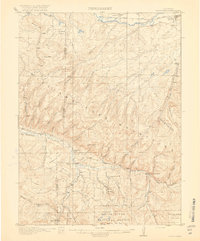 1920 Daton Peak1920 Print · USGSNorthwest Colorado in the era of early mountain ranching and coal mining features a landscape of isolated homesteads and high peaks. Genealogists and historians can trace family-named sites like Jim Dunns Mine, Cary Ranch, and the Pagoda School.2 unique versions available
 - 1922 Map of Paradox Valley
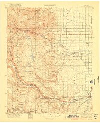
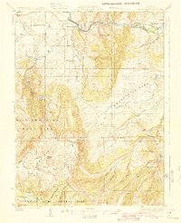
 1922 Paradox Valley1922 Print · USGSMontrose and San Miguel Counties are shown here during the early twentieth-century mining era, featuring a network of ore-processing camps and early river settlements. Researchers can trace historic industrial sites like the Cashin Mine and Coke Ovens or locate early rural institutions such as the Radium School.2 unique versions available
 - 1922 Map of Conejos
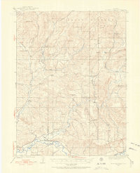
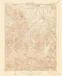
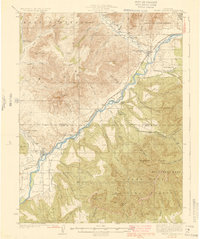
 1922 Conejos1922 Print · USGSThe high San Juan peaks meet the irrigated Luis Valley in the early 1920s, showing a landscape defined by mountain ranching and rail. Trace the Denver and Rio Grande Railroad through the mountains or locate old local landmarks like Bowen Church, Antonito, and the Hot Creek School.4 unique versions available
 - 1923 Map of Elkhead Creek, 1955 Print
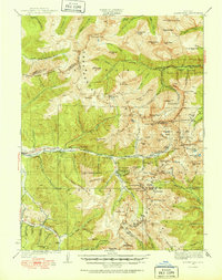
 1923 Elkhead Creek1955 Print · USGSMoffat and Routt counties in the early 1920s reveal a landscape of mountain ranching and coal mining before modern development. Genealogists can trace a network of one-room schoolhouses like Dry Fork School and Elkhead School, or locate old family claims near Seymour Mine.5 unique versions available
 - 1923 Map of Pilot Knob, 1958 Print
 1923 Pilot Knob1958 Print · USGSRoutt County mountain life and early industry are captured here in the early 1920s, showing the high-altitude parks and remote schoolhouses of the period. Genealogists and researchers can trace rural homesteads near Gantts Cabin, several early mines like the Ducey Mine, and small community centers like Deep Creek School.4 unique versions available
 - 1924 Map of Elkhead Creek
 1924 Elkhead Creek1924 Print · USGSNorthwest Colorado in the 1920s was a landscape of remote coal mines and scattered one-room schoolhouses along the Yampa River. Genealogists can trace family roots through numerous sites like Elkhead School, the Seymour Mine, and the Bears Ears Ranger Station.2 unique versions available
 - 1924 Map of Montezuma
 1924 Montezuma1924 Print · USGSHigh Colorado peaks and mining camps define the landscape during the 1920s and 1930s. Genealogists and historians can trace the foundations of Montezuma and Keystone, and locate historic operations like the Hamill Mine and Waldorf Mine.2 unique versions available
 - 1924 Map of Mt. Harris
 1924 Mt. Harris1924 Print · USGSRoutt County coal country and the Yampa River valley are captured in the mid-twenties, showing the rise of rail-side settlements and mining camps. Trace early homesteads and community hubs like Coal View, Pinnacle PO, and the Chicago Mine.4 unique versions available
 - 1924 Map of Ignacio, 1939 Print
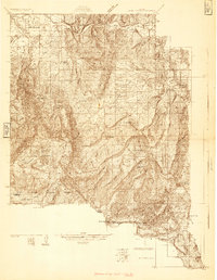
 1924 Ignacio1939 Print · USGSLa Plata County during the mid-1920s reveals a landscape shaped by the Denver and Rio Grande Railroad and the carving of the Animas River. Researchers can trace the early layout of DURANGO, locate remote mountain schoolhouses like Little Red Sch, and identify historic boundaries such as the South Boundary Ceded Ute Land.4 unique versions available
 - 1924 Map of Fraser, 1957 Print
 1924 Fraser1957 Print · USGSGrand County's high-country rail and ranching corridors come alive in this mid-twenties survey of the Fraser Valley. Researchers can trace the original Denver and Salt Lake RR route, locate the Pole Creek School, and study the early layout of West Portal near the Moffat Tunnel.2 unique versions available
 - 1924 Map of Pagosa Springs, 1958 Print
 1924 Pagosa Springs1958 Print · USGSArchuleta County comes into focus in the 1920s as a vital mountain corridor defined by the San Juan and Piedra rivers. Genealogists and historians can trace the Denver and Rio Grande Western rail line and discover remote schoolhouses like Stollsteimer School and O'Neal Park School.2 unique versions available
 - 1925 Map of Pilot Knob
 1925 Pilot Knob1925 Print · USGSRoutt County in the early twenties reveals a landscape of high-altitude parks and remote mountain mining. Genealogists and researchers can trace early rural life through Gantts Cabin, the Long Gulch School, and the Ducey Mine.2 unique versions available
 - 1925 Map of Parachute Creek, 1965 Print
 1925 Parachute Creek1965 Print · USGSThe Roan Plateau in the mid-1920s was a center for early energy exploration and high-country ranching. Genealogists and historians can trace industrial outposts like Washington Shale Camp and local education at Granlee School across this mountain landscape.
 - 1926 Map of Mount Harris
 1926 Mount Harris1926 Print · USGSRoutt County's coal and ranching country comes alive in the mid-1920s as the Denver and Salt Lake railroad follows the Yampa River. Genealogists and historians can trace the foundations of local life through rural schools like Windy Point School and vanished mining-era stops such as Coal View.2 unique versions available
 - 1926 Map of Fraser
 1926 Fraser1926 Print · USGSThe high Rockies come alive in the mid-twenties as the Moffat Tunnel and Denver and Salt Lake Railroad reshape the landscape. Researchers can trace early infrastructure like the Lumber Flume and the isolated Pole Creek School.4 unique versions available
 - 1926 Map of Montezuma
 1926 Montezuma1926 Print · USGSThe Continental Divide during the 1920s reveals a high-country landscape defined by its mining heritage and high mountain passes. Researchers can trace the rugged operations at the Waldorf Mine and Stevens Mine or locate the early mountain settlements of Montezuma and Swandyke.3 unique versions available
 - 1927 Map of Parachute Creek
 1927 Parachute Creek1927 Print · USGSThe Book Plateau is shown here during the 1920s oil shale boom, prior to modern industrial development. Researchers can find early industrial outposts like Columbia Shale Camp, the Granlee School, and pioneer sites such as Summers Cabin.3 unique versions available
 - 1927 Map of Pagosa Springs
 1927 Pagosa Springs1927 Print · USGSThe high country of the San Juan Mountains comes into focus in the 1920s as ranching and rail reach into the river valleys. Genealogists and historians can trace the Denver and Rio Grande Western line through Pagosa Junction and locate old rural hubs like Yellowjacket School.3 unique versions available
 - 1927 Map of Glenwood Springs, 1956 Print
 1927 Glenwood Springs1956 Print · USGSGarfield County’s mountain interior comes to life in the 1920s, showing the high-country settlements and early forest service infrastructure across the Colorado River valley. Genealogists can trace family footprints at Sweetwater Lake Sch, the Shoshone Power Plant, and remote outposts like Hip Roof Cabin.3 unique versions available
 - 1929 Map of Grand Valley
 1929 Grand Valley1929 Print · USGSThe Colorado River corridor near the Garfield and Mesa County line reveals a landscape of early oil shale exploration and rail-side growth in the late 1920s. Genealogists can locate family landmarks like Cunningham Ranch and remote schools including Crawford Sch and Battlement Sch.3 unique versions available
 - 1929 Map of Highmore
 1929 Highmore1929 Print · USGSGarfield County’s high plateau country is captured here in the late twenties during a period of mountain ranching and early energy exploration. Researchers can find old homesteads like Denton Cabin, the Good Hope Shale Camp, and the original Highmore PO site.3 unique versions available
 - 1929 Map of Roan Creek
 1929 Roan Creek1929 Print · USGSThe Colorado oil shale country is captured here in the late 1920s as industry and ranching met in the canyons. Researchers can locate remote schools like Dry Fork Sch, the INDEX SHALE PLANT, and early family outposts including Wilcoxson Ranch.3 unique versions available
 - 1929 Map of Dillon, 1955 Print
 1929 Dillon1955 Print · USGSIn the late 1920s, the Blue River valley was a high-country network of rail stops and mining camps before the landscape was changed by major dam projects. Genealogists and historians can trace the early footprints of Dillon, Frisco, and the Colorado and Southern railroad line.2 unique versions available
End of results
Showing maps 1-24 of 24
Top cities of Colorado
- Denver historical maps
- Colorado Springs historical maps
- Aurora historical maps
- Fort Collins historical maps
- Lakewood historical maps
- Thornton historical maps
See more
Top counties of Colorado
- Denver historical maps
- El Paso County historical maps
- Arapahoe County historical maps
- Jefferson County historical maps
- Adams County historical maps
- Larimer County historical maps
See more
Frequently asked questions
- What are the different types of historical maps available for Colorado?
- What is the oldest map of Colorado?
- Where can I purchase historical maps of Colorado for my home or office?
- Where can I download high-res historical maps of Colorado?
- Are there historical topographic maps available for Colorado?
- Is there historical aerial imagery available for Colorado?
- Where are historical maps of Colorado sourced from?