1990s Maps of Colorado
Explore 284 historic maps of Colorado from the 1990s. These maps offer a rare glimpse into what life looked like during the 1990s — showing old roads, neighborhoods, homes, and landmarks that have changed or disappeared over time.
Whether you're researching your family's past, planning a metal detecting trip, or studying how Colorado's landscape evolved across the 1990s, these high-resolution maps are a powerful tool for exploring the history of this region.
- Focus on a specific era: All maps on this page are from the 1990s, giving you a focused view of this time period.
- See what’s changed: Compare century-old streets, trails, and buildings to today's modern landscape using overlays and satellite layers.
- Research with precision: Use these maps for genealogy, historical research, land use analysis, or educational projects.
- View, download, or print: Maps are fully viewable online in high resolution, and can be downloaded or printed for your own records.
Start exploring Colorado's history through authentic maps from the 1990s. This is your window into the past.
Colorado maps
(284)- 1991 Map of Arcola, 1995 Print
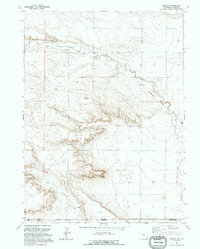 1991 Arcola1995 Print · USGSThe high plains along the Wyoming and Colorado border appear in the early 1990s as a landscape of remote drainages and industrial relics. Trace the Old Railroad Grade past Arcola and locate landmarks like Chalk Bluffs and Porter Creek.
 - 1991 Map of Pine Bluffs SW, 1995 Print
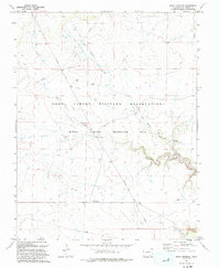
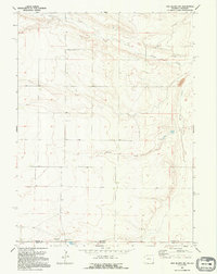 1991 Pine Bluffs SW1995 Print · USGSHigh Plains ranching and the interstate border define this landscape in the early nineties. Genealogists and researchers can trace family-named sites like Kelly Ranch and Baumann Ranch or locate the Butler Landing Strip.
 - 1991 Map of Carpenter, 1995 Print
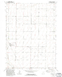 1991 Carpenter1995 Print · USGSNear the Wyoming-Colorado border in the early nineties, the small community of Carpenter remained a quiet agricultural hub. Local historians can trace the remnants of the Old Railroad Grade and locate family markers at the village Cem.
 - 1991 Map of Pine Bluffs SE, 1995 Print
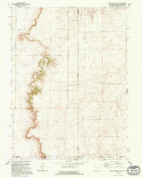 1991 Pine Bluffs SE1995 Print · USGSHigh Plains ranching territory meets at the convergence of three states in the early nineties. Genealogists and land researchers can trace the jagged Pine Bluffs escarpment and the historic Johnson land division near Muddy Creek.
 - 1993 Map of Delhi
 1993 Delhi1993 Print · USGSThe high plains of the Colorado borderlands are captured here in the early 1990s, where the Santa Fe railroad meets the Comanche National Grassland. Researchers can trace old ranching infrastructure through local landmarks like Barbee Windmill, Hixon Spring, and the small settlement of Delhi.
 - 1993 Map of The Glade
 1993 The Glade1993 Print · USGSThe San Juan National Forest uplands come into focus in the early nineties, revealing a complex web of remote springs and reservoirs. Researchers can trace the water-management history of the high country via Glade FS Station, Wolf Den Reservoir, and Wild Bill Spring.
 - 1993 Map of Joe Davis Hill
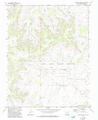
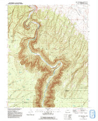 1993 Joe Davis Hill1993 Print · USGSThe Dolores River corridor in San Miguel County is revealed in the early 1990s as a center for mining and remote ranching. Researchers can locate specific industrial sites like the Sarah Ellen Mine, the Spud Patch Camp (Site), and multiple upland reservoirs.
 - 1993 Map of Sheep Canyon
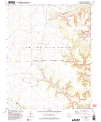
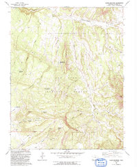
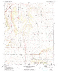 1993 Sheep Canyon1993 Print · USGSSoutheast Colorado ranching lands and military training grounds converge in the 1990s near the Santa Fe National Historic Trail. Researchers can trace old family ranching legacies through remote landmarks like Mills Well, the Hoffman Windmill, and Kennedy Ponds.
 - 1993 Map of South Mountain
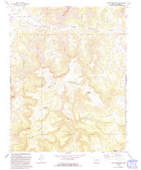 1993 South Mountain1993 Print · USGSDolores County’s high-country terrain was carefully documented in the early nineties, revealing a landscape of remote plateaus and mountain peaks. Researchers can locate Nash Cem and trace water infrastructure like the Flume and Siphon along Disappointment Creek.
 - 1993 Map of Dawson Draw
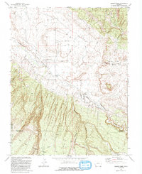 1993 Dawson Draw1993 Print · USGSThe San Miguel and Dolores County line comes alive in the 1990s as it crosses a landscape of ranching and resource extraction. Trace the high desert geography near Daddy Williams Bridge, the Klondike mine, and a remote Cem.
 - 1993 Map of Thatcher
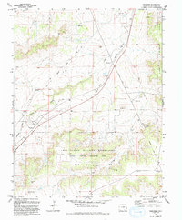 1993 Thatcher1993 Print · USGSLas Animas County in the early nineties reveals a landscape shaped by military maneuvers and deep western history. Trace the path of the Historic Santa Fe National Trail or explore the settlements of Thatcher and Houghton along the Old RR Grade.
 - 1993 Map of Bloom
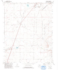
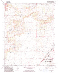
 1993 Bloom1993 Print · USGSSoutheast Colorado's high plains reveal a landscape of transit and ranching in the early nineties, where the Historic Santa Fe Trail follows the same path as the railroad. Researchers can trace the small settlement at Bloom or locate family-named landmarks like Cochran Reservoir and Fultz Reservoir.
 - 1993 Map of Stage Canyon
 1993 Stage Canyon1993 Print · USGSThe high plains of Las Animas County are seen here during the early nineties within the Fort Carson Military Reservation. Researchers can trace old routes like Red Rock Road and locate critical water sources such as Stage Spring and Sugarloaf Spring.2 unique versions available
 - 1993 Map of Tyrone
 1993 Tyrone1993 Print · USGSLas Animas County ranchlands are shown here in the early 1990s as the military reservation transformed the local landscape. Genealogists and historians can trace the Santa Fe National Historic Trail and locate the Simpson Cem and Tyrone settlement.
 - 1993 Map of Trimble Point
 1993 Trimble Point1993 Print · USGSMontezuma County underwent a significant transformation by the early 1990s as the Dolores River was harnessed for recreation and irrigation. You can trace the Old Railroad Grade through the canyons or locate infrastructure like the McPhee Dam and Beaver Creek Marina.
 - 1993 Map of Brown Sheep Camp
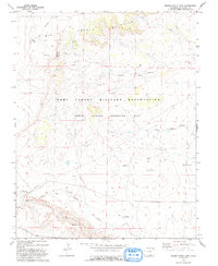 1993 Brown Sheep Camp1993 Print · USGSLas Animas County ranchlands meet military training grounds in the 1990s as the Fort Carson Military Reservation expands. Trace the remote history of the high plains through outposts like Brown Sheep Camp and Burson Camp.
 - 1993 Map of Boggy Draw
 1993 Boggy Draw1993 Print · USGSMontezuma County's timber and ranching history is preserved here in the early nineties, centered on the high plateau of the San Juan National Forest. Trace the remnants of local industry at Rusts Sawmill (Site) and follow the Old Railroad Grade past dozens of family-named reservoirs.2 unique versions available
 - 1993 Map of Lockwood Arroyo
 1993 Lockwood Arroyo1993 Print · USGSIn the early nineties, this Las Animas County landscape shows the expansion of the Fort Carson Military Reservation. Researchers can trace the drainage of Lockwood Arroyo and find early sites like Graves.
 - 1993 Map of Glade Mountain
 1993 Glade Mountain1993 Print · USGSDolores County’s high forest terrain is captured in the early 1990s, showing a landscape of named springs and old pack trails. Researchers can trace remote landmarks like the Benchmark Lookout Glade, McKinney Reservoir, and the winding course of Disappointment Creek.2 unique versions available
 - 1993 Map of Willow Spring
 1993 Willow Spring1993 Print · USGSDolores and Montezuma counties are shown here in the early 1990s, where high mesas meet a complex network of forest reservoirs. Local historians can trace the Old Railroad Grade or locate the Beaver Creek Massacre Historical Marker near Willow Spring.
 - 1993 Map of Bates Lake
 1993 Bates Lake1993 Print · USGSLas Animas County in the early 1990s showcases a landscape shaped by military maneuvers and historic migration routes. Researchers can trace the Santa Fe National Historic Trail or locate remote ranching landmarks like the Smith Ranch Windmill and Poitrey.
 - 1993 Map of Narraguinnep Mountain
 1993 Narraguinnep Mountain1993 Print · USGSThe borderlands of Montezuma and Dolores Counties come into sharp focus in the early 1990s, revealing a landscape of high-country water management and mountain terrain. Researchers can locate remote landmarks like the Fort Narraguinnep Historical Site, Long Park Lake, and the winding Narraguinnep Canyon.
 - 1993 Map of Sun Valley Ranch
 1993 Sun Valley Ranch1993 Print · USGSLas Animas County in the early nineties remains a landscape of deep canyons and isolated cattle-ranching infrastructure. Researchers can trace the rugged drainage of the Apishapa River through the Sun Valley Ranch or locate remote water sources like Box Spring and Bruenellie Windmill.
 - 1993 Map of Doe Canyon
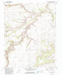
 1993 Doe Canyon1993 Print · USGSThe river canyon country of the San Juan National Forest is documented here in the early 1990s. Researchers can trace land use patterns through landmarks like Bradfield Bridge, the Dolores River State Wildlife Area, and the numerous reservoirs including Arnold Reservoir and McClure Reservoir.
 - 1993 Map of Rock Crossing
 1993 Rock Crossing1993 Print · USGSThe Piñon Canyon Maneuver Site in Las Animas County is shown here in the 1990s as a vast military training area. You can trace early transit routes and water sources like Pipeline Road, Rock Crossing, and Big Water Arroyo.
Showing maps 1-25 of 284
Top cities of Colorado
- Denver historical maps
- Colorado Springs historical maps
- Aurora historical maps
- Fort Collins historical maps
- Lakewood historical maps
- Thornton historical maps
See more
Top counties of Colorado
- Denver historical maps
- El Paso County historical maps
- Arapahoe County historical maps
- Jefferson County historical maps
- Adams County historical maps
- Larimer County historical maps
See more
Frequently asked questions
- What are the different types of historical maps available for Colorado?
- What is the oldest map of Colorado?
- Where can I purchase historical maps of Colorado for my home or office?
- Where can I download high-res historical maps of Colorado?
- Are there historical topographic maps available for Colorado?
- Is there historical aerial imagery available for Colorado?
- Where are historical maps of Colorado sourced from?