1890s Maps of Colorado
Explore 82 historic maps of Colorado from the 1890s. These maps offer a rare glimpse into what life looked like during the 1890s — showing old roads, neighborhoods, homes, and landmarks that have changed or disappeared over time.
Whether you're researching your family's past, planning a metal detecting trip, or studying how Colorado's landscape evolved across the 1890s, these high-resolution maps are a powerful tool for exploring the history of this region.
- Focus on a specific era: All maps on this page are from the 1890s, giving you a focused view of this time period.
- See what’s changed: Compare century-old streets, trails, and buildings to today's modern landscape using overlays and satellite layers.
- Research with precision: Use these maps for genealogy, historical research, land use analysis, or educational projects.
- View, download, or print: Maps are fully viewable online in high resolution, and can be downloaded or printed for your own records.
Start exploring Colorado's history through authentic maps from the 1890s. This is your window into the past.
Colorado maps
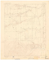
(82)- 1890 Map of East Denver
 1890 East Denver1890 Print · USGSDenver and the surrounding plains are captured in the late frontier era as a complex web of irrigation canals and iron rails. Researchers can trace early water systems like the High Line Ditch or locate early settlements such as Parker's and Scranton.
 - 1890 Map of Granada, 1962 Print
 1890 Granada1962 Print · USGSSoutheast Colorado at the close of the nineteenth century was a landscape of expanding steel and water. Researchers can trace early railroad developments along the Missouri Pacific Railroad and locate pioneer outposts like Ellis Ranch or Granada.
 - 1891 Map of Walsenburg
 1891 Walsenburg1891 Print · USGSHuerfano County in the early 1890s was a landscape shaped by coal and steam as the Denver and Rio Grande Railroad expanded through the region. Genealogists and historians can trace early settlements and junctions like Walsenburg, Rouse, and Cuchara Junction.
 - 1891 Map of Sanborn
 1891 Sanborn1891 Print · USGSEastern Colorado ranching life at the end of the century centers on isolated outposts and seasonal watercourses. Genealogists can trace family holdings like the Fody Ranch and Orcutt Ranch or the small settlement at Sanborn.
 - 1891 Map of Catlin
 1891 Catlin1891 Print · USGSSoutheast Colorado's high plains were a landscape of competing rail lines and isolated ranching camps in the late nineteenth century. Genealogists and historians can trace the early development of Rocky Ford and Catlin along the Arkansas River or locate remote outposts like Lone Tree Ranch and Sheep Camp.
 - 1891 Map of Pueblo
 1891 Pueblo1891 Print · USGSPueblo and the Arkansas River valley are shown here in the late nineteenth century as the region's rail and industrial power surged. Local historians can trace the early footprints of Bessemer, the extensive rail yards of the Missouri Pacific Railroad, and rural landmarks like the Three R Ranch.
 - 1891 Map of Arroyo
 1891 Arroyo1891 Print · USGSEastern Colorado was still a ranching frontier in the late 1880s as the rail lines expanded across the high plains. Genealogists and historians can trace early holdings like Cox Ranch and Mosley Ranch along the route of the Union Pacific Railroad.
 - 1891 Map of Albany
 1891 Albany1891 Print · USGSThe Colorado-Kansas borderlands were a crossroads of historic transit in the early 1890s. Genealogists and historians can trace the paths of the Santa Fe Trail and Texas Trail past frontier outposts like Albany and Kline Ranche.
 - 1891 Map of Kit Carson
 1891 Kit Carson1891 Print · USGSThe eastern Colorado plains appear here in the late nineteenth century as a landscape defined by the arrival of the rails. Researchers can trace the early path of the Union Pacific Railroad through the stations at Kit Carson, Wild Horse, and First View.
 - 1891 Map of Higbee
 1891 Higbee1891 Print · USGSSoutheastern Colorado’s high plains and canyon country are captured in the late 1880s, showcasing a frontier landscape. Trace early water sources like Alkali Springs and follow the deep cuts of Smith Canon near the isolated outpost of Higbee.
 - 1891 Map of Las Animas
 1891 Las Animas1891 Print · USGSSoutheast Colorado in the early 1890s centers on the confluence of the Arkansas River and Purgatoire River at Las Animas. Researchers can trace the early rail networks of the Atchison Topeka and Santa Fe Railroad and find historic sites like Fort Lyon.
 - 1891 Map of Spanish Peaks
 1891 Spanish Peaks1891 Print · USGSLas Animas county at the end of the nineteenth century was a rugged landscape of new rail lines and river settlements. Genealogists and historians can trace the early footprints of Trinidad, the path of the Denver Texas and Fort Worth Railroad, and canyon outposts like Starkville and Sopris.2 unique versions available
 - 1891 Map of Timpas
 1891 Timpas1891 Print · USGSHigh plains ranching and steam-era railroading dominate this Otero County landscape during the late 1800s. Genealogists and researchers can trace the historic route of the Atchison Topeka and Santa Fe Railroad through early stops at Timpas and Iron Springs.
 - 1891 Map of Nepesta
 1891 Nepesta1891 Print · USGSSoutheast Colorado at the close of the 1880s reveals a landscape defined by the arrival of the rails along the Arkansas River. Researchers can trace early ranching sites like Skinner & Tabor Ranch and follow the competing paths of the Atchison Topeka and Santa Fe Railroad and the Missouri Pacific Railroad.
 - 1891 Map of Apishapa
 1891 Apishapa1891 Print · USGSSoutheastern Colorado was a land of high mesas and vital rail connections in the 1890s. Genealogists and historians can trace early rail stops like Thatcher and Delhi along the Atchison Topeka and Santa Fe Railroad.
 - 1891 Map of Leadville
 1891 Leadville1891 Print · USGSThe Silver City and its surrounding mining camps are caught at their industrial height in the 1880s and 90s. Trace the competing rail lines and high-altitude settlements from Holy Cross City to the busy streets of Leadville and London Park City.7 unique versions available
 - 1891 Map of Springfield
 1891 Springfield1891 Print · USGSSoutheastern Colorado is captured in the late frontier era just after the county's founding. Researchers can trace the early layout of Springfield and its relationship to the seasonal waters of Sand Arroyo and Bear Creek.
 - 1891 Map of Mesa De Maya
 1891 Mesa De Maya1891 Print · USGSLas Animas County ranching country appears here in the early 1890s as a landscape of deep rimrock canyons and isolated mesas. Trace early settlements like Indianapolis and Troy or the route of the Denver Texas & Ft Worth railroad near Watervale.
 - 1891 Map of Limon, 1963 Print
 1891 Limon1963 Print · USGSEastern Colorado's rail corridors are captured in the early 1890s as steam-age transit hubs began to reshape the plains. Trace early homesteads and rail junctions at Limon, River Bend, and the Silsby Ranch along the route of the Kansas Pacific Railroad.
 - 1892 Map of Huerfano Park
 1892 Huerfano Park1892 Print · USGSSouthern Colorado mountain life is captured here in the late nineteenth century, showing the early settlements and rail lines of the Huerfano region. Researchers can trace the path of the Denver and Rio Grande Railroad and locate vanished stops at Malachite, Sharpsdale, and Placer.5 unique versions available
 - 1892 Map of Lamar
 1892 Lamar1892 Print · USGSSoutheastern Colorado in the early 1890s shows the pivotal arrival of the rail-and-river economy across the High Plains. Researchers can trace the development of early irrigation systems and rail stops like Lamar, Chivington, and Graveyard Creek.7 unique versions available
 - 1892 Map of Limon
 1892 Limon1892 Print · USGSThe High Plains of eastern Colorado come into focus in the 1890s as a critical railway junction at the meeting of the Elbert and Lincoln county line. Trace early settlements like Agate, River Bend, and Resolis along the path of the Kansas Pacific Railroad.6 unique versions available
 - 1892 Map of Cheyenne Wells
 1892 Cheyenne Wells1892 Print · USGSEastern Colorado during the early frontier era is documented here as the railroad transformed the High Plains. Genealogists and historians can trace the vital iron link of the Union Pacific Railroad through settlements like Cheyenne Wells and Arapahoe.
 - 1892 Map of Vilas
 1892 Vilas1892 Print · USGSSoutheast Colorado and the Kansas borderland are shown here in the early 1890s, when ranching and the cattle trade dominated the high plains. Genealogists and historians can trace the Texas Trail and early settlements like Boston, Vilas, and Mathews Ranch.5 unique versions available
 - 1892 Map of Abajo
 1892 Abajo1892 Print · USGSSoutheastern Utah in the 1890s remained a remote frontier where settlement followed the river and historic paths. Researchers can trace early routes like the Old Spanish Trail and find the riverside location of Bluff City below the Abajo Mts.
Showing maps 1-25 of 82
Top cities of Colorado
- Denver historical maps
- Colorado Springs historical maps
- Aurora historical maps
- Fort Collins historical maps
- Lakewood historical maps
- Thornton historical maps
See more
Top counties of Colorado
- Denver historical maps
- El Paso County historical maps
- Arapahoe County historical maps
- Jefferson County historical maps
- Adams County historical maps
- Larimer County historical maps
See more
Frequently asked questions
- What are the different types of historical maps available for Colorado?
- What is the oldest map of Colorado?
- Where can I purchase historical maps of Colorado for my home or office?
- Where can I download high-res historical maps of Colorado?
- Are there historical topographic maps available for Colorado?
- Is there historical aerial imagery available for Colorado?
- Where are historical maps of Colorado sourced from?