1950s Maps of Colorado
Explore 528 historic maps of Colorado from the 1950s. These maps offer a rare glimpse into what life looked like during the 1950s — showing old roads, neighborhoods, homes, and landmarks that have changed or disappeared over time.
Whether you're researching your family's past, planning a metal detecting trip, or studying how Colorado's landscape evolved across the 1950s, these high-resolution maps are a powerful tool for exploring the history of this region.
- Focus on a specific era: All maps on this page are from the 1950s, giving you a focused view of this time period.
- See what’s changed: Compare century-old streets, trails, and buildings to today's modern landscape using overlays and satellite layers.
- Research with precision: Use these maps for genealogy, historical research, land use analysis, or educational projects.
- View, download, or print: Maps are fully viewable online in high resolution, and can be downloaded or printed for your own records.
Start exploring Colorado's history through authentic maps from the 1950s. This is your window into the past.
Colorado maps
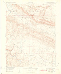
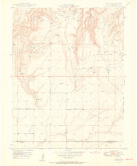
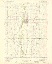
(528)- 1950 Map of Horse Range Mesa
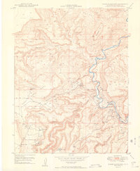 1950 Horse Range Mesa1950 Print · USGSSan Miguel County mining operations are captured here at the dawn of the nuclear age. Researchers can trace numerous uranium and radium claims like Veta Mad Mine and the Charles T Mines near the settlement of Slick Rock.2 unique versions available
 - 1950 Map of Frederick
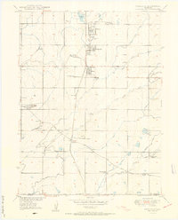 1950 Frederick1950 Print · USGSThe coal-rich corridor of Weld County is caught in a moment of industrial transition during the early 1950s. Genealogists and historians can trace the mining family hubs of Frederick, Firestone, and Dacono, alongside local schools like Mount View School and the Shamrock Mine.7 unique versions available
 - 1950 Map of Manitou
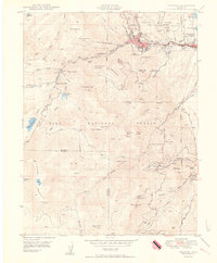 1950 Manitou1950 Print · USGSThe foothills of the Rampart Range come alive in this mid-century survey of the mountain rail systems and canyon retreats west of Colorado Springs. Researchers can trace the steep Inclined Railway, locate the Helen Hunt Jackson Cemetery, and find vanished stops like Minnehaha along the cog railway.2 unique versions available
 - 1950 Map of Derby
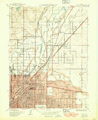 1950 Derby1950 Print · USGSThe northern reaches of Denver and Adams County are captured here at mid-century as industry and rail lines shaped the river valley. Researchers can trace the early footprints of Adams City, the Stockyards, and family history at Riverside Cemetery or Rose Hill Cem.
 - 1950 Map of Cascade
 1950 Cascade1950 Print · USGSThe Rampart Range foothills during the mid-twentieth century show a landscape of mountain health retreats and early tourism. Genealogists can trace families near Chipita Park, Glen Eyrie, and the Holy Rosary Chapel.2 unique versions available
 - 1950 Map of Englewood
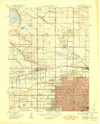
 1950 Englewood1950 Print · USGSDenver and Englewood are seen during a period of rapid post-war expansion, blending urban civic centers with emerging suburban country clubs. Researchers can trace historic burial sites at Fairmount Cemetery or locate the settlement of Sullivan near the Highline Canal.
 - 1950 Map of Juanita Arch
 1950 Juanita Arch1950 Print · USGSMesa County is shown at the height of the uranium boom in the early fifties, where the Dolores River carves through massive mesas. Researchers can trace early mining activity at the Maverick Mines or locate the natural Juanita Arch.3 unique versions available
 - 1950 Map of Greeley
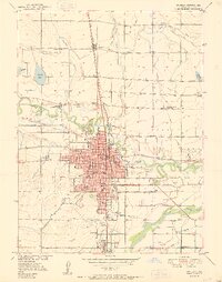 1950 Greeley1950 Print · USGSGreeley and Evans thrive at the mid-century confluence of the Cache La Poudre and South Platte Rivers. Researchers can trace historic neighborhoods and landmarks like the Spanish Colony, Linn Grove Cemetery, and the Union Pacific rail network.8 unique versions available
 - 1950 Map of Elsmere
 1950 Elsmere1950 Print · USGSEl Paso County at the dawn of the 1950s shows an area transitioning through military aviation and ranching. Trace the early layout of Peterson Field or find local landmarks like Pikes Peak Speedway and the settlement of Elsmere.2 unique versions available
 - 1950 Map of Gowanda
 1950 Gowanda1950 Print · USGSWeld County farming and rail communities thrive along the river bottom in the years following the war. Researchers can locate the Pearl Howlett School, trace the Great Western tracks, and identify family landmarks like the Rinn Valley Grange.2 unique versions available
 - 1950 Map of Hamm Canyon
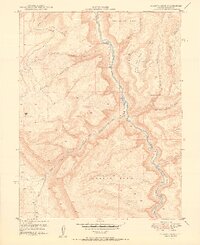
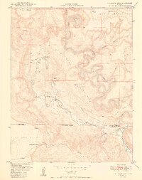
 1950 Hamm Canyon1950 Print · USGSSan Miguel County saw a surge in uranium prospecting at mid-century, as shown in this detailed 1950 survey. Researchers can trace early mining access near Mexico Mines and Lookout Mine or follow the winding course of the Dolores River through Hamm Canyon.
 - 1950 Map of Platteville
 1950 Platteville1950 Print · USGSThe South Platte River valley in the mid-twentieth century shows an intensive irrigation landscape supporting the agricultural community of Platteville. Genealogists and local historians can trace the Union Pacific rail line and locate the Site of Old Fort Vasquez or the St Francis Cemetery.2 unique versions available
 - 1950 Map of Calamity Mesa
 1950 Calamity Mesa1950 Print · USGSMesa County mining operations are shown in detail during the early Cold War uranium boom. Researchers can trace the rugged access roads leading to Calamity Camp and Outlaw Camp or locate the Hidden Treasure Mine.2 unique versions available
 - 1950 Map of Fountain
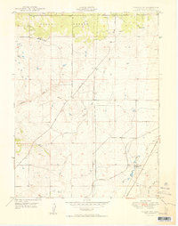
 1950 Fountain1950 Print · USGSEl Paso County at the dawn of the fifties shows a landscape of strategic rail lines and expanding irrigation. Genealogy researchers can trace family landmarks like Fairview Cemetery and the original sites of Widefield School and Fountain Valley School.2 unique versions available
 - 1950 Map of Joe Davis Hill
 1950 Joe Davis Hill1950 Print · USGSThe Colorado mining frontier of the late 1940s comes alive in this survey of the high plateaus along the Dolores River. Local historians and researchers can trace uranium-era claims like the Sarah Ellen Mine and remote outposts such as Spud Patch Camp.2 unique versions available
 - 1950 Map of Egnar
 1950 Egnar1950 Print · USGSSouthwest Colorado mining and ranching take center stage at the turn of the fifties on the San Miguel County line. Genealogists and industrial historians can locate specific operations like the Golden Rod Mines, Effie B Mine, and the Egnar School.2 unique versions available
 - 1950 Map of Arvada
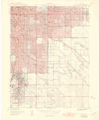
 1950 Arvada1950 Print · USGSMid-century Jefferson County comes to life as Denver’s western edge begins its suburban transformation from a landscape of irrigation ditches and small farms. Researchers can trace the original footprints of Arvada, Wheatridge, and local landmarks like the Crown Hill Cemetery and Regis College.
 - 1950 Map of Anderson Mesa
 1950 Anderson Mesa1950 Print · USGSMontrose and San Miguel Counties are shown at the height of post-war mineral exploration in the late 1940s. Researchers can trace early mining operations like Morning Star Mine and The Raven Mine near the loops of Dolores River.2 unique versions available
 - 1950 Map of Fountain NE
 1950 Fountain NE1950 Print · USGSEl Paso County ranch lands are captured here in the late 1940s, showing a landscape shaped by water and wide-open range. Researchers can trace early family holdings like Slate Ranch and Kane Ranch or locate historical water infrastructure like the Bailey Windmill.
 - 1950 Map of Falcon NW
 1950 Falcon NW1950 Print · USGSEl Paso County ranching culture is frozen in time here during the post-war era, showing a landscape defined by large family estates and high-plains drainages. Genealogists can locate named landmarks like Wolf Ranch and Banning Lewis Ranch or trace the early course of the Chicago Rock Island and Pacific railroad.2 unique versions available
 - 1950 Map of Fort Lupton
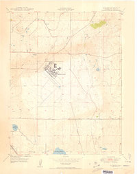
 1950 Fort Lupton1950 Print · USGSFort Lupton and the South Platte River valley are captured in detail during the post-war era, showing a landscape shaped by rail and irrigation. Genealogists can locate family landmarks like Hillside Cemetery, Porter Sch, and the small settlement of Wattenberg.2 unique versions available
 - 1950 Map of Pine Mountain
 1950 Pine Mountain1950 Print · USGSMesa County was a hub of resource mapping and forestry in the early postwar era. You can trace the steep routes of the Snowshoe Trail and Basin Trail as they navigate from Pine Mountain down into Yellowjacket Canyon.2 unique versions available
 - 1950 Map of Atkinson Creek
 1950 Atkinson Creek1950 Print · USGSThe San Miguel River valley and surrounding mesas are captured here during the mid-century mining boom. Local history researchers can trace the roads leading to the Wright Mine or locate early ranching landmarks like Spring Creek Ranch and Hog Park.2 unique versions available
 - 1950 Map of Windsor
 1950 Windsor1950 Print · USGSWindsor and the surrounding plains of Weld and Larimer Counties appear here in the mid-twentieth century as a thriving agricultural and rail corridor. Researchers can trace the layout of small rail stops like Kelim and Officer or locate rural landmarks like Oklahoma School and Jeffers Sch.8 unique versions available
 - 1950 Map of Red Canyon
 1950 Red Canyon1950 Print · USGSCanyon country at the Mesa and Montrose County line comes into focus in 1950 as postwar mineral exploration intensified. Local historians and mineral enthusiasts can locate the North Star Mine, Club Ranch, and several inactive placer mines along the Dolores River.2 unique versions available
Showing maps 1-25 of 528
Top cities of Colorado
- Denver historical maps
- Colorado Springs historical maps
- Aurora historical maps
- Fort Collins historical maps
- Lakewood historical maps
- Thornton historical maps
See more
Top counties of Colorado
- Denver historical maps
- El Paso County historical maps
- Arapahoe County historical maps
- Jefferson County historical maps
- Adams County historical maps
- Larimer County historical maps
See more
Frequently asked questions
- What are the different types of historical maps available for Colorado?
- What is the oldest map of Colorado?
- Where can I purchase historical maps of Colorado for my home or office?
- Where can I download high-res historical maps of Colorado?
- Are there historical topographic maps available for Colorado?
- Is there historical aerial imagery available for Colorado?
- Where are historical maps of Colorado sourced from?