1960s Maps of Colorado
Explore 3,005 historic maps of Colorado from the 1960s. These maps offer a rare glimpse into what life looked like during the 1960s — showing old roads, neighborhoods, homes, and landmarks that have changed or disappeared over time.
Whether you're researching your family's past, planning a metal detecting trip, or studying how Colorado's landscape evolved across the 1960s, these high-resolution maps are a powerful tool for exploring the history of this region.
- Focus on a specific era: All maps on this page are from the 1960s, giving you a focused view of this time period.
- See what’s changed: Compare century-old streets, trails, and buildings to today's modern landscape using overlays and satellite layers.
- Research with precision: Use these maps for genealogy, historical research, land use analysis, or educational projects.
- View, download, or print: Maps are fully viewable online in high resolution, and can be downloaded or printed for your own records.
Start exploring Colorado's history through authentic maps from the 1960s. This is your window into the past.
Colorado maps
- 1960 Map of Denver
 1960 Denver1960 Print · USGSDenver and the Colorado Front Range are seen here at a pivotal moment of postwar expansion into the plains and foothills. Researchers can trace the mid-century rail network of the Denver & Rio Grande Western RR and locate historic institutional landmarks like Buckley Field and the Colorado School of Mines.
 - 1960 Map of Leadville
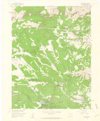
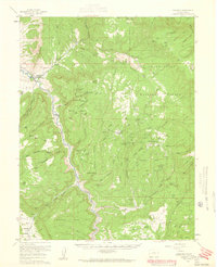
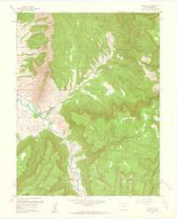
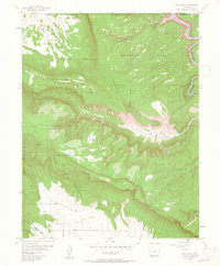
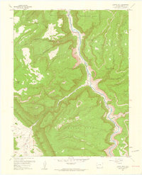
 1960 Leadville1960 Print · USGSThe Colorado high country in the mid-fifties comes alive through its mining camps, river valleys, and rail lines. Trace the industrial legacy of the Climax Molybdenum Mine and explore the alpine reaches of the Camp Hale Military Reservation.2 unique versions available
 - 1960 Map of Craig
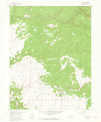
 1960 Craig1960 Print · USGSNorthwest Colorado in the 1950s is a landscape of mountain summits and industrial growth at the headwaters of the West. Genealogists and historians can trace rail-town development along the Denver and Salt Lake line, while locating Uranium Mines and settlements like Craig, Meeker, and Steamboat Springs.
 - 1960 Map of Montrose
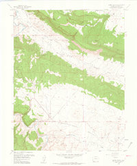
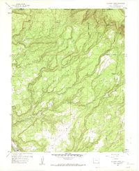
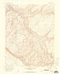
 1960 Montrose1960 Print · USGSThe Colorado high country in the mid-fifties is captured here during a period of steady ranching and persistent mining. Researchers can trace the path of the Denver & Rio Grande Western RR or locate small settlements like Somerset, Maher, and Sargent.2 unique versions available
 - 1960 Map of Moab
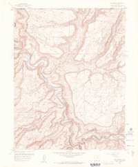
 1960 Moab1960 Print · USGSThe canyonlands and high plateaus of the Utah-Colorado border are shown here during the mid-century uranium boom. Researchers can trace the river-and-rail corridors of the Colorado River and the Denver and Rio Grande Western near Moab and Uravan.3 unique versions available
 - 1960 Map of Vernal
 1960 Vernal1960 Print · USGSNortheastern Utah was a rugged frontier of mineral extraction and federal conservation in the mid-twentieth century. Genealogists and historians can trace the growth of Vernal, locate Gilsonite mining operations near Bonanza, and explore the 1950s boundaries of Dinosaur National Monument.
 - 1960 Map of Evergreen
 1960 Evergreen1960 Print · USGSThe foothills of Jefferson County are shown here in the early 1960s as mountain communities like Evergreen and Kittredge expanded. Trace the development of local landmarks like Evergreen Lake, Troutdale, and the grounds of the Mt Vernon Club Place.
 - 1960 Map of Grand Junction
 1960 Grand Junction1960 Print · USGSThe Grand Junction area at the dawn of the 1960s shows a landscape of river-valley agriculture and high-plateau extraction. Researchers can trace the path of the dismantled railroad and find vanished sites like Watson and Sego.2 unique versions available
 - 1960 Map of Nucla, 1961 Print
 1960 Nucla1961 Print · USGSMontrose County in the early 1960s reveals a unique intersection of high-desert ranching and the regional mining economy. Researchers can trace local lineage through Nucla and the Templeton Ranch, or locate historical workings like the Navajo Mine and Nix Mine.3 unique versions available
 - 1960 Map of Hamm Canyon, 1961 Print
 1960 Hamm Canyon1961 Print · USGSSan Miguel County mining and ranching lands appear in detail at the start of the 1960s. Researchers can locate remote operations like the Maggie No 2 Mine, the Uncle Sam Mine, and a solitary Airstrip near the Dolores River.3 unique versions available
 - 1960 Map of Paradox, 1961 Print
 1960 Paradox1961 Print · USGSWestern Colorado at the height of the post-war mining boom reveals a landscape carved by the Dolores River and its uranium-rich mesas. Local historians can trace the foundations of Paradox and Bedrock alongside dozens of named claims like the Golden Cycle Mine and Shamrock Mines.4 unique versions available
 - 1960 Map of Gateway, 1961 Print
 1960 Gateway1961 Print · USGSWestern Colorado's high mesas and mining outposts are recorded here in the early sixties as the uranium boom shaped the landscape. Researchers can locate remote operations like the New Verde Mines and Mammoth Mine or trace the Dolores River past Gateway.4 unique versions available
 - 1960 Map of Atkinson Creek, 1961 Print
 1960 Atkinson Creek1961 Print · USGSMontrose County was a landscape of high mesas and deep canyons at the start of the 1960s. Researchers can trace land use through landmarks like Spring Creek Ranch, high-altitude Airstrips, and the early footprints of the mining community at Uravan.3 unique versions available
 - 1960 Map of Gateway, 1961 Print
 1960 Gateway1961 Print · USGSThe Dolores River canyon country of Mesa County is captured here in the early sixties, showing a landscape shaped by mining and cattle. Trace the uranium-era activity at the Black Mama No 2 Mine, Mammoth Mine, and the Wayside Chapel in Gateway.4 unique versions available
 - 1960 Map of Uravan, 1961 Print
 1960 Uravan1961 Print · USGSMontrose County was the epicenter of the American uranium boom when this survey was field-checked in the mid-century. Researchers can trace the industrial footprint of the Uravan site, including the Tailings Ponds and mines like Sunbeam Mine or Virgin Mine.4 unique versions available
 - 1960 Map of Roc Creek, 1961 Print
 1960 Roc Creek1961 Print · USGSThe canyon country of western Colorado comes to life in the early 1960s, showing a world of remote cattle ranches and active uranium-era prospects. Trace the routes of the Radium Trail and Salt Train past the Radium Cycle Mine and Pace Ranch.3 unique versions available
 - 1960 Map of Pine Mountain, 1961 Print
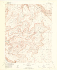
 1960 Pine Mountain1961 Print · USGSThe Uncompahgre highlands are documented here during the early sixties, showing a wilderness of canyons and high-plateau ponds. Researchers can trace historic access routes like the Snowshoe Trail and locate remote landmarks such as Wolf Hill and Yellowjacket Canyon.3 unique versions available
 - 1960 Map of Nepesta, 1961 Print
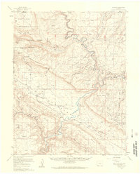
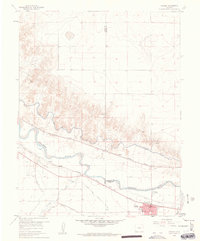
 1960 Nepesta1961 Print · USGSThe Arkansas River valley comes alive in the early sixties as a hub of rail lines and complex irrigation. Genealogists and historians can trace the tracks of the Missouri Pacific or locate the Rodeo Ground and the settlement of Nepesta.4 unique versions available
 - 1960 Map of Slick Rock, 1961 Print
 1960 Slick Rock1961 Print · USGSSan Miguel County was at the peak of its uranium mining era when this survey recorded its canyons and mesas. Researchers can trace dozens of specific claims like the Joe Dandy Mine and locate lost outposts like Bachelor Camp or Indian Henrys Cabin.2 unique versions available
 - 1960 Map of Red Canyon, 1961 Print
 1960 Red Canyon1961 Print · USGSThe canyons and mesas of western Colorado appear here at the height of a mid-century mining boom. Researchers can trace dozens of specific claims like the Shamrock Mine and Bluebird Mine near the isolated Club Ranch.3 unique versions available
 - 1960 Map of Fowler, 1961 Print
 1960 Fowler1961 Print · USGSIn the Arkansas River valley during the early sixties, the local economy relied heavily on a sophisticated network of canals and competing rail lines. Researchers can trace the layout of Fowler and the settlement at Hamlet, or locate industrial sites like the Gravel Pits and the Rocky Ford Highline Canal.3 unique versions available
 - 1960 Map of Bull Canyon, 1961 Print
 1960 Bull Canyon1961 Print · USGSThe high mesas of western Colorado appear here during the peak of the mid-century mining era. Researchers can trace dozens of individual operations like the Big Bull Mine and Rim Rock No 3 Mine, alongside remote sites like Indian Henrys Cabin.4 unique versions available
 - 1960 Map of Juanita Arch, 1961 Print
 1960 Juanita Arch1961 Print · USGSThe Dolores River corridor in the early sixties was a landscape of remote mineral claims and high plateaus. Trace old uranium prospects like the Mother Dee Mine and Nielson Mine or find the namesake Juanita Arch.10 unique versions available
 - 1960 Map of Calamity Mesa, 1961 Print
 1960 Calamity Mesa1961 Print · USGSIn the Colorado plateau during the mid-twentieth century, this landscape was a hub of intense mineral exploration and remote mining outposts. Researchers can trace the network of trails and shafts at Arrowhead Mines, Calamity Camp, and the Cliffdweller Mines.4 unique versions available
 - 1960 Map of Davis Mesa, 1961 Print
 1960 Davis Mesa1961 Print · USGSMontrose County was a center of intensive mineral prospecting in the years following the war. Genealogists and historians can locate specific claims like the Phonograph Mine and Buck Shot Mine, or trace the course of the Dolores River.2 unique versions available
Showing maps 1-25
Top cities of Colorado
- Denver historical maps
- Colorado Springs historical maps
- Aurora historical maps
- Fort Collins historical maps
- Lakewood historical maps
- Thornton historical maps
See more
Top counties of Colorado
- Denver historical maps
- El Paso County historical maps
- Arapahoe County historical maps
- Jefferson County historical maps
- Adams County historical maps
- Larimer County historical maps
See more
Frequently asked questions
- What are the different types of historical maps available for Colorado?
- What is the oldest map of Colorado?
- Where can I purchase historical maps of Colorado for my home or office?
- Where can I download high-res historical maps of Colorado?
- Are there historical topographic maps available for Colorado?
- Is there historical aerial imagery available for Colorado?
- Where are historical maps of Colorado sourced from?