Old Maps of Jacksonville, Florida for Metal Detecting
Plan your next treasure hunt with 206 historic maps of Jacksonville. Find old homesites, ghost towns, trails, and gathering spots that may be lost to time — perfect for identifying promising metal detecting locations.
- Locate forgotten sites: Uncover places like long-lost settlements, abandoned rail lines, or gathering spots.
- Plan better hunts: Use map overlays combined with LiDAR or satellite views to narrow in on historically rich areas.
- Made for detectorists: Thousands of hobbyists use these maps to discover relics, coins, and hidden history.
Use these historic maps to boost your research and find new opportunities beneath the surface of Jacksonville.
Jacksonville, FL maps
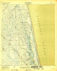
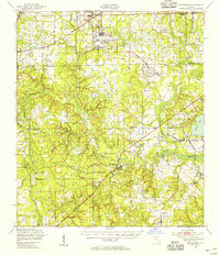
(206)- 1917 Map of Orange Park, 1957 Print
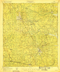
 1917 Orange Park1957 Print · USGSThe St. Johns River corridor comes to life in this early twentieth-century survey of the riverbanks between Jacksonville and Green Cove Springs. Genealogists can trace family footprints through rural sites like Swimming Pen School, Hibernia, and the Durbin P.O. long before suburban sprawl.
 - 1917 Map of Cambon, 1960 Print
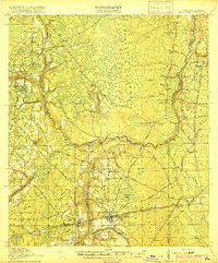
 1917 Cambon1960 Print · USGSWest of Jacksonville during the First World War, this landscape is defined by its critical railroad junctions and pine-flat timberlands. Genealogists can trace family names at Higginbotham School or explore rural stations like Dahoma, Inglehome, and Otis.2 unique versions available
 - 1917 Map of Macclenny, 1967 Print
 1917 Macclenny1967 Print · USGSThe Florida-Georgia borderlands come to life in the years before the Great War, showing the rail junctions and river crossings that shaped Baker County. Genealogists can trace family roots through numerous local landmarks like Sings Still, Macedon Church, and Garrett School.
 - 1917 Map of Hilliard, 1967 Print
 1917 Hilliard1967 Print · USGSNassau County at the start of the twentieth century was a landscape of timber camps and rail junctions. Genealogists can trace old homesteads near Hilliard and Callahan, or find vanished rural school sites like Romulus School and New Hope School.
 - 1918 Map of St Marys
 1918 St Marys1918 Print · USGSCoastal Nassau County and the Georgia border are seen here just after the Great War, during a period of peak railroad expansion. Trace family roots and old landings at St Marys, Wild's Ferry, and the Evergreen School house.
 - 1918 Map of Middleburg
 1918 Middleburg1918 Print · USGSClay County near the end of the Great War reveals a landscape of isolated settlements and vital creek crossings. Genealogists and historians can trace the foundations of local communities through the locations of Rideout Ferry, Black Creek Church, and several namesake institutions like the Bell School.4 unique versions available
 - 1918 Map of Lawtey
 1918 Lawtey1918 Print · USGSFlorida's northern interior during the First World War reveals a landscape of isolated farmsteads and growing rail towns. Researchers can locate early schoolhouses like Ben Rowe School and Vanderbilt School or trace the early footprint of the Bradford Farms (State Prison).5 unique versions available
 - 1918 Map of Cambon
 1918 Cambon1918 Print · USGSDuval County is captured here at a peak moment of railway expansion and timber harvesting during the Great War era. Genealogy researchers can locate early homesteads near Baldwin, find family-named sites like Higginbotham School, and trace the path of the Heber Tramroad.3 unique versions available
 - 1918 Map of Jacksonville
 1918 Jacksonville1918 Print · USGSJacksonville and the winding St. Johns River are shown here during the First World War, capturing the city's rail-and-river industrial core. Genealogists and researchers can trace early neighborhoods like Brooklyn and Murray Hill, or locate rural landmarks like Otto Chapel School and the Braddock School.5 unique versions available
 - 1918 Map of Orange Park
 1918 Orange Park1918 Print · USGSThe St. Johns River corridor comes to life in the years following the Great War, showing the transition from riverine commerce to early rail and road networks. Genealogists can locate family landmarks like Neals Dock, Bethel Church, and the Deep Bottom School across three counties.5 unique versions available
 - 1918 Map of Palm Valley
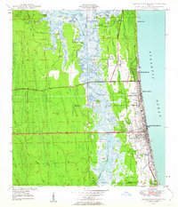
 1918 Palm Valley1918 Print · USGSCoastal St. Johns County in the years before heavy development was a wilderness of swamps and vital river landings. Genealogists and researchers can trace early homesteads and rail stops like Sampson, Hilden, and the small community at Palm Valley.4 unique versions available
 - 1918 Map of Macclenny
 1918 Macclenny1918 Print · USGSThe Florida-Georgia borderlands come to life in this World War I-era survey of the pine flatwoods and river prongs. Researchers can trace early family sites like Macclenny and Glen St Mary, alongside rural landmarks such as Hicks Church and Suggs Still.4 unique versions available
 - 1918 Map of Mayport
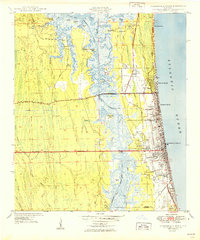
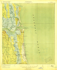 1918 Mayport1918 Print · USGSCoastal Duval County comes alive in the years during the First World War, showing the early shoreline rail network and riverside settlements. Genealogists and historians can trace the foundations of Atlantic Beach and Pablo Beach or locate vanished sites like East Mayport Coquina PO and Howells Mills.4 unique versions available
 - 1919 Map of Fernandina
 1919 Fernandina1919 Print · USGSCoastal Florida and Georgia meet at the mouth of the St Marys River in this survey from the late nineteen-teens. Historians can trace the early waterfront at Fernandina, the military grounds of Ft Clinch, and the remote settlement of Franklintown.4 unique versions available
 - 1919 Map of St Marys
 1919 St Marys1919 Print · USGSThe Georgia-Florida borderlands near the coast were a patchwork of tidal marshes and rail towns just after the Great War. You can trace early river landings and rural schools like Evergreen School, Wilds Ferry, and the Seaboard Air Line rail stops.5 unique versions available
 - 1919 Map of Hilliard
 1919 Hilliard1919 Print · USGSNassau County's timber and rail economy is on full display in this post-WWI era survey of the Florida interior. Genealogists and historians can trace old homesteads and local institutions like New Hope School, Hodges Mill, and the rail junction at Callahan.3 unique versions available
 - 1941 Map of Middleburg, 1943 Print
 1941 Middleburg1943 Print · USGSClay County at the dawn of the motorized era reveals a landscape of ferry crossings and rural schoolhouses connected by early roads. Researchers can trace the legacy of the Middleburg area through sites like the Rideout Ferry, Black Creek Church, and several named family schools.
 - 1944 Map of Fernandina
 1944 Fernandina1944 Print · USGSThe Florida-Georgia borderlands come to life in this mid-forties coastal survey of Nassau County and its barrier islands. Genealogists and historians can trace the early footprints of Old Fernandina and Franklintown or locate landmarks like Ft Clinch and the U S Quarantine Sta.
 - 1948 Map of Jacksonville
 1948 Jacksonville1948 Print · USGSNortheast Florida and Southeast Georgia's coastal waterways and railroad towns are captured here in the years following the war. Genealogists can trace family connections through river towns like St Marys or identify long-standing military landmarks like Jacksonville NAS.
 - 1948 Map of Jacksonville Beach, 1958 Print
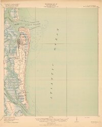
 1948 Jacksonville Beach1958 Print · USGSJacksonville’s coastal suburbs and the marshy barrier islands are shown in detail during the late 1940s. Genealogists and researchers can trace early family sites at Tillotson Cemetery or follow the development of Beach Boulevard.3 unique versions available
 - 1948 Map of Eastport, 1962 Print
 1948 Eastport1962 Print · USGSCoastal Duval County comes to life in the late 1940s as a landscape of tidal marshes and riverfront hamlets along the St Johns River. Researchers can locate vanished landmarks like Quarantine Island or trace local history through the New Berlin Sch and Dunn Creek Cem.
 - 1949 Map of Jacksonville Beach
 1949 Jacksonville Beach1949 Print · USGSCoastal Florida is in a period of rapid post-war expansion as residential neighborhoods push eastward toward the Atlantic. Genealogists and local researchers can locate early landmarks like Donner, Tillotson Cem, and Fletcher High Sch amidst a changing landscape of new roads.2 unique versions available
 - 1949 Map of Fiftone, 1953 Print
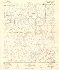
 1949 Fiftone1953 Print · USGSThe rural border of Duval and Clay Counties appears here just after the war, where military expansion met traditional Florida timber and rail lands. Genealogists can locate family landmarks like Mt Zion Ch and Long Branch Ch or trace the early footprint of the Cecil Naval Auxiliary Air Station.2 unique versions available
 - 1949 Map of Jacksonville Heights, 1953 Print
 1949 Jacksonville Heights1953 Print · USGSIn the late 1940s, the rural border of Duval and Clay Counties was being reshaped by naval aviation. Researchers can trace the massive footprints of the Cecil Naval Auxiliary Air Station and Branan Outlying Air Field alongside the Atlantic Coast Line.2 unique versions available
 - 1949 Map of Middleburg, 1955 Print
 1949 Middleburg1955 Print · USGSClay County at mid-century shows a landscape of deep-rooted river settlements and emerging Cold War aviation. Genealogists and historians can trace the foundations of Middleburg and Doctors Inlet, alongside notable sites like Rideout Ferry and Peoria Ch.
Showing maps 1-25 of 206
Top cities near Jacksonville
Top neighborhoods of Jacksonville
- Maxville historical maps
- Biltmore historical maps
- Hyde Park historical maps
- Grand Park historical maps
- Brentwood historical maps
- Lake Shore historical maps
See more
Frequently asked questions
- What are the different types of historical maps available for Jacksonville?
- What is the oldest map of Jacksonville?
- Where can I purchase historical maps of Jacksonville for my home or office?
- Where can I download high-res historical maps of Jacksonville?
- Are there historical topographic maps available for Jacksonville?
- Is there historical aerial imagery available for Jacksonville?
- Where are historical maps of Jacksonville sourced from?