1900s (20th Century) Maps of Idaho
Explore 4,279 historic maps of Idaho from the 1900s (20th Century). These maps offer a rare glimpse into what life looked like during the 1900s — showing old roads, neighborhoods, homes, and landmarks that have changed or disappeared over time.
Whether you're researching your family's past, planning a metal detecting trip, or studying how Idaho's landscape evolved across the 1900s, these high-resolution maps are a powerful tool for exploring the history of this region.
- Focus on a specific era: All maps on this page are from the 1900s, giving you a focused view of this time period.
- See what’s changed: Compare century-old streets, trails, and buildings to today's modern landscape using overlays and satellite layers.
- Research with precision: Use these maps for genealogy, historical research, land use analysis, or educational projects.
- View, download, or print: Maps are fully viewable online in high resolution, and can be downloaded or printed for your own records.
Start exploring Idaho's history through authentic maps from the 1900s. This is your window into the past.
Idaho maps
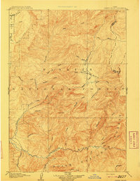
- 1900 Map of Sawtooth
 1900 Sawtooth1900 Print · USGSCovers Idaho, including Cathedral Pines, Easley Hot Springs, and other nearby areas4 unique versions available
 - 1901 Map of Sandpoint
 1901 Sandpoint1901 Print · USGSCovers Idaho, including Sandpoint, Priest River, and other nearby areas3 unique versions available
 - 1901 Map of Hamilton
 1901 Hamilton1901 Print · USGSCovers Idaho, including Hamilton, Darby, and other nearby areas6 unique versions available
 - 1901 Map of Spokane
 1901 Spokane1901 Print · USGSCovers Idaho, including Spokane, Spokane Valley, and other nearby areas6 unique versions available
 - 1901 Map of Coeur D'Alene District, 1954 Print
 1901 Coeur D'Alene District1954 Print · USGSCovers Idaho, including Kellogg, Osburn, and other nearby areas
 - 1903 Map of Oakesdale
 1903 Oakesdale1903 Print · USGSCovers Idaho, including Tekoa, Rosalia, and other nearby areas
 - 1903 Map of Rathdrum
 1903 Rathdrum1903 Print · USGSCovers Idaho, including Coeur d'Alene, Post Falls, and other nearby areas4 unique versions available
 - 1903 Map of Coeur D'Alene District
 1903 Coeur D'Alene District1903 Print · USGSCovers Idaho, including Kellogg, Osburn, and other nearby areas
 - 1905 Map of Oakesdale
 1905 Oakesdale1905 Print · USGSCovers Idaho, including Tekoa, Rosalia, and other nearby areas3 unique versions available
 - 1906 Map of Coeur D'Alene District
 1906 Coeur D'Alene District1906 Print · USGSCovers Idaho, including Kellogg, Osburn, and other nearby areas3 unique versions available
 - 1906 Map of Mitchell Butte
 1906 Mitchell Butte1906 Print · USGSCovers Idaho, including Nyssa, Vale, and other nearby areas3 unique versions available
 - 1909 Map of Garden Valley
 1909 Garden Valley1909 Print · USGSCovers Idaho, including Crouch, Lowman, and other nearby areas2 unique versions available
 - 1909 Map of Cataldo, 1954 Print
 1909 Cataldo1954 Print · USGSCovers Idaho, including Kellogg, Pinehurst, and other nearby areas
 - 1909 Map of Montpelier, 1957 Print
 1909 Montpelier1957 Print · USGSCovers Idaho, including Montpelier, Paris, and other nearby areas
 - 1910 Map of Pullman
 1910 Pullman1910 Print · USGSCovers Idaho, including Pullman, Moscow, and other nearby areas5 unique versions available
 - 1911 Map of Meadows
 1911 Meadows1911 Print · USGSCovers Idaho, including McCall, Cascade, and other nearby areas2 unique versions available
 - 1911 Map of Montpelier
 1911 Montpelier1911 Print · USGSCovers Idaho, including Montpelier, Paris, and other nearby areas3 unique versions available
 - 1911 Map of Cataldo
 1911 Cataldo1911 Print · USGSCovers Idaho, including Kellogg, Pinehurst, and other nearby areas2 unique versions available
 - 1911 Map of Priest Lake, 1954 Print
 1911 Priest Lake1954 Print · USGSCovers Idaho, including Sandpoint, Bonners Ferry, and other nearby areas
 - 1911 Map of Lolo, 1954 Print
 1911 Lolo1954 Print · USGSCovers Idaho, including Lolo Hot Springs, Missoula County, and other nearby areas
 - 1911 Map of Slug Creek, 1958 Print
 1911 Slug Creek1958 Print · USGSCovers Idaho, including Caribou County, Bear Lake County, and other nearby areas
 - 1911 Map of Sandpoint, 1959 Print
 1911 Sandpoint1959 Print · USGSCovers Idaho, including Sandpoint, Priest River, and other nearby areas2 unique versions available
 - 1912 Map of Randolph
 1912 Randolph1912 Print · USGSCovers Idaho, including Randolph, Garden City, and other nearby areas3 unique versions available
 - 1912 Map of Missoula
 1912 Missoula1912 Print · USGSCovers Idaho, including Missoula, Lolo, and other nearby areas4 unique versions available
 - 1913 Map of Lolo
 1913 Lolo1913 Print · USGSCovers Idaho, including Lolo Hot Springs, Missoula County, and other nearby areas2 unique versions available
Showing maps 1-25
Top cities of Idaho
- Boise historical maps
- Meridian historical maps
- Nampa historical maps
- Idaho Falls historical maps
- Caldwell historical maps
- Pocatello historical maps
See more
Top counties of Idaho
- Ada County historical maps
- Canyon County historical maps
- Kootenai County historical maps
- Bonneville County historical maps
- Bannock County historical maps
- Twin Falls County historical maps
See more
Frequently asked questions
- What are the different types of historical maps available for Idaho?
- What is the oldest map of Idaho?
- Where can I purchase historical maps of Idaho for my home or office?
- Where can I download high-res historical maps of Idaho?
- Are there historical topographic maps available for Idaho?
- Is there historical aerial imagery available for Idaho?
- Where are historical maps of Idaho sourced from?