1940s Maps of Idaho
Explore 222 historic maps of Idaho from the 1940s. These maps offer a rare glimpse into what life looked like during the 1940s — showing old roads, neighborhoods, homes, and landmarks that have changed or disappeared over time.
Whether you're researching your family's past, planning a metal detecting trip, or studying how Idaho's landscape evolved across the 1940s, these high-resolution maps are a powerful tool for exploring the history of this region.
- Focus on a specific era: All maps on this page are from the 1940s, giving you a focused view of this time period.
- See what’s changed: Compare century-old streets, trails, and buildings to today's modern landscape using overlays and satellite layers.
- Research with precision: Use these maps for genealogy, historical research, land use analysis, or educational projects.
- View, download, or print: Maps are fully viewable online in high resolution, and can be downloaded or printed for your own records.
Start exploring Idaho's history through authentic maps from the 1940s. This is your window into the past.
Idaho maps
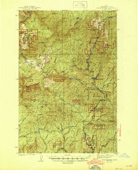
- 1940 Map of Rowland
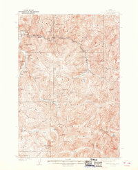
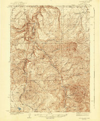 1940 Rowland1940 Print · USGSRemote ranching and high-desert terrain define this borderland region during the mid-1930s. Genealogists and researchers can trace family-named sites such as Budde Rizzi Ranch, the McKnight Cabin, and the community of Rowland.2 unique versions available
 - 1940 Map of Mountain City
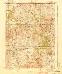 1940 Mountain City1940 Print · USGSElko County mining and ranching life are detailed in this survey of the Nevada-Idaho borderlands during the late thirties. Researchers can locate remote family operations like Rizzi Ranch and trace the local mining economy at the Rio Tinto Mine and Patsville.2 unique versions available
 - 1940 Map of Mackay
 1940 Mackay1940 Print · USGSCuster and Butte counties are captured here in the late 1930s, showing a landscape defined by irrigation ditches and high-altitude mining. You can trace the development of the Big Lost River valley, finding early schools like Barton Sch and remote mountain sites like Leadbelt Mine.2 unique versions available
 - 1940 Map of Blackfoot, 1958 Print
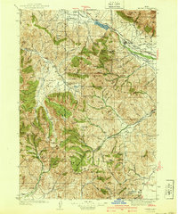
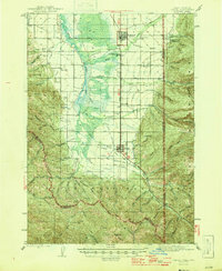
 1940 Blackfoot1958 Print · USGSBingham County at the dawn of the 1940s reveals a landscape defined by the Snake River and a vast irrigation network. Genealogists and historians can trace the Fort Hall Indian Reservation boundaries, find School No 12, and locate the Indian Agency and Ross Fork Indian Sch.
 - 1942 Map of Owyhee
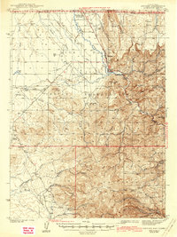 1942 Owyhee1942 Print · USGSThe high desert borderlands of Nevada and Idaho come alive in this pre-war survey of the Duck Valley Indian Reservation. Researchers can trace early irrigation systems and ranching landmarks like Lamb Reservoir, the Number One Settlement, and the Idaho-Nev Shaft mine.3 unique versions available
 - 1942 Map of Big Creek
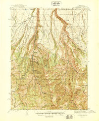
 1942 Big Creek1942 Print · USGSThe remote Idaho backcountry during the 1930s is revealed as a landscape of isolated cabins and active lode mines. Genealogists and historians can trace the foundations of local industry at the Golden Hand Mine, find early homesteads like Mahan Cabin, and locate the small settlement of Edwardsburg.
 - 1942 Map of Metaline
 1942 Metaline1942 Print · USGSThe Pend Oreille River valley and the surrounding Selkirk Mountains are shown here in the early 1940s, during a period of intense mining and timber activity. Genealogists and historians can trace rail-side settlements like Ione and Tiger or locate mining sites such as Josephine Mine and Bunker Hill Mines.3 unique versions available
 - 1942 Map of Newport
 1942 Newport1942 Print · USGSPend Oreille River country is captured here during the early 1940s, showing the vital rail and river links between Newport and the mountain frontier. Researchers can trace family homesteads near old schools like Fertile Valley Sch or locate the Indian Mission and Dalkena mill site.3 unique versions available
 - 1943 Map of Boehls Butte
 1943 Boehls Butte1943 Print · USGSThe Bitterroot Mountains of Northern Idaho are documented here during the mid-1940s, showing a rugged landscape managed for timber and fire protection. Genealogists and historians can locate remote mountain dwellings like Mix Cabin and prominent fire towers including Boehls Butte Lookout.2 unique versions available
 - 1943 Map of Mt Spokane
 1943 Mt Spokane1943 Print · USGSThe Washington and Idaho borderlands are shown here during the early years of the state park's development. Genealogists and local historians can trace rural school districts like Blanchard Valley Sch and old supply points like the Peone Store.2 unique versions available
 - 1943 Map of Blackfoot
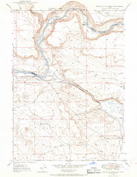
 1943 Blackfoot1943 Print · USGSSoutheastern Idaho's river valleys and irrigation networks are on full display in the early 1940s, centered on the confluence of the Snake River and Blackfoot River. Genealogists and historians can trace family-named waterworks like Wearyrick Ditch and explore the historic layout of the Fort Hall Indian Reservation and Blackfoot.2 unique versions available
 - 1943 Map of Yellow Pine
 1943 Yellow Pine1943 Print · USGSThe Yellow Pine backcountry during the 1930s is revealed as a center for remote mining and forest service operations. Researchers can trace early aviation and industry through sites like Oberbilling Airport, the Stibnite outpost, and the Antimony Mine.2 unique versions available
 - 1943 Map of Jarbidge, 1954 Print
 1943 Jarbidge1954 Print · USGSThe Jarbidge mining district in northern Elko County was still a remote outpost of industry and ranching in the 1940s. Genealogists and historians can trace the locations of the Altitude Mine, family operations at Larios Ranch, and the Mahoney Ranger Sta.3 unique versions available
 - 1943 Map of Driggs, 1955 Print
 1943 Driggs1955 Print · USGSTeton Valley during the mid-forties is depicted as a thriving agricultural and rail corridor between the high peaks of the Teton Mountains. Researchers can trace the heritage of local rural life through labels for Bates Sch, Darby Ch, and the Union Pacific line.3 unique versions available
 - 1943 Map of Garns Mtn, 1957 Print
 1943 Garns Mtn1957 Print · USGSEastern Idaho's high ridges and the winding Snake River corridor are captured here during the mid-1940s. Researchers can locate remote industrial sites like the Brown Bear Mine, early education landmarks such as the Upper Pine Creek Sch, and the Durrant Ranch.3 unique versions available
 - 1944 Map of Pocatello
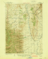
 1944 Pocatello1944 Print · USGSBannock County and the Fort Hall Indian Reservation are captured here in the years leading up to the second World War. Researchers can trace the early streets of Pocatello and Alameda, or locate rural landmarks like the Portneuf Sch and the Fort Hall Mine.
 - 1944 Map of Headquarters
 1944 Headquarters1944 Print · USGSClearwater County timber operations and forest management are in full swing here during the mid-1940s. Researchers can locate remote outposts like Casey Cabin, trace the rail spurs at Cardiff Spur, and find early mining sites at the Democrat Mines.2 unique versions available
 - 1944 Map of Arbon
 1944 Arbon1944 Print · USGSPower County ranching and early aviation mark this mid-century survey of the Idaho high country. Genealogists and historians can locate family holdings like Rudeen Ranch and Elkhead Ranch or trace the early community hubs of Arbon Sch and Pauline.2 unique versions available
 - 1945 Map of Riggins
 1945 Riggins1945 Print · USGSRiggins and the deep river canyons of central Idaho are captured here just before the mid-century, showing the isolated ranching and forest-service life of the era. Researchers can locate remote homesteads and outposts like Hinkley Cabin, the Middle District Sch, and Old Pollock.
 - 1945 Map of Jarbidge
 1945 Jarbidge1945 Print · USGSElko County, Nevada, during the mid-1940s reveals a high-country mining district centered on the town of Jarbidge. Researchers can trace the legacy of gold and silver extraction at the Success Mine or locate family-named sites like Larios Ranch.2 unique versions available
 - 1945 Map of Clarkston, 1965 Print
 1945 Clarkston1965 Print · USGSThe Snake and Clearwater rivers meet in the mid-1940s, showing the early industrial growth of the border towns. Genealogists can trace family landmarks like Huggins Ranch and Stout Ranch or locate burials at Vineland Cem and Asotin Cem.
 - 1946 Map of Limekiln Rapids
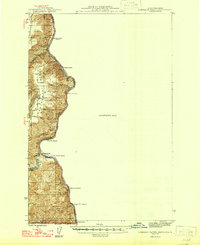 1946 Limekiln Rapids1946 Print · USGSThe Snake River canyon at the junction of Washington, Oregon, and Idaho is captured here just after the war. Local historians can trace the river economy through Rogersburg and sites like Captain John Ferry or Brahams Landing.
 - 1946 Map of Driggs
 1946 Driggs1946 Print · USGSThe Teton Valley was a landscape of remote mountain peaks and irrigated ranch land during the mid-forties. Genealogists and historians can trace old homestead sites near Bates Sch and Sorensen or follow the historic Union Pacific rail line between Driggs and Victor.
 - 1946 Map of Garns Mtn
 1946 Garns Mtn1946 Print · USGSHigh-country ranching and coal mining define this Idaho landscape in the 1940s, situated where the Snake River meets the Big Flat. Genealogists and historians can trace family locations at the Durant Ranch or follow the local mining economy through sites like the Mikesell Mine and Pintar Mine.
 - 1946 Map of Mouth of Bruneau, 1967 Print
 1946 Mouth of Bruneau1967 Print · USGSThe confluence of the Snake and Bruneau rivers in the late 1940s reveals a landscape shaped by overland migration and canyon ranching. Genealogists and historians can trace the Emigrant Trail and locate family landmarks like the Roy Johnson Ranch or Halls Ferry.3 unique versions available
Showing maps 1-25
Top cities of Idaho
- Boise historical maps
- Meridian historical maps
- Nampa historical maps
- Idaho Falls historical maps
- Caldwell historical maps
- Pocatello historical maps
See more
Top counties of Idaho
- Ada County historical maps
- Canyon County historical maps
- Kootenai County historical maps
- Bonneville County historical maps
- Bannock County historical maps
- Twin Falls County historical maps
See more
Frequently asked questions
- What are the different types of historical maps available for Idaho?
- What is the oldest map of Idaho?
- Where can I purchase historical maps of Idaho for my home or office?
- Where can I download high-res historical maps of Idaho?
- Are there historical topographic maps available for Idaho?
- Is there historical aerial imagery available for Idaho?
- Where are historical maps of Idaho sourced from?