1970s Maps of Idaho
Explore 441 historic maps of Idaho from the 1970s. These maps offer a rare glimpse into what life looked like during the 1970s — showing old roads, neighborhoods, homes, and landmarks that have changed or disappeared over time.
Whether you're researching your family's past, planning a metal detecting trip, or studying how Idaho's landscape evolved across the 1970s, these high-resolution maps are a powerful tool for exploring the history of this region.
- Focus on a specific era: All maps on this page are from the 1970s, giving you a focused view of this time period.
- See what’s changed: Compare century-old streets, trails, and buildings to today's modern landscape using overlays and satellite layers.
- Research with precision: Use these maps for genealogy, historical research, land use analysis, or educational projects.
- View, download, or print: Maps are fully viewable online in high resolution, and can be downloaded or printed for your own records.
Start exploring Idaho's history through authentic maps from the 1970s. This is your window into the past.
Idaho maps
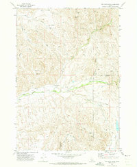
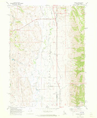
(441)- 1970 Map of Georgetown, 1973 Print
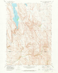
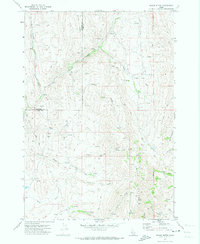
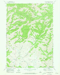
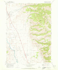 1970 Georgetown1973 Print · USGSBear Lake Valley in the 1970s is shown as a hub of rail transport and river-bottom agriculture. Genealogists and local historians can trace the settlement footprints of Georgetown, Bennington, and Pescadero or locate early family burials at the Cem.2 unique versions available
 - 1970 Map of Border, 1973 Print
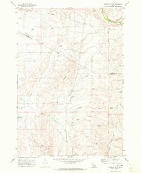
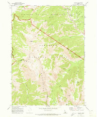
 1970 Border1973 Print · USGSThe Idaho-Wyoming border comes alive in the early seventies, capturing a high-desert landscape defined by the Bear River and the Union Pacific Railroad. Genealogists and historians can trace old homestead sites near Chausse or explore the transit history of Border and Border Junction.2 unique versions available
 - 1970 Map of Horton Peak, 1973 Print
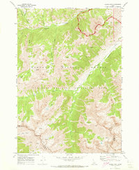
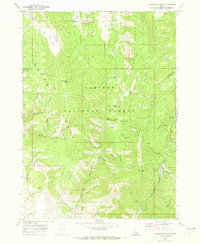
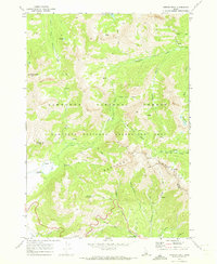 1970 Horton Peak1973 Print · USGSThe Sawtooth and Boulder Mountains of central Idaho are shown here during the early seventies as a high-altitude wilderness of forest service outposts and pack routes. Researchers can locate the Horton Peak Lookout, trace the Pack Trails around Champion Lakes, and find the remote Pole Creek Guard Station.3 unique versions available
 - 1970 Map of Dodson Pass, 1973 Print
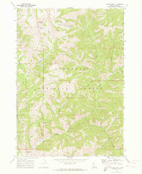
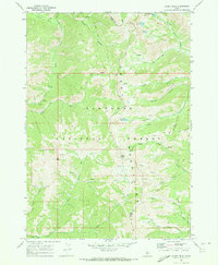
 1970 Dodson Pass1973 Print · USGSThe Gem and Washington county line in the early 1970s is a landscape of remote forest outposts and high-mountain passes. Trace old wilderness access routes to Third Fork Guard Station, Dodson Pass, and the waters of Beech Lake.
 - 1970 Map of Bear Lake North, 1973 Print
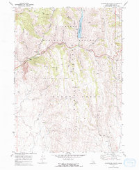
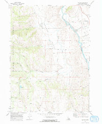
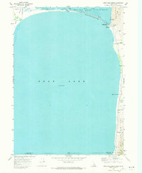 1970 Bear Lake North1973 Print · USGSThe northern reaches of the Idaho-Utah border come alive in the 1970s, centered on the diverse shorelines of Bear Lake. Trace the development of North Beach State Park and locate historic sites like Bear Lake Hot Springs and the settlement of Lifton.
 - 1970 Map of Hog Cove Butte, 1973 Print
 1970 Hog Cove Butte1973 Print · USGSThe high-desert ranchlands of Payette and Gem counties are captured here just as modern aerial surveying began to document the landscape in the late sixties. Researchers can trace historic water routes and stock points like French Corner, Raymer Spring, and the Flume.
 - 1970 Map of Sydney Butte, 1973 Print
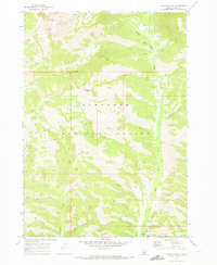
 1970 Sydney Butte1973 Print · USGSThe Sawtooth National Forest near the Camas county line is shown here in the 1970s, at a time of mountain recreation and legacy mining. Researchers can trace remote sites like the Five Points Mine, Big Smoky Guard Station, and the PACK TRAIL through Couch Summit.
 - 1970 Map of Boundary Ridge, 1973 Print
 1970 Boundary Ridge1973 Print · USGSBoundary Ridge stood at the remote intersection of three states in the early seventies, a landscape of high plateaus and vital mountain springs. Researchers can trace historic grazing routes through Taylor Meadow and locate landmarks like the Windmill or the heights of Red Mtn.
 - 1970 Map of Fossil Canyon, 1973 Print
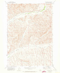
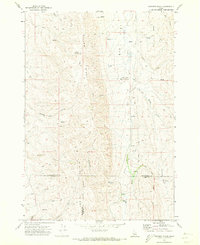
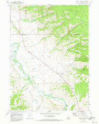 1970 Fossil Canyon1973 Print · USGSSoutheast Idaho in the early seventies shows a landscape defined by the Bear River and the transit corridor of the Union Pacific. Trace industrial sites like the Ship Mine or find the high terrain of Georgetown Summit and Manson.
 - 1970 Map of Paddock Valley Reservoir, 1973 Print
 1970 Paddock Valley Reservoir1973 Print · USGSThe high-desert ranching country of western Idaho is captured here in the early 1970s, focused on the critical water management of the region. Researchers can trace historic grazing routes and water sources across Little Willow Flat or follow the drainages of Indian Creek and Rattlesnake Creek.
 - 1970 Map of Montpelier Canyon, 1973 Print
 1970 Montpelier Canyon1973 Print · USGSThe high country of eastern Idaho is captured here in the early 1970s, showing a landscape defined by water management and mountain transit. Local researchers can trace old routes over Geneva Summit or locate the Montpelier Creek Dam and its reservoir.2 unique versions available
 - 1970 Map of Paradise Peak, 1973 Print
 1970 Paradise Peak1973 Print · USGSCamas County, Idaho, is depicted in the early 1970s as a remote backcountry territory within the Sawtooth National Forest. Researchers can locate seasonal outposts and landmarks like Skillern Hot Springs, Headquarters Camp, and Paradise Peak.
 - 1970 Map of Sheep Ridge, 1973 Print
 1970 Sheep Ridge1973 Print · USGSPayette County in the early 1970s shows a landscape of high ridges and intricate water management. Researchers can trace historic ranching infrastructure like the Siphon, Corral, and Flume along Little Willow Creek and Big Willow Creek.
 - 1970 Map of Geneva, 1973 Print
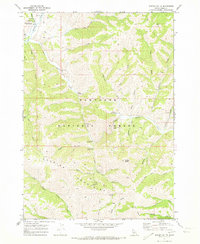
 1970 Geneva1973 Print · USGSHigh-altitude ranching and mountain geography define this borderlands area in 1970 as it straddles Bear Lake County and Wyoming. Genealogists can locate family-named sites like G H Hall Ranch, Mumford Ranch, and the Geneva Cem.
 - 1970 Map of Galena Peak, 1973 Print
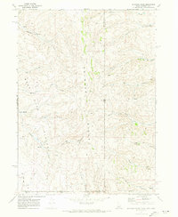
 1970 Galena Peak1973 Print · USGSThe Boulder Mountains of central Idaho are shown here in the early 1970s, tracing the headwaters of the Salmon River. Researchers can locate high-altitude Mines near Galena Peak or follow the Pack Trails along Germania Creek and Jack Creek.2 unique versions available
 - 1970 Map of Nounan, 1973 Print
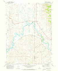
 1970 Nounan1973 Print · USGSBear Lake County in the early seventies centers on the quiet agricultural life of Nounan and the winding Bear River corridor. Researchers can trace family history at Skinner Cem, locate western Mines, or follow the Union Pacific through Georgetown (Siding).2 unique versions available
 - 1970 Map of Newman Peak, 1973 Print
 1970 Newman Peak1973 Print · USGSThe Sawtooth Range in the early 1970s was a landscape of remote mines and wilderness trails. Genealogists and historians can trace the paths of early miners at the Old Sam Mine, El Oro Mine, and Axolotl Mine near the South Boise River.2 unique versions available
 - 1970 Map of Squaw Butte, 1973 Print
 1970 Squaw Butte1973 Print · USGSThe high desert terrain of Gem and Payette counties is captured here during the 1970s, showcasing a landscape of ranching drainages and remote peaks. Trace the intricate network of water rights and range access through features like Bissel Creek, Squaw Butte, and the Gaging Station on Big Willow Creek.
 - 1970 Map of Coonrod Gulch, 1973 Print
 1970 Coonrod Gulch1973 Print · USGSSouthwestern Idaho ranching country is captured here in the early seventies, where Washington, Payette, and Gem counties meet. Trace the remote Butte Ranch and the network of high-country water sources like Mossman Spring and French Spring.
 - 1970 Map of Easley Hot Springs, 1973 Print
 1970 Easley Hot Springs1973 Print · USGSThe high basins and river valleys of Blaine and Custer counties are captured here in the early seventies, just as modern recreation was taking hold. Discover old outposts and seasonal camps like Russian John Guard Station, the Boulder (Site), and Easley Hot Springs.3 unique versions available
 - 1970 Map of Granger Butte, 1973 Print
 1970 Granger Butte1973 Print · USGSThe high basalt plateaus between the Adams and Washington county lines are captured here in the early seventies. Genealogists and land historians can trace grazing landmarks like Corrals, the remote Landing Strip, and family-named water sources like Bill George Spring.2 unique versions available
 - 1970 Map of Dollarhide Mtn, 1973 Print
 1970 Dollarhide Mtn1973 Print · USGSThe Idaho backcountry in the early seventies reveals a landscape shaped by high-country mining and seasonal ranching. Local historians can trace the legacy of remote camps and mineral claims like Carrietown, the Silver Star Mine, and Gooding Cow Camp.
 - 1970 Map of Galena, 1973 Print
 1970 Galena1973 Print · USGSThe high central Idaho backcountry is documented here during the early 1970s, as the Sawtooth region transitioned into a major recreation area. Outdoor researchers and genealogists can trace early routes over Galena Summit, find the Galena Pioneer Cem, or follow old pack trails to Miner Lake.3 unique versions available
 - 1970 Map of Harrington Peak, 1973 Print
 1970 Harrington Peak1973 Print · USGSThe Caribou National Forest backcountry comes into focus in this 1970 survey of the Idaho highlands. Genealogists and historians can trace industrial mining sites like the Slug Mine or find family-named landmarks such as Hess Park and Harrington Peak.2 unique versions available
 - 1970 Map of Baker Peak, 1973 Print
 1970 Baker Peak1973 Print · USGSThe Smoky Mountains of Camas and Blaine Counties are shown in great detail during the early 1970s. Explorers and historians can trace the high-altitude Pack Trail network connecting landmarks like Baker Peak, Baker Lake, and the aptly named Lost Shirt Trail.2 unique versions available
Showing maps 1-25 of 441
Top cities of Idaho
- Boise historical maps
- Meridian historical maps
- Nampa historical maps
- Idaho Falls historical maps
- Caldwell historical maps
- Pocatello historical maps
See more
Top counties of Idaho
- Ada County historical maps
- Canyon County historical maps
- Kootenai County historical maps
- Bonneville County historical maps
- Bannock County historical maps
- Twin Falls County historical maps
See more
Frequently asked questions
- What are the different types of historical maps available for Idaho?
- What is the oldest map of Idaho?
- Where can I purchase historical maps of Idaho for my home or office?
- Where can I download high-res historical maps of Idaho?
- Are there historical topographic maps available for Idaho?
- Is there historical aerial imagery available for Idaho?
- Where are historical maps of Idaho sourced from?