1930s Maps of Idaho
Explore 51 historic maps of Idaho from the 1930s. These maps offer a rare glimpse into what life looked like during the 1930s — showing old roads, neighborhoods, homes, and landmarks that have changed or disappeared over time.
Whether you're researching your family's past, planning a metal detecting trip, or studying how Idaho's landscape evolved across the 1930s, these high-resolution maps are a powerful tool for exploring the history of this region.
- Focus on a specific era: All maps on this page are from the 1930s, giving you a focused view of this time period.
- See what’s changed: Compare century-old streets, trails, and buildings to today's modern landscape using overlays and satellite layers.
- Research with precision: Use these maps for genealogy, historical research, land use analysis, or educational projects.
- View, download, or print: Maps are fully viewable online in high resolution, and can be downloaded or printed for your own records.
Start exploring Idaho's history through authentic maps from the 1930s. This is your window into the past.
Idaho maps
- 1930 Map of Casto
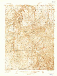
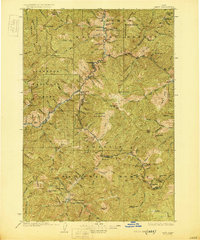 1930 Casto1930 Print · USGSCentral Idaho’s rugged backcountry in the late 1920s was a land of isolated mines and family ranches. Genealogists and historians can trace high-altitude mining at the Lost Packer Mine or locate early homesteads like Falconberry Ranch and Mormon Ranch.2 unique versions available
 - 1931 Map of Buffalo Hump, 1957 Print
 1931 Buffalo Hump1957 Print · USGSIdaho County’s high backcountry was a hub of gold mining and remote ranching in the years between the world wars. Genealogists and historians can locate family lands like the McComas Ranch and trace the operations of the Mother Lode Mine or New York Mine.
 - 1932 Map of Irwin
 1932 Irwin1932 Print · USGSThe Snake River corridor and the high mountain basins of eastern Idaho are captured here in the early 1930s. Researchers can trace early river crossings like Edwards Ferry or find small-community landmarks like Rainy Dale and Pumpkin Center Sch.2 unique versions available
 - 1932 Map of Trout Creek, 1955 Print
 1932 Trout Creek1955 Print · USGSThe Clark Fork River corridor in the 1930s shows a landscape of mountain rail travel and early forest management. Genealogists and historians can locate rural schools like Ayers School, local industry at Tuscor Mill, and old mining sites such as the Jack White Mine.
 - 1934 Map of Buffalo Hump
 1934 Buffalo Hump1934 Print · USGSIdaho County mining activity and forest settlement are captured here during the 1930s, documenting a remote region of the Nez Perce National Forest. Researchers can locate specific claims like the Mother Lode Mine or trace family roots at Orogrande and McComas Ranch.
 - 1934 Map of American Falls, 1957 Print
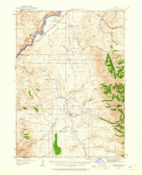
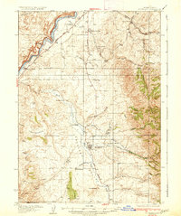
 1934 American Falls1957 Print · USGSThe Snake River region in the mid-1930s shows a landscape of massive water projects and ranching roots. Genealogists and historians can trace the Old Oregon Trail, locate remote rural schools like Mt Hope Sch, and see the early footprint of the American Falls Dam.
 - 1934 Map of Michaud, 1957 Print
 1934 Michaud1957 Print · USGSThe Fort Hall Indian Reservation was undergoing significant changes in the 1930s as the American Falls Reservoir reshaped the valley. Genealogists and historians can trace the paths of the Oregon Trail, locate the Indian Cem, and find old rail stops at Schiller and Michaud.
 - 1934 Map of Metaline, 1959 Print
 1934 Metaline1959 Print · USGSThe Pend Oreille River valley was a hub of mining and rail activity in the 1930s as the railroad pushed north toward the Canadian border. Genealogists and historians can trace the foundations of Metaline Falls and Tiger or locate the Bunker Hill Mine and Lincoln Sch.
 - 1934 Map of Rockland, 1960 Print
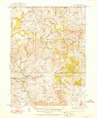
 1934 Rockland1960 Print · USGSPower County ranching and transit corridors are frozen in time during the mid-1930s, showing the early infrastructure of the Upper Snake River Valley. Researchers can trace the dual routes of the Oregon Trail and locate isolated schoolhouses like Garris Sch and Central Sch.2 unique versions available
 - 1935 Map of MacKay
 1935 MacKay1935 Print · USGSCuster County was a rugged center of mining and irrigation in the mid-1930s. Genealogists and historians can trace high-altitude homesteads and industry through Mackay, the Star O Hope Mine, and rural schools like Franklin Sch.
 - 1935 Map of Irwin
 1935 Irwin1935 Print · USGSThe Idaho-Wyoming borderlands are captured here in the 1930s as the river economy and mountain ranching defined the region. Researchers can trace the early road networks and rural institutions from Edwards Ferry to local schools like Fidelity Sch and Blowout Sch.3 unique versions available
 - 1935 Map of Trout Creek, 1949 Print
 1935 Trout Creek1949 Print · USGSThe Clark Fork valley and the mining districts of Shoshone County are caught in high detail in the 1930s. Genealogists and historians can trace rail-side schools like Tuscor Sch, the operations at Jack Waite Mine, and old settlements from Noxon to Mace.
 - 1935 Map of Borah Peak, 1959 Print
 1935 Borah Peak1959 Print · USGSCuster and Lemhi counties are shown during the mid-1930s, centering on the high peaks of the Lost River Range and the cattle country of the river valleys. Researchers can locate remote schools and stations such as Goldburg School, Dickey, and the Mahogany Ranger Station.
 - 1936 Map of Boehls Butte
 1936 Boehls Butte1936 Print · USGSThe timbered highlands of Shoshone and Clearwater counties are shown here in the mid-1930s before modern road development. Researchers can trace remote pioneer sites like Mix Cabin and identify fire-watch stations such as Bertha Hill Lookout and Boehls Butte.3 unique versions available
 - 1936 Map of Newport
 1936 Newport1936 Print · USGSThe Pend Oreille River valley in the 1930s reveals a landscape of railroad towns and timber outposts along the Idaho border. Genealogists can locate family-named school districts like Locke Sch and Otter Creek Sch, alongside settlements at Dalkena, Cusick, and Scotia.2 unique versions available
 - 1936 Map of Mountain City
 1936 Mountain City1936 Print · USGSElko County and the borderlands of Idaho are captured during the 1930s as mining and ranching shaped this high-desert region. Researchers can trace historic family properties like McKenzie Ranch or locate industrial sites such as the Rio Tinto Mine and the Allegheny Sch.4 unique versions available
 - 1936 Map of Rowland
 1936 Rowland1936 Print · USGSThe Nevada-Idaho borderlands come to life in the mid-1930s as a landscape of remote ranching and mining outposts. Trace the family legacies of the Hagenbuch Ranch and Palacio Ranch near the Bruneau Mine and Rowland PO.4 unique versions available
 - 1936 Map of Trout Creek
 1936 Trout Creek1936 Print · USGSThe Clark Fork valley and the Bitterroot mountains are captured here in the mid-1930s, showing a landscape defined by timber and mining. Researchers can trace the industrial footprint of the Tuscor Mill, remote operations like the Jack Waite Mine, and old mountain schools such as Flat Sch.2 unique versions available
 - 1936 Map of American Falls
 1936 American Falls1936 Print · USGSPower and Bingham counties are captured in the mid-1930s, showing the early years of the massive reservoir on the Snake River. Genealogists and historians can trace family-named sites like Kerr Ranch and a network of schools including Williams Sch and Range Sch.
 - 1937 Map of Yellow Pine
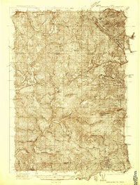
 1937 Yellow Pine1937 Print · USGSMining and forest management in central Idaho were in full swing during the late 1930s as this survey of the Payette National Forest was completed. Researchers can trace the layout of the Stibnite mining camp, locate the Johnston Creek Ranger Sta, and identify high-altitude outposts like the Meadow Creek Lookout.
 - 1937 Map of Big Creek
 1937 Big Creek1937 Print · USGSMid-century mining activity in the Idaho backcountry centers on the remote outposts of Edwardsburg and Big Creek. Genealogists and historians can trace lode claims like the Golden Hand Mine and Moscow Mine alongside early structures like Hand Cabin.2 unique versions available
 - 1937 Map of Rockland
 1937 Rockland1937 Print · USGSRockland and the surrounding high-desert canyons are captured here in the mid-1930s as modern highways began to parallel historic western routes. Genealogists and historians can trace the Old Oregon Trail, locate the Cem at Rockland, and find rural schoolhouses like Cold Creek Sch and Garris Sch.2 unique versions available
 - 1937 Map of Pocatello
 1937 Pocatello1937 Print · USGSBannock County is captured in the late 1930s as a burgeoning rail and highway crossroads along the Portneuf River. Genealogists can locate family landmarks in old Alameda, trace the Fort Hall Mine, or find rural school sites like Blackrock Sch.3 unique versions available
 - 1937 Map of Michaud
 1937 Michaud1937 Print · USGSThe Fort Hall Indian Reservation and its mid-century transportation networks are documented here just as the aviation age was taking flight. Genealogists and historians can trace family-named sites and early infrastructure like the Indian School, Indian Cem, and the path of the Old Oregon Trail.
 - 1938 Map of Riggins
 1938 Riggins1938 Print · USGSRiggins and the canyon of the Salmon River appear here in the late 1930s, showing a landscape defined by mining, ranching, and forest management. Genealogists and historians can trace family-named sites like McMillians Mine, the Black Bear Inn, and the Middle District School.2 unique versions available
Showing maps 1-25
Top cities of Idaho
- Boise historical maps
- Meridian historical maps
- Nampa historical maps
- Idaho Falls historical maps
- Caldwell historical maps
- Pocatello historical maps
See more
Top counties of Idaho
- Ada County historical maps
- Canyon County historical maps
- Kootenai County historical maps
- Bonneville County historical maps
- Bannock County historical maps
- Twin Falls County historical maps
See more
Frequently asked questions
- What are the different types of historical maps available for Idaho?
- What is the oldest map of Idaho?
- Where can I purchase historical maps of Idaho for my home or office?
- Where can I download high-res historical maps of Idaho?
- Are there historical topographic maps available for Idaho?
- Is there historical aerial imagery available for Idaho?
- Where are historical maps of Idaho sourced from?