Old Maps of Butler County, Kansas for Genealogy
Trace your family roots with 241 historic maps of Butler County. These high-res maps reveal old neighborhoods, homesites, landmarks, and streets — helping you uncover where your ancestors lived and how the area evolved over time.
- Explore historic neighborhoods: Identify where your relatives may have lived in the 1800s or 1900s.
- Compare maps over time: Trace the changes in streets, buildings, and landmarks for multi-generational research.
- Perfect for genealogy & ancestry research: Used by family historians and researchers to map out lineage and migration.
These maps are an incredible resource for exploring your personal connection to Butler County's past.
Butler County, KS maps
(241)- 1888 Map of Eldorado
 1888 Eldorado1888 Print · USGSButler County in the late 1880s is defined by a rapidly expanding rail network centered on El Dorado and Augusta. Genealogists and historians can trace early prairie settlements and vanished railroad stops like Schonholm, Keighley, and Haverhill.6 unique versions available
 - 1889 Map of Newton
 1889 Newton1889 Print · USGSRailroad expansion defines this Kansas landscape in the late 1880s, centered on the growing hubs of Newton and Marion. Genealogists and historians can trace the early grids of towns like Peabody, Hillsboro, and Lehigh as they appeared at their founding.
 - 1889 Map of Burden
 1889 Burden1889 Print · USGSCowley County was at the height of its railroad-driven expansion in the 1880s, becoming a vital corridor for three major lines. Researchers can trace the early layouts of Winfield, Burden, and Dexter alongside long-lost railroad stops like Torrance.6 unique versions available
 - 1889 Map of Wichita
 1889 Wichita1889 Print · USGSWichita and its surrounding townships thrived as a rail-driven boomtown in the late nineteenth century. Genealogists can trace family footprints through early settlements like Oatville, Valley Center, and Douglass along the Arkansas River.
 - 1890 Map of Wellington
 1890 Wellington1890 Print · USGSSumner and Cowley counties are captured here in the late nineteenth century as a dense network of railroads and river towns transformed the Kansas prairie. Genealogists and historians can trace the early layouts of Wellington, Oxford, and Geuda Springs before the turn of the century.6 unique versions available
 - 1894 Map of Wichita
 1894 Wichita1894 Print · USGSWichita and the surrounding prairie are captured here during the height of the Victorian era's railroad boom. Genealogists and historians can trace the early development of Wichita and find vanished stations and rural townships like Indianola, Oatville, and Green Station.5 unique versions available
 - 1894 Map of Newton
 1894 Newton1894 Print · USGSCentral Kansas was undergoing a rapid transformation into a rail-driven agricultural hub during the 1890s. Genealogists and historians can trace the early growth of Newton, Marion, and Peabody alongside branching rail lines and the winding COTTONWOOD RIVER.5 unique versions available
 - 1898 Map of Cottonwood Falls
 1898 Cottonwood Falls1898 Print · USGSChase and Marion counties thrive in the late 1890s as the railroad and river valleys define the region's development. Researchers can trace the early rail paths of the Atchison Topeka and Santa Fe RR and locate settlements like Cottonwood Falls, Cedar Point, and Wonsevu.4 unique versions available
 - 1945 Map of Andover
 1945 Andover1945 Print · USGSAndover and the Sedgwick-Butler county line are documented here in the early 1940s as rural townships began to transition toward residential growth. Local researchers can trace family-named schoolhouses like Mammoth Cave Sch and Fidelity Sch or locate gravesites in the Andover Cem.2 unique versions available
 - 1955 Map of Udall, 1956 Print
 1955 Udall1956 Print · USGSCowley County in the mid-fifties is a landscape of river bends and rural crossroads during a time of active petroleum exploration and rail travel. Researchers can locate country schools like Red Bud Sch, the tracks of the Atchison Topeka and Santa Fe, and the Old Indian Boundary.2 unique versions available
 - 1955 Map of Santa Fe Lake, 1956 Print
 1955 Santa Fe Lake1956 Print · USGSButler County is captured in the mid-fifties as the new Kansas Turnpike began to reshape the prairie landscape near the Whitewater River. Genealogists and local historians can locate rural landmarks like Indianola Sch, Fairview Cem, and the early recreation grounds at Santa Fe Lake.3 unique versions available
 - 1955 Map of Benton, 1956 Print
 1955 Benton1956 Print · USGSButler County, Kansas, is captured mid-century as its traditional rail-centered towns met the new petroleum and turnpike era. Trace the path of the Missouri Pacific and find ancestral sites like Old Benton Cem and the Old Indian Boundary.3 unique versions available
 - 1955 Map of Greenwich, 1956 Print
 1955 Greenwich1956 Print · USGSThe rural landscapes of Sedgwick and Butler Counties are captured here in the mid-fifties at a peak of rail and oil activity. Researchers can trace family sites at Greenwich or locate pioneer burials at Old Benton Cem and Fairview Cem.
 - 1955 Map of Rose Hill, 1956 Print
 1955 Rose Hill1956 Print · USGSThe Butler and Sedgwick County line in the mid-fifties shows a landscape of steady agricultural growth and rising aviation influence. Researchers can trace family sites near Branson Cem, aviation history at Hamilton Landing Field, and the path of the Atchison Topeka and Santa Fe railroad.
 - 1955 Map of Mulvane, 1956 Print
 1955 Mulvane1956 Print · USGSThe rail-and-river landscape surrounding mid-century Mulvane is captured here at the intersection of four Kansas counties. Researchers can trace the original Atchison Topeka and Santa Fe corridor and locate local landmarks like Littleton Cem and Central Sch.
 - 1955 Map of Douglass, 1956 Print
 1955 Douglass1956 Print · USGSThe Butler County countryside in the mid-1950s reveals a landscape shaped by the Walnut River and the busy Atchison Topeka and Santa Fe rail line. Researchers can trace rural genealogy through landmarks like Richland Cem, Floral Sch, and the small community at Salter.4 unique versions available
 - 1955 Map of Wichita, 1959 Print
 1955 Wichita1959 Print · USGSSouth-central Kansas comes alive in the mid-1950s as Wichita grows into its role as a regional industrial and military powerhouse. Trace the rail-and-river network connecting El Dorado and Arkansas City through the Atchison Topeka and Santa Fe lines.3 unique versions available
 - 1955 Map of Hutchinson, 1967 Print
 1955 Hutchinson1967 Print · USGSCentral Kansas in the mid-sixties reveals a landscape of growing reservoirs and evolving transportation corridors. Trace the development of towns like Hutchinson and Abilene alongside the Union Pacific Railroad and the expanding Interstate 70.3 unique versions available
 - 1956 Map of Andover, 1957 Print
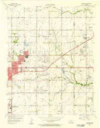 1956 Andover1957 Print · USGSEastern Wichita and Andover appear here during a mid-century boom in aviation and infrastructure. Researchers can trace the development of Mc Connell Air Force Base alongside local landmarks like Seltzer Spring and Mammoth Cave Sch.
 - 1957 Map of Elbing, 1958 Print
 1957 Elbing1958 Print · USGSButler and Harvey Counties are documented here in the late 1950s, showing the agricultural rhythm of the Whitewater Creek basin. Genealogists and local historians can trace the foundations of the community through sites like Mission Cem, Grace Hill Ch, and the Sugar Grove Sch (Abandoned).2 unique versions available
 - 1958 Map of Wichita
 1958 Wichita1958 Print · USGSSouth Central Kansas in the late fifties was a landscape of aviation industry, oil exploration, and expanding turnpikes. Researchers can trace mid-century growth through McConnell Air Force Base, major facilities for Cessna Aircraft Company, and the active El Dorado Oil Field.
 - 1959 Map of Hutchinson
 1959 Hutchinson1959 Print · USGSCentral Kansas thrives at the intersection of rail and river in the mid-1950s, as post-war aviation infrastructure reshapes the prairie. Genealogists and historians can trace the paths of the AT&SF RR through Newton and Hutchinson, or locate military sites like Smoky Hill Air Force Base.2 unique versions available
 - 1960 Map of Rose Hill, 1961 Print
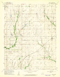 1960 Rose Hill1961 Print · USGSThe Kansas prairie south of Wichita comes alive in this mid-century survey as the region's agricultural and aviation sectors expanded. Researchers can trace the heritage of Rose Hill and its surrounding townships through local landmarks like Branson Cem, Hamilton Airport, and the Atchison Topeka and Santa Fe railroad line.2 unique versions available
 - 1960 Map of Greenwich, 1961 Print
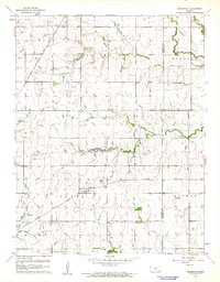 1960 Greenwich1961 Print · USGSIn the early sixties, the prairie surrounding Greenwich was a landscape of rail junctions, oil production, and deep-rooted farming communities. Genealogists can trace family connections at Greenwich Cem, Palmyra Ch, and along the historic Old Indian Boundary.3 unique versions available
 - 1961 Map of Andover
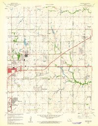 1961 Andover1961 Print · USGSEast of Wichita in the early 1960s, the landscape is a mix of rapid suburban growth and significant aviation infrastructure. Researchers can trace mid-century developments like Beech Landing Field, Mc Connell Air Force Base, and local landmarks like Seltzer Church.4 unique versions available
Showing maps 1-25 of 241
Top cities of Butler County
- El Dorado historical maps
- Andover historical maps
- Augusta historical maps
- Rose Hill historical maps
- Prospect historical maps
- Douglass historical maps
See more
Frequently asked questions
- What are the different types of historical maps available for Butler County?
- What is the oldest map of Butler County?
- Where can I purchase historical maps of Butler County for my home or office?
- Where can I download high-res historical maps of Butler County?
- Are there historical topographic maps available for Butler County?
- Is there historical aerial imagery available for Butler County?
- Where are historical maps of Butler County sourced from?