1910s Maps of Missouri
Explore 25 historic maps of Missouri from the 1910s. These maps offer a rare glimpse into what life looked like during the 1910s — showing old roads, neighborhoods, homes, and landmarks that have changed or disappeared over time.
Whether you're researching your family's past, planning a metal detecting trip, or studying how Missouri's landscape evolved across the 1910s, these high-resolution maps are a powerful tool for exploring the history of this region.
- Focus on a specific era: All maps on this page are from the 1910s, giving you a focused view of this time period.
- See what’s changed: Compare century-old streets, trails, and buildings to today's modern landscape using overlays and satellite layers.
- Research with precision: Use these maps for genealogy, historical research, land use analysis, or educational projects.
- View, download, or print: Maps are fully viewable online in high resolution, and can be downloaded or printed for your own records.
Start exploring Missouri's history through authentic maps from the 1910s. This is your window into the past.
Missouri maps
(25)- 1910 Map of Macon
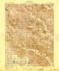
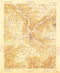
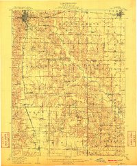 1910 Macon1910 Print · USGSMacon County's rural landscape is captured here in the decade before the Great War, showing a territory defined by railroad towns and isolated river mills. Genealogists can trace family roots through numerous country landmarks like Blees Military Academy, Levick Mill, and the Bear Thicket School.
 - 1910 Map of Higdon
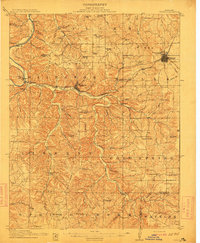
 1910 Higdon1910 Print · USGSThe Missouri Ozarks are captured here at the turn of the century as a landscape of mills and mountain hollows. Genealogists can trace family roots through numerous remote landmarks like Nations Mill, Bandenstistle School, and Spring Valley Church.2 unique versions available
 - 1910 Map of Leavenworth
 1910 Leavenworth1910 Print · USGSLeavenworth and the Missouri River borderlands are captured here during a period of significant military and institutional growth. Researchers can trace family sites among dozens of landmarks like Slabtown, the U S Penitentiary Reserve, and Kickapoo School.8 unique versions available
 - 1911 Map of Queen City, 1971 Print
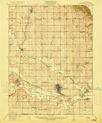
 1911 Queen City1971 Print · USGSSchuyler and Adair counties thrive as a rural railway crossroads during the early 1900s. Researchers can locate dozens of country schoolhouses like Patterson School and trace the paths of the Wabash RR through Queen City or the Iowa and St Louis RR near Connelsville.
 - 1912 Map of Rolla
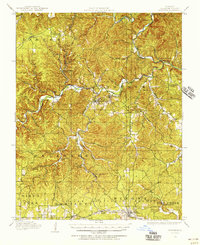
 1912 Rolla1912 Print · USGSThe northern Ozark plateau comes into focus just after the turn of the century as the railroad transforms the river valleys. Genealogists can trace family roots through dozens of rural sites like Western Star School, Turners Mill, and Zion Hill Church.2 unique versions available
 - 1912 Map of Kimmswick
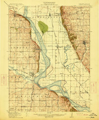
 1912 Kimmswick1912 Print · USGSThe Illinois bottomlands along the Mississippi River are shown here in the early twentieth century, just as the railroad was solidifying the region's economy. Genealogists and local researchers can trace the locations of Harrisonville, the Blue Church, and historic schools like Miles Prairie School.2 unique versions available
 - 1912 Map of Green City, 1968 Print
 1912 Green City1968 Print · USGSNorthern Missouri at the dawn of the twentieth century reveals a landscape shaped by rural education and early rail lines. Local historians can trace dozens of country schools like Boon Hill School and vanished stops along the Quincy Omaha and Kansas City railroad.
 - 1913 Map of Queen City
 1913 Queen City1913 Print · USGSSchuyler and Adair counties appear in this pre-war survey as a bustling network of small farming townships and rural school districts. Researchers can trace family roots through dozens of local sites like Queen City, New Hope School, and the river crossing at Slate Ford.2 unique versions available
 - 1914 Map of Smithville
 1914 Smithville1914 Print · USGSMissouri's northern river valleys are depicted here just before the Great War, showing a landscape of rail-dependent small towns and rural school districts. Genealogists can trace family footprints through numerous community landmarks like Paradise, Hixson Mill, and Mt. Zion School.4 unique versions available
 - 1914 Map of Green City
 1914 Green City1914 Print · USGSNorth-central Missouri thrived as a patchwork of small townships and family farms during the early twentieth century. Genealogists can trace rural life through dozens of local landmarks like Unionville, Shibley Point School, and the Kansas City and Omaha rail line.2 unique versions available
 - 1915 Map of Falls City
 1915 Falls City1915 Print · USGSRichardson County was a bustling corridor of rail lines and rural school districts during the early twentieth century. Genealogists can trace family footprints across dozens of local landmarks like Williamsville School, Straussville, and the Stone Quarry along the river.3 unique versions available
 - 1915 Map of Nemaha
 1915 Nemaha1915 Print · USGSThe Missouri River borderlands between Nebraska and Missouri are captured here in the years before major flood control altered the channel. Genealogists can trace family roots through dozens of rural landmarks, including Mt Vernon Cemetery, Antioch Church, and the river landing at St Deroin.2 unique versions available
 - 1915 Map of Renault
 1915 Renault1915 Print · USGSThe Illinois river bluffs and the American Bottom appear here in the early twentieth century as a landscape of thriving rail-side villages and rural schools. You can trace early family sites like Stuptown Church, the historic Ruma Convent, and landings at Prairie du Rocher.4 unique versions available
 - 1915 Map of Chester
 1915 Chester1915 Print · USGSThe Mississippi River bottoms and the bluffs of Illinois meet here just before the Great War. Genealogists can trace family footprints across dozens of local schoolhouses like Walnut Ridge School and vanished river landings such as Okaw Ldg.5 unique versions available
 - 1915 Map of Crystal City
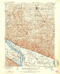
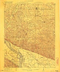
 1915 Crystal City1915 Print · USGSThe Missouri-Illinois riverfront comes alive in this early 1900s survey of the industrial corridor between Crystal City and VALLES MINES. Researchers can trace the path of the St Louis and San Francisco railroad and locate old community centers like Rush Tower or the Telegraph School.4 unique versions available
 - 1915 Map of Eminence, 1956 Print
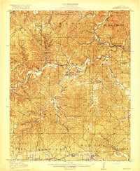
 1915 Eminence1956 Print · USGSShannon County at the height of the early twentieth-century timber era shows a landscape defined by deep hollows and the winding Current River. Genealogists can trace family roots through numerous rural landmarks like Angeline P.O., West Eminence, and over a dozen country schools including Shawnee School.2 unique versions available
 - 1916 Map of Kimmswick
 1916 Kimmswick1916 Print · USGSThe Mississippi River valley comes alive in this early twentieth-century survey of the Missouri-Illinois borderlands. Genealogists and historians can trace defunct schoolhouses like Fawn Ridge School, river landings such as Harrisonville Landing, and the path of the St Louis Iron Mountain and Southern RR.6 unique versions available
 - 1916 Map of Neosho
 1916 Neosho1916 Print · USGSNewton County's rail and mining heart beat strong during the years before the Great War. Genealogists and local historians can trace forgotten rural schoolhouses like Possumtrot School and Jaybird School, or locate early lead workings such as the Tiger Mine near Granby.5 unique versions available
 - 1916 Map of Campbell Hill, 1953 Print
 1916 Campbell Hill1953 Print · USGSThe Mississippi River borderlands in the early twentieth century are captured here during a peak era of rail-and-river commerce. Genealogists can trace family names through dozens of rural schools like Oak School and settlements like Shiloh Hill or Wine Hill.3 unique versions available
 - 1917 Map of Knobnoster
 1917 Knobnoster1917 Print · USGSSettlement and education are deeply rooted in this early twentieth-century survey of Johnson County, Missouri. Genealogists can trace family school districts like Hepsidam School and Union Prairie School or locate early rail stops at Knobnoster and Montserrat.3 unique versions available
 - 1917 Map of Sturgeon
 1917 Sturgeon1917 Print · USGSMid-Missouri rural life is captured here in the years before the First World War, centered on the Sturgeon rail connection. Researchers can trace ancestral farmsteads through dozens of local landmarks like Indian Mound, Stephens, and the many country schoolhouses like Wade School.3 unique versions available
 - 1917 Map of Eminence
 1917 Eminence1917 Print · USGSThe Ozark highlands of Shannon County are captured here just as the timber industry and river-based commerce shaped local life. Researchers can trace the footprints of lost rural communities at Horse Hollow Angeline P.O., Delaware, and West Eminence.4 unique versions available
 - 1918 Map of Altenburg
 1918 Altenburg1918 Print · USGSThe riverfronts of Perry and Jackson counties were still shaped by steam and rail when this survey was completed during the First World War. Local historians can trace family ties to small communities like Neunert and Jacob or locate old schoolhouse sites such as Hanlein School.
 - 1918 Map of Campbell Hill
 1918 Campbell Hill1918 Print · USGSThe Illinois-Missouri borderlands near Campbell Hill are shown here during the late First World War era, where rail lines and river landings drove the local economy. Genealogists can trace family footprints across numerous rural school districts like Ebenezer School, Tangen School, and settlements such as Shiloh Hill.3 unique versions available
 - 1919 Map of Halltown
 1919 Halltown1919 Print · USGSThe Missouri Ozarks are captured here during a time of dense rural settlement across Lawrence and Greene counties. Genealogists can locate dozens of country schools and churches, from Buck Prairie School to Mt Olive Church and Wade Chapel Cemetery.3 unique versions available
End of results
Showing maps 1-25 of 25
Top cities of Missouri
- Kansas City historical maps
- St. Louis historical maps
- Springfield historical maps
- Columbia historical maps
- Independence historical maps
- Lee's Summit historical maps
See more
Top counties of Missouri
- Saint Louis County historical maps
- Jackson County historical maps
- Saint Charles County historical maps
- St. Louis historical maps
- Greene County historical maps
- Clay County historical maps
See more
Frequently asked questions
- What are the different types of historical maps available for Missouri?
- What is the oldest map of Missouri?
- Where can I purchase historical maps of Missouri for my home or office?
- Where can I download high-res historical maps of Missouri?
- Are there historical topographic maps available for Missouri?
- Is there historical aerial imagery available for Missouri?
- Where are historical maps of Missouri sourced from?