1950s Maps of Missouri
Explore 485 historic maps of Missouri from the 1950s. These maps offer a rare glimpse into what life looked like during the 1950s — showing old roads, neighborhoods, homes, and landmarks that have changed or disappeared over time.
Whether you're researching your family's past, planning a metal detecting trip, or studying how Missouri's landscape evolved across the 1950s, these high-resolution maps are a powerful tool for exploring the history of this region.
- Focus on a specific era: All maps on this page are from the 1950s, giving you a focused view of this time period.
- See what’s changed: Compare century-old streets, trails, and buildings to today's modern landscape using overlays and satellite layers.
- Research with precision: Use these maps for genealogy, historical research, land use analysis, or educational projects.
- View, download, or print: Maps are fully viewable online in high resolution, and can be downloaded or printed for your own records.
Start exploring Missouri's history through authentic maps from the 1950s. This is your window into the past.
Missouri maps
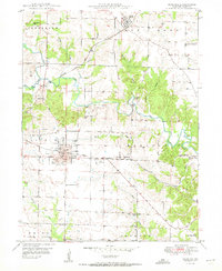
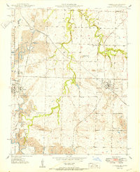
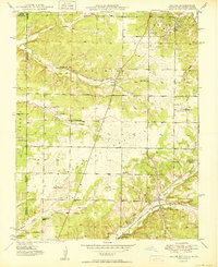
(485)- 1950 Map of Maywood
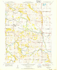 1950 Maywood1950 Print · USGSNortheast Missouri farm country comes to life in the late 1940s as the railroad and river systems shape the landscape. Genealogists can locate family landmarks like Hebron Cem and Shannon Sch, or trace the tracks of the Chicago Burlington and Quincy through Maywood.
 - 1950 Map of Columbia
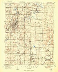
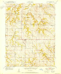
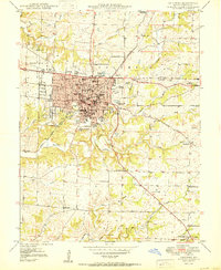 1950 Columbia1950 Print · USGSMid-century Columbia and its surrounding Boone County landscape are captured here just after the post-war culture revision. Researchers can trace the early footprint of the University of Missouri, locate family sites near Jewell Cem, or find rural landmarks like Sugar Grove Ch.2 unique versions available
 - 1950 Map of Lexington East
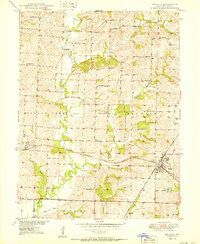
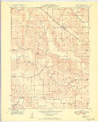
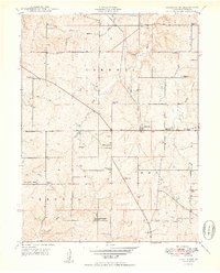
 1950 Lexington East1950 Print · USGSMid-century Lafayette County comes alive through this survey of the river valley and its surrounding uplands. Genealogists and historians can trace local family roots at Forest Grove Cem, Slusher Cem, and several rural schoolhouses like Burns Sch.
 - 1950 Map of Bucklin
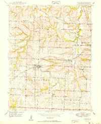
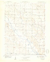
 1950 Bucklin1950 Print · USGSBucklin and St. Catherine appear at a mid-century crossroads where two major railroads intersected among the hills of Linn County. Researchers can trace the locations of several rural schoolhouses like Warren Sch and historic local landmarks including Switzer Chapel and the Mine Dump.3 unique versions available
 - 1950 Map of Mayview
 1950 Mayview1950 Print · USGSLafayette County was a landscape of coal mining and country schoolhouses at mid-century, centered on the rail hub of Mayview. Researchers can trace old family landmarks like Marvin Chapel and numerous vanished rural schools, including Wheatly Sch and Elm Grove Sch.
 - 1950 Map of Kahoka
 1950 Kahoka1950 Print · USGSKahoka and the surrounding Clark County townships are captured here at mid-century, defined by a landscape of small schools and dual rail lines. Genealogists and local historians can trace family locations near Lincoln College Sch, Grace Chapel, and the County Fairgrounds.3 unique versions available
 - 1950 Map of Kansas City
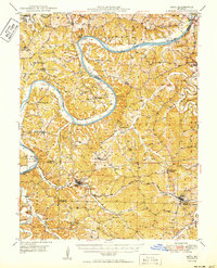
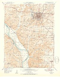
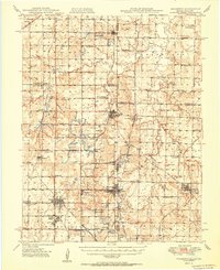
 1950 Kansas City1950 Print · USGSMid-century Kansas and Missouri are captured here during a period of industrial growth and shifting transportation. Genealogists and historians can trace rail lines like the Wabash RR or locate ancestral homes near the Potawatomi Indian Reservation and Horton.
 - 1950 Map of Paducah
 1950 Paducah1950 Print · USGSThe confluence of the great midwestern rivers defines this mid-century landscape at the intersection of Illinois, Kentucky, and Missouri. Genealogists and historians can trace the rail-and-river economy through the hubs of Paducah, Cairo, and Metropolis or locate family roots near the Wildcat Hills.
 - 1950 Map of Pittsburg
 1950 Pittsburg1950 Print · USGSThe coal country along the Kansas-Missouri border was defined by heavy industry and rail just after the war. Genealogists and historians can trace numerous rural schools and family burial sites, including Mindenmines Cem, Council Corner Sch, and the town of Litchfield.2 unique versions available
 - 1950 Map of Durham
 1950 Durham1950 Print · USGSMarion and Lewis County at the close of the 1940s show a landscape of rural townships and winding river bottoms. Genealogists can locate family landmarks like Wagner Cem and McPike Cem or trace the old Chicago Burlington and Quincy rail line.2 unique versions available
 - 1950 Map of Saint Patrick
 1950 Saint Patrick1950 Print · USGSNortheast Missouri agriculture and rural life are preserved here just after the war, centered on the community of St Patrick. Researchers can locate numerous country schools and cemeteries, from Pride of the West Sch to Bash Cem and Higbee Cem.2 unique versions available
 - 1950 Map of St. Clair
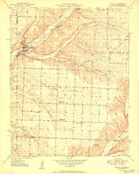
 1950 St. Clair1950 Print · USGSFranklin County's winding river valleys and ridge-top settlements are captured here in the mid-twentieth century. Genealogists and local historians can trace family locations near Virginia Mines, the Henry Shaw Arboretum, and numerous rural schools like Ten Tiney Bluff Sch.
 - 1950 Map of Liberal
 1950 Liberal1950 Print · USGSBarton County and the Kansas borderlands appear here during the peak of mid-century coal production, when rail and mining shaped every township. Researchers can trace rural life via Lone Star Sch, Liberal Cem, and the path of the Kansas City Southern railroad.2 unique versions available
 - 1950 Map of Meta
 1950 Meta1950 Print · USGSMid-century life in the Missouri river hills centers on the winding Osage River and the small parish towns of the interior. Genealogists can trace family roots through several rural schools and burial grounds, including St Cecelia Cem and the Bodie Ferry (Aban'd).
 - 1950 Map of Fredericktown
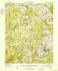 1950 Fredericktown1950 Print · USGSFredericktown and the surrounding mineral-rich hills are shown here just after the war, when mining and rail travel still anchored the local economy. Researchers can locate vanished rural schoolhouses like Brightstone Sch and trace the rail lines serving the Catherine Mines and Park City Mines.2 unique versions available
 - 1950 Map of Seneca
 1950 Seneca1950 Print · USGSNewton County at the Missouri-Oklahoma line is shown here at mid-century, where the rail-linked town of Seneca meets the mineral-rich hills. Researchers can trace rural landmarks including the Tripoli Mine, Westview Sch, and Hollow Springs Ch.2 unique versions available
 - 1950 Map of Elkton
 1950 Elkton1950 Print · USGSHickory County's rural townships are captured here at mid-century, just before large-scale reservoir projects altered the regional landscape. Researchers can trace family history through a remarkable density of local sites, from Round Tree Cem and McCracken Cem to a dozen neighborhood schools like Mashburn Sch and Royal Sch.2 unique versions available
 - 1950 Map of Columbia
 1950 Columbia1950 Print · USGSMid-century Columbia and the Missouri River bottoms are captured here during a period of steady institutional and rail-driven growth. Genealogists and researchers can locate numerous country schools and churches like Mt Zion Ch, Huntsdale, and Valley Springs Sch.2 unique versions available
 - 1950 Map of Alton
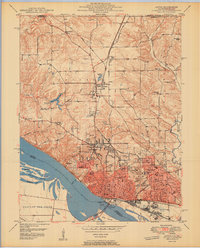 1950 Alton1950 Print · USGSAlton was a bustling river and rail hub at the mid-century, defined by its educational institutions and heavy river infrastructure. Trace the old campus of Western Military Academy, the riverfront at Lock and Dam No 26, and cemeteries like Confederate Cem.2 unique versions available
 - 1950 Map of Kahoka SE
 1950 Kahoka SE1950 Print · USGSNortheast Missouri agriculture and river life are captured here in the mid-century, before modern consolidation changed the rural landscape. Researchers can trace family history through numerous country schools like Gravel Hill Sch and local landmarks such as Bluff Springs Ch.2 unique versions available
 - 1950 Map of Sumner
 1950 Sumner1950 Print · USGSMid-century Chariton County comes to life at this rail junction where the Wabash line intersects the Chicago Burlington and Quincy. Genealogists can trace local roots at Purvis Cem, Prairie Mound Sch, and the Forker Boomer PO.2 unique versions available
 - 1950 Map of Racine
 1950 Racine1950 Print · USGSNewton County's tri-state border region is captured here in the mid-century, showing a landscape shaped by mining and rural schooling. Researchers can locate family landmarks like Gibson Cem or trace the old St Louis San Francisco rail line through Racine.2 unique versions available
 - 1950 Map of Nashua
 1950 Nashua1950 Print · USGSClay and Platte Counties are captured here in the late 1940s, showing a landscape of rural school districts and small crossroads towns. Researchers can trace family ties through community hubs like Nashua, Mt Olivet Church, and the Lone Star School.
 - 1950 Map of Mulberry
 1950 Mulberry1950 Print · USGSThe Kansas-Missouri borderlands at mid-century are defined here by a dense network of coal-mining towns and rail lines. Genealogists can trace family roots through numerous local landmarks like McKill Chapel, the settlement of Red Onion, and the layout of Camp 50.2 unique versions available
 - 1950 Map of Ferrelview
 1950 Ferrelview1950 Print · USGSMid-century Platte County is captured here as a landscape of small farming communities and country schools. Genealogists can locate family-named landmarks like Waller Cemetery and Pancake Cemetery or trace the early foundations of Ferrelview and Linkville.2 unique versions available
Showing maps 1-25 of 485
Top cities of Missouri
- Kansas City historical maps
- St. Louis historical maps
- Springfield historical maps
- Columbia historical maps
- Independence historical maps
- Lee's Summit historical maps
See more
Top counties of Missouri
- Saint Louis County historical maps
- Jackson County historical maps
- Saint Charles County historical maps
- St. Louis historical maps
- Greene County historical maps
- Clay County historical maps
See more
Frequently asked questions
- What are the different types of historical maps available for Missouri?
- What is the oldest map of Missouri?
- Where can I purchase historical maps of Missouri for my home or office?
- Where can I download high-res historical maps of Missouri?
- Are there historical topographic maps available for Missouri?
- Is there historical aerial imagery available for Missouri?
- Where are historical maps of Missouri sourced from?