1960s Maps of Missouri
Explore 418 historic maps of Missouri from the 1960s. These maps offer a rare glimpse into what life looked like during the 1960s — showing old roads, neighborhoods, homes, and landmarks that have changed or disappeared over time.
Whether you're researching your family's past, planning a metal detecting trip, or studying how Missouri's landscape evolved across the 1960s, these high-resolution maps are a powerful tool for exploring the history of this region.
- Focus on a specific era: All maps on this page are from the 1960s, giving you a focused view of this time period.
- See what’s changed: Compare century-old streets, trails, and buildings to today's modern landscape using overlays and satellite layers.
- Research with precision: Use these maps for genealogy, historical research, land use analysis, or educational projects.
- View, download, or print: Maps are fully viewable online in high resolution, and can be downloaded or printed for your own records.
Start exploring Missouri's history through authentic maps from the 1960s. This is your window into the past.
Missouri maps
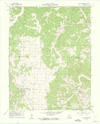
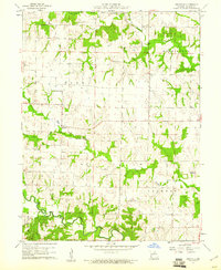
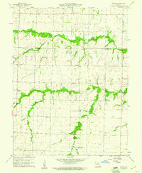
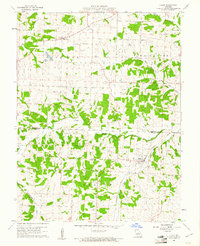
(418)- 1960 Map of Rector
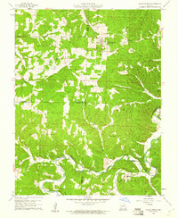
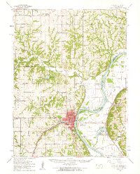
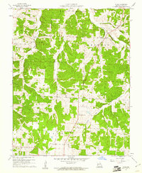
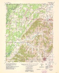 1960 Rector1960 Print · USGSClay County at the end of the fifties reveals a landscape shaped by the rise of Crowleys Ridge and an intricate network of drainage ditches. Local historians can trace the foundations of Rector and Boydsville or locate rural landmarks like the Knob Sch and Purcell Mill.
 - 1960 Map of Kansas City
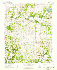
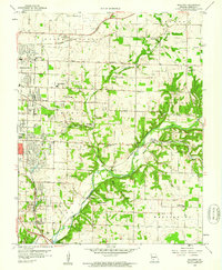
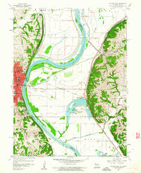
 1960 Kansas City1960 Print · USGSMid-century Kansas and Missouri meet at the river forks, showing a sprawling rail-and-river economy during the 1950s growth era. Genealogists and researchers can trace tribal lands like the Kickapoo Indian Reservation or follow the early interstate corridors through Saint Joseph and Independence.3 unique versions available
 - 1960 Map of Moberly
 1960 Moberly1960 Print · USGSCentral Missouri comes alive in the mid-twentieth century as a bustling network of river towns and significant rail corridors. Genealogists and historians can trace the paths of the Wabash RR through Moberly or explore the riverfronts of Lexington and Brunswick.
 - 1960 Map of Poplar Bluff
 1960 Poplar Bluff1960 Print · USGSSoutheast Missouri and Northeast Arkansas are captured here during the post-war era, showing the transition from the Ozark highlands to the Delta. Genealogists and historians can trace rail corridors like the St. Louis Southwestern RR and remote settlements such as Birch Tree and Warm Springs.
 - 1960 Map of Rolla
 1960 Rolla1960 Print · USGSThe Ozark Highlands in the mid-twentieth century reveal a landscape of deep timber and heavy industry. Researchers can trace the rail-and-mine economy through the St Louis-San Francisco RR and the Iron Mountain Mine, alongside the growth of Fort Leonard Wood.
 - 1960 Map of Brookline, 1961 Print
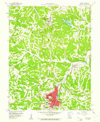
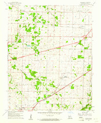 1960 Brookline1961 Print · USGSGreene County is captured during a period of infrastructure expansion in the early sixties as new highways were being built alongside established rail lines. Genealogists and local historians can locate several burial sites like Evergreen Cemetery and trace the original ST LOUIS SAN FRANCISCO rail route through Republic and Brookline.5 unique versions available
 - 1960 Map of Barnett, 1961 Print
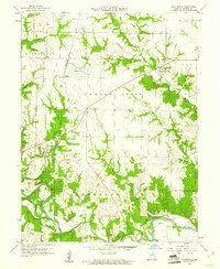
 1960 Barnett1961 Print · USGSBarnett and the rural townships of central Missouri appear here just as the new decade began. Researchers can trace family roots at Kelsay Cem or follow the Chicago Rock Island and Pacific rail line past the Simpson Mine.2 unique versions available
 - 1960 Map of Goss, 1961 Print
 1960 Goss1961 Print · USGSMonroe County was a landscape of winding river bends and small rural hubs in the early sixties. Genealogists can trace family names through sites like Crutcher Cem and Marr Sch, or follow the WABASH rail line through Goss.2 unique versions available
 - 1960 Map of Cross Timbers, 1961 Print
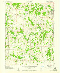
 1960 Cross Timbers1961 Print · USGSThe community of Cross Timbers and the surrounding Hickory County landscape are captured here in the early sixties. Genealogists and local historians can trace family locations near Davis Cem, Bethel Ch, and the waters of Turkey Creek.2 unique versions available
 - 1960 Map of Nixa, 1961 Print
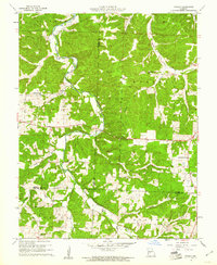
 1960 Nixa1961 Print · USGSThe Ozark foothills south of Springfield appear here in the early 1960s as a landscape of rural family cemeteries and creek-side settlements. Genealogists can trace local history through landmarks like Union Chapel, McConnell Cem, and the historic Frazier Bridge.5 unique versions available
 - 1960 Map of Springfield, 1961 Print
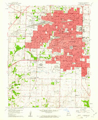 1960 Springfield1961 Print · USGSSpringfield and its surrounding Greene County townships appear in the early sixties during a season of post-war growth. Researchers can trace institutional roots at Southwest Missouri State College, explore the FEDERAL MEDICAL CENTER, or locate family sites near Hazelwood Cemetery and Bethany Ch.4 unique versions available
 - 1960 Map of De Soto, 1961 Print
 1960 De Soto1961 Print · USGSJefferson County was a landscape of winding creek valleys and rail-fed towns in the early sixties. Genealogists can trace family roots through several sites including Good Shepherd Cem, Victoria, and the campus of Mt St Clements College.2 unique versions available
 - 1960 Map of Climax Springs, 1961 Print
 1960 Climax Springs1961 Print · USGSClimax Springs and the Little Niangua River country are captured here at the start of the 1960s, showing a landscape of deep hollows and high ridges. Researchers can trace rural community roots through local landmarks like Wiseman Ch, Green Ridge Cem, and the Climax Springs Lookout Tower.3 unique versions available
 - 1960 Map of Galloway, 1961 Print
 1960 Galloway1961 Print · USGSEastern Greene County at the dawn of the 1960s shows a mix of rural heritage and emerging city growth. Researchers can trace family roots through numerous landmarks like Kinser Chapel, the St Louis San Francisco railroad, and Bodenhamer Cem.4 unique versions available
 - 1960 Map of Granville, 1961 Print
 1960 Granville1961 Print · USGSMonroe County was a mosaic of quiet townships and creek-side farms in the early sixties. Genealogists and local historians can trace rural roots at Spencer Chapel Cem, Granville Sch, and the community of Granville.2 unique versions available
 - 1960 Map of Rowena, 1961 Print
 1960 Rowena1961 Print · USGSThe rural borders of Monroe and Audrain counties are captured here at the start of the 1960s, showing a landscape defined by traditional farming communities. Genealogists can locate several named country schoolhouses and churches, including Goodwater Sch, Strother Sch, and Bethlehem Ch.2 unique versions available
 - 1960 Map of Olean, 1961 Print
 1960 Olean1961 Print · USGSThe borderlands of Moniteau and Miller counties come into focus during the early sixties, centered on the Missouri Pacific rail corridor. Genealogists and local researchers can trace old family landmarks like High Point Cemetery, the Tiff Mine, and Green Ridge Church.2 unique versions available
 - 1960 Map of Stoutsville, 1961 Print
 1960 Stoutsville1961 Print · USGSMonroe County was a landscape of river fords and rail lines in the early sixties, centered on the river convergence at Stoutsville. Genealogists and local historians can trace the Wabash line, locate St Andrews Cem, and identify old river crossings like Kitty Wheel Ford.2 unique versions available
 - 1960 Map of Paris West, 1961 Print
 1960 Paris West1961 Print · USGSMonroe County was a network of river forks and rail lines in the early sixties, centered around the community of Paris. Researchers can trace local heritage through numerous family landmarks like McKinney Cem, the Sanford Sch, and the old Wabash railroad corridor.4 unique versions available
 - 1960 Map of Branch, 1961 Print
 1960 Branch1961 Print · USGSCamden County was a land of quiet creek valleys and scattered hilltop churches at the dawn of the 1960s. Family historians can trace ancestral sites along the Little Niangua River, from the Stanton Cem to the Branch Lookout Tower.2 unique versions available
 - 1960 Map of Atchison, 1961 Print
 1960 Atchison1961 Print · USGSAtchison thrived as a Missouri River rail and education hub at the dawn of the sixties. Genealogists can trace family roots through numerous rural landmarks like Shannon Hill Sch, Mt Calvary Cem, and the riverfront settlement of Winthrop.2 unique versions available
 - 1960 Map of Vineland, 1961 Print
 1960 Vineland1961 Print · USGSJefferson and St. Francois counties are shown here in the early sixties, as rural life centered around the Big River and the Missouri Pacific line. Researchers can trace family history through sites like Moontown Cem, the Sunrise Sch, and Valles Mines.2 unique versions available
 - 1960 Map of Atchison East, 1961 Print
 1960 Atchison East1961 Print · USGSThe Missouri River floodplain comes to life in the early 1960s, showing the intricate relationship between the river, rail lines, and border settlements. Genealogists and local historians can trace landmarks like St Benedicts College, Sugar Lake, and the vanished site of the Drive-in Theater.3 unique versions available
 - 1960 Map of Republic, 1961 Print
 1960 Republic1961 Print · USGSSouthwest Missouri at the start of the 1960s reveals a landscape still deeply connected to its Civil War history and rural roots. Genealogists and historians can trace family locations through numerous sites like Wise Hill Cem, the historic Ray House, and the Wilson Creek Battlefield.4 unique versions available
 - 1960 Map of Tunas, 1961 Print
 1960 Tunas1961 Print · USGSThe community of Tunas and the Little Niangua River valley are shown here in the early sixties. Genealogists and local historians can locate rural landmarks such as Howard Chapel, Cherry Grove Ch, and the winding Coatney Branch.2 unique versions available
Showing maps 1-25 of 418
Top cities of Missouri
- Kansas City historical maps
- St. Louis historical maps
- Springfield historical maps
- Columbia historical maps
- Independence historical maps
- Lee's Summit historical maps
See more
Top counties of Missouri
- Saint Louis County historical maps
- Jackson County historical maps
- Saint Charles County historical maps
- St. Louis historical maps
- Greene County historical maps
- Clay County historical maps
See more
Frequently asked questions
- What are the different types of historical maps available for Missouri?
- What is the oldest map of Missouri?
- Where can I purchase historical maps of Missouri for my home or office?
- Where can I download high-res historical maps of Missouri?
- Are there historical topographic maps available for Missouri?
- Is there historical aerial imagery available for Missouri?
- Where are historical maps of Missouri sourced from?