1970s Maps of Missouri
Explore 334 historic maps of Missouri from the 1970s. These maps offer a rare glimpse into what life looked like during the 1970s — showing old roads, neighborhoods, homes, and landmarks that have changed or disappeared over time.
Whether you're researching your family's past, planning a metal detecting trip, or studying how Missouri's landscape evolved across the 1970s, these high-resolution maps are a powerful tool for exploring the history of this region.
- Focus on a specific era: All maps on this page are from the 1970s, giving you a focused view of this time period.
- See what’s changed: Compare century-old streets, trails, and buildings to today's modern landscape using overlays and satellite layers.
- Research with precision: Use these maps for genealogy, historical research, land use analysis, or educational projects.
- View, download, or print: Maps are fully viewable online in high resolution, and can be downloaded or printed for your own records.
Start exploring Missouri's history through authentic maps from the 1970s. This is your window into the past.
Missouri maps
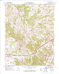
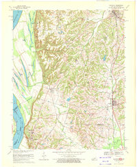
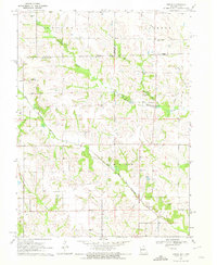
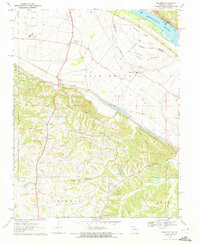
(334)- 1970 Map of Greenville
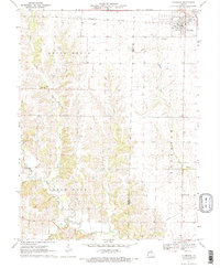
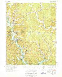 1970 Greenville1970 Print · USGSThe St Francis River valley and Wappapello Lake shoreline are captured in the late sixties, showing the rural communities of Wayne County. Trace family roots at Old Greenville Cem and explore landmarks like White Hollow Sch and Logan Mountain.
 - 1970 Map of Fair Grove, 1971 Print
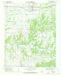
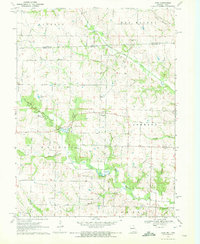
 1970 Fair Grove1971 Print · USGSThe northern reaches of Greene County are captured here at the start of the 1970s, where the winding Pomme De Terre River meets the rural crossroads of Fair Grove. Researchers can trace the family names of the Ozarks through landmarks like Goodnight Knob and the Mallard Cemetery.2 unique versions available
 - 1970 Map of Rogersville, 1971 Print
 1970 Rogersville1971 Print · USGSRogersville and the surrounding Ozark townships are captured here at the end of the sixties as rural life centered on the railroad and local creeks. Researchers can trace family roots through numerous country burial grounds and churches like Holland Cem, Roller Cem, and Grace Gospel Ch.3 unique versions available
 - 1970 Map of Elkland, 1971 Print
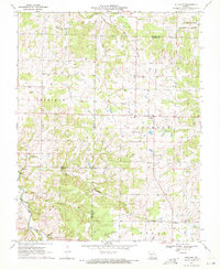 1970 Elkland1971 Print · USGSElkland and the surrounding Missouri countryside appear here in the early 1970s, at the intersection of Webster, Dallas, and Greene counties. Researchers can trace rural lineages through sites like the Elkland Sch, Union Mound Ch, and Stever Cem.
 - 1970 Map of Strafford, 1971 Print
 1970 Strafford1971 Print · USGSThe Strafford area in the early seventies shows a landscape shaped by the St. Louis - San Francisco railroad and the upper reaches of the James River. Researchers can trace rural church life and family history at Mt Calvary Ch, Caldwell Cem, and Epworth Ch.2 unique versions available
 - 1970 Map of Oak Grove Heights, 1971 Print
 1970 Oak Grove Heights1971 Print · USGSWebster County’s rural landscape is captured here in the early seventies, centered on Oak Grove Heights and the James River. Genealogists can locate family sites at Henderson Cem, Panther Valley Cem, and numerous country chapels.2 unique versions available
 - 1970 Map of Ozark, 1971 Print
 1970 Ozark1971 Print · USGSChristian County at the start of the seventies reveals a landscape where the river-and-rail economy of Ozark meets the karst terrain of the Missouri hills. Trace local family history through numerous burial grounds like Weaver Cem and Pembina Cem, or find landmarks like Smallin Cave and the Drag Strip.3 unique versions available
 - 1970 Map of Bloomsdale, 1972 Print
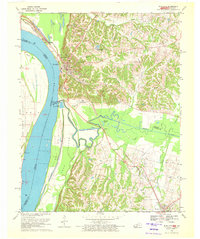
 1970 Bloomsdale1972 Print · USGSThe Mississippi River borderlands between Missouri and Illinois are captured here in the early seventies. Genealogists can trace the rural communities of Bloomsdale and Needmore, while historians can locate Fort Chartres State Park and the lines of the St Louis San Francisco railroad.3 unique versions available
 - 1970 Map of Prairie Du Rocher, 1972 Print
 1970 Prairie Du Rocher1972 Print · USGSThe Mississippi River floodplain and limestone bluffs define the Randolph County borderlands around the 1970s. Genealogists and historians can trace rail-side settlements like Prairie du Rocher, the Modoc Rock Shelter National Historic Site, and riverfront sites at Mudds Landing.3 unique versions available
 - 1970 Map of Arlington, 1972 Print
 1970 Arlington1972 Print · USGSThe Mississippi River bluffs and Carlisle County uplands are captured here in the 1970s. Trace family history through rural sites like Webbs Chapel, Rogers Cem, and Allen Cem, or follow the path of the Gulf Mobile and Ohio railroad.3 unique versions available
 - 1970 Map of Hickman, 1972 Print
 1970 Hickman1972 Print · USGSThe riverfront at Hickman and the surrounding Kentucky-Tennessee borderlands are shown here during the early seventies. Genealogists and local historians can trace family sites at Hubbard Cem, visit Anna Lynne, or follow the Illinois Central Railroad line.2 unique versions available
 - 1970 Map of Chester, 1972 Print
 1970 Chester1972 Print · USGSChester and the Mississippi River bluffs are captured here in the early 1970s, showcasing a landscape defined by industry and state institutions. Genealogists and researchers can trace family plots at Evergreen Cem or locate the State Penitentiary and nearby Mine Tunnels.2 unique versions available
 - 1970 Map of Lithium, 1972 Print
 1970 Lithium1972 Print · USGSPerry County in the early seventies shows a landscape in transition as new highway construction began to redefine the area. Local researchers can locate Lithium, Brewer, and unique landmarks like the Ball Mill Resurgence or the Drive-in Theater.2 unique versions available
 - 1970 Map of Brock, 1972 Print
 1970 Brock1972 Print · USGSThe Missouri-Iowa borderlands come into focus in the early 1970s, showing a rural landscape defined by the winding forks of the Wyaconda River. Genealogists can trace family heritage through numerous burial sites like Hubbard Cem, Trinity Cem, and the small settlement at Brock.
 - 1970 Map of Kaskaskia, 1972 Print
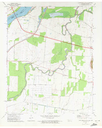
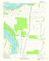
 1970 Kaskaskia1972 Print · USGSKaskaskia Island and its riverfront settlements are documented in the early seventies, showcasing a unique Illinois territory west of the Mississippi. Trace the locations of Old Kaskaskia, Kaskaskia Cem, and the historic FORT KASKASKIA STATE PARK bluffs.2 unique versions available
 - 1970 Map of Bentonville North, 1972 Print
 1970 Bentonville North1972 Print · USGSNorthwest Arkansas around the state line was beginning a period of rapid suburban growth in the early seventies. Genealogists and historians can trace the transition from rural hollows to established neighborhoods through sites like Wonderland Cave, Foster Cem, and Bella Vista.4 unique versions available
 - 1970 Map of Azen, 1972 Print
 1970 Azen1972 Print · USGSThe border between Missouri and Iowa comes alive in the 1970s, showing a landscape defined by meandering rivers and rural townships. Family history researchers can locate numerous burial sites and congregations, including Billups Cem, Needham Cem, and Prairieview Ch.
 - 1970 Map of Belgique, 1972 Print
 1970 Belgique1972 Print · USGSThe Mississippi River bottomlands of Perry County come into sharp focus in the early seventies, showing a landscape shaped by both the river and the rail. Researchers can locate vanished landmarks and family sites like Nativity Cem, School No 73, and the rural community of Belgique.
 - 1970 Map of Wickliffe, 1972 Print
 1970 Wickliffe1972 Print · USGSThe river bluffs of western Kentucky met the great confluence in the 1970s, where the Missouri and Illinois borders converge. Genealogists and historians can trace significant landmarks like the Ancient Buried City, the Site of Fort Jefferson, and the Wickliffe Cem.2 unique versions available
 - 1971 Map of Rolla
 1971 Rolla1971 Print · USGSThe Missouri Ozarks are captured here during the early seventies, showing a landscape of deep river valleys and industrial mining towns. Researchers can trace historic lead mining operations at St Joseph Mines and locate rural landmarks like Viburnum and the Galveston Trail.
 - 1971 Map of Kearney, 1972 Print
 1971 Kearney1972 Print · USGSClay County in the early seventies shows a transition from traditional farming life to modern suburban growth. Genealogists and local historians can trace family ties through numerous burial sites like Baldwin Cem or locate the old Means Sch and Mt Olive Ch.
 - 1971 Map of Glasgow, 1972 Print
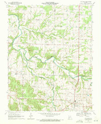
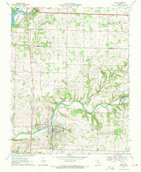
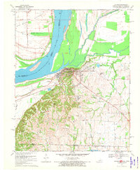
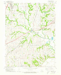
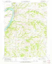 1971 Glasgow1972 Print · USGSThe Missouri River town of Glasgow is captured in the early seventies at a vital crossroads of three counties and major rail lines. Genealogists and local historians can trace the paths of the Gulf Mobile and Ohio railroad through Steinmetz or locate the Richland Ch and Pleasant Green Cem.
 - 1971 Map of Clarence, 1972 Print
 1971 Clarence1972 Print · USGSShelby and Macon counties are shown in the early seventies as small farming communities thrived along the Burlington Northern rail line. Genealogists can locate family landmarks such as Bethlehem Cem, Graves Chapel, and the settlement of Enterprise.2 unique versions available
 - 1971 Map of Caruthersville SE, 1972 Print
 1971 Caruthersville SE1972 Print · USGSThe Mississippi River bottomlands of Dyer County come to life in this early 1970s survey of the Tennessee-Missouri border. Researchers can trace the rural landscape through family-centric hubs like Boothspoint, Mengelwood, and the Emmanuel Ch cemetery and church site.2 unique versions available
 - 1971 Map of Tennemo, 1972 Print
 1971 Tennemo1972 Print · USGSThe Mississippi River bottoms of Lake County come into focus during the early 1970s, showing a landscape defined by levees and drainage bayous. Researchers can trace the layout of riverside hamlets like Tennemo and Owl Hoot, or locate the Cottonwood Ch near the Tennessee-Missouri border.2 unique versions available
Showing maps 1-25 of 334
Top cities of Missouri
- Kansas City historical maps
- St. Louis historical maps
- Springfield historical maps
- Columbia historical maps
- Independence historical maps
- Lee's Summit historical maps
See more
Top counties of Missouri
- Saint Louis County historical maps
- Jackson County historical maps
- Saint Charles County historical maps
- St. Louis historical maps
- Greene County historical maps
- Clay County historical maps
See more
Frequently asked questions
- What are the different types of historical maps available for Missouri?
- What is the oldest map of Missouri?
- Where can I purchase historical maps of Missouri for my home or office?
- Where can I download high-res historical maps of Missouri?
- Are there historical topographic maps available for Missouri?
- Is there historical aerial imagery available for Missouri?
- Where are historical maps of Missouri sourced from?