
Historical Maps of Koochiching County, Minnesota
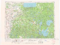
What stories do these 161 old maps tell about Koochiching County's past? From 1918 to present day, these maps reveal the evolution of streets, neighborhoods, iconic landmarks, and natural features in stunning high-res detail. Whether you're a history enthusiast, genealogist, or professional in education, environmental work, or architecture, these maps are perfect for exploration, research, and discovery.
Discover Koochiching County's history through maps:
- Trace Koochiching County's growth: Explore earlier and latest maps and editions to uncover how the region changed over time.
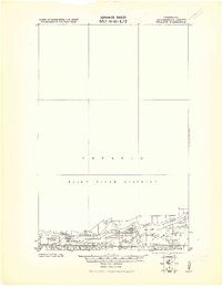
- Examine technical details: Each map includes its creators, publishers, scale, dimensions, and full source information.
- Layer maps with modern tools & imagery: Compare historical maps to modern-day with high-resolution satellite imagery and detailed LiDAR layers.
- Sourced from trusted archives: Carefully preserved and digitized by institutions like the United Stated Geological Survey and the US Library of Congress.
- Access in any format: View and explore in high resolution, download for offline use, or order a museum-quality print for yourself or a loved one.
Begin your journey into Koochiching County's history with these remarkable must-see maps.
Koochiching County, MN maps
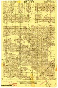
(161)- 1918 Map of Zora, 1943 Print
 1918 Zora1943 Print · USGSCovers Koochiching County, including Pomroy, Wildwood, and other nearby areas
 - 1919 Map of Zora
 1919 Zora1919 Print · USGSCovers Koochiching County, including Pomroy, Wildwood, and other nearby areas
 - 1919 Map of Lundgren
 1919 Lundgren1919 Print · USGSCovers Koochiching County, including Gates Corner, United States, and other nearby areas
 - 1919 Map of Gemmell
 1919 Gemmell1919 Print · USGSCovers Koochiching County, including Northome, Mizpah, and other nearby areas
 - 1919 Map of Norden
 1919 Norden1919 Print · USGSCovers Koochiching County, including Beltrami County, United States, and other nearby areas
 - 1919 Map of Pelland
 1919 Pelland1919 Print · USGSCovers Koochiching County, including Emo Township, Alberton Township, and other nearby areas
 - 1919 Map of Birchdale
 1919 Birchdale1919 Print · USGSCovers Koochiching County, including Chapple Township, Morley Township, and other nearby areas
 - 1919 Map of I
 1919 I1919 Print · USGSCovers Koochiching County, including Fairland, United States, and other nearby areas
 - 1919 Map of Bridgie, 1924 Print
 1919 Bridgie1924 Print · USGSCovers Koochiching County, including Kelliher, Northome, and other nearby areas
 - 1919 Map of Pelland, 1943 Print
 1919 Pelland1943 Print · USGSCovers Koochiching County, including Emo Township, Alberton Township, and other nearby areas
 - 1919 Map of Happy Land, 1943 Print
 1919 Happy Land1943 Print · USGSCovers Koochiching County, including Littlefork, Wisner, and other nearby areas
 - 1919 Map of Lundgren, 1943 Print
 1919 Lundgren1943 Print · USGSCovers Koochiching County, including Gates Corner, United States, and other nearby areas
 - 1919 Map of M, 1943 Print
 1919 M1943 Print · USGSCovers Koochiching County, including United States, Minnesota, and other nearby areas
 - 1919 Map of Margie, 1943 Print
 1919 Margie1943 Print · USGSCovers Koochiching County, including Big Falls, Grand Falls, and other nearby areas
 - 1919 Map of International Falls, 1943 Print
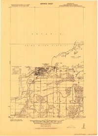 1919 International Falls1943 Print · USGSCovers Koochiching County, including Fort Frances, International Falls, and other nearby areas
 - 1924 Map of Bridgie, 1944 Print
 1924 Bridgie1944 Print · USGSCovers Koochiching County, including Kelliher, Northome, and other nearby areas
 - 1943 Map of Lindford
 1943 Lindford1943 Print · USGSCovers Koochiching County, including Lindford, Hendrickson Landing, and other nearby areas
 - 1954 Map of Bemidji, 1966 Print
 1954 Bemidji1966 Print · USGSCovers Koochiching County, including Bemidji, Fosston, and other nearby areas
 - 1954 Map of Bemidji, 1966 Print
 1954 Bemidji1966 Print · USGSCovers Koochiching County, including Bemidji, Fosston, and other nearby areas
 - 1954 Map of Hibbing, 1966 Print
 1954 Hibbing1966 Print · USGSCovers Koochiching County, including Hibbing, Virginia, and other nearby areas
 - 1954 Map of Roseau, 1969 Print
 1954 Roseau1969 Print · USGSCovers Koochiching County, including Roseau, Warroad, and other nearby areas
 - 1954 Map of Bemidji, 1974 Print
 1954 Bemidji1974 Print · USGSCovers Koochiching County, including Bemidji, Fosston, and other nearby areas
 - 1954 Map of Hibbing, 1974 Print
 1954 Hibbing1974 Print · USGSCovers Koochiching County, including Hibbing, Virginia, and other nearby areas
 - 1954 Map of Roseau, 1976 Print
 1954 Roseau1976 Print · USGSCovers Koochiching County, including Roseau, Warroad, and other nearby areas
 - 1954 Map of International Falls, 1980 Print
 1954 International Falls1980 Print · USGSCovers Koochiching County, including Fort Frances, International Falls, and other nearby areas
Showing maps 1-25 of 161
Top cities in Koochiching County
- International Falls historical maps
- Littlefork historical maps
- Big Falls historical maps
- Northome historical maps
- Ranier historical maps
- Mizpah historical maps
Frequently asked questions
- What are the different types of historical maps available for Koochiching County?
- What is the oldest map of Koochiching County?
- Where can I purchase historical maps of Koochiching County for my home or office?
- Where can I download high-res historical maps of Koochiching County?
- Are there historical topographic maps available for Koochiching County?
- Is there historical aerial imagery available for Koochiching County?
- Where are historical maps of Koochiching County sourced from?