Old Maps of Brockton District, Montana for Hiking & Exploration
Hike through history with 153 historic maps of Brockton District. Explore old trails, ghost towns, and forgotten backroads — perfect for outdoor adventurers and local explorers.
- Rediscover forgotten places: Map out old mining camps, roads, and footpaths that no longer exist on modern maps.
- Layer with modern tools: Combine with LiDAR or satellite views to plan hikes through historical terrain.
- Made for exploration: Popular among hikers, overlanders, and local history lovers.
Use these maps to find adventure and explore the hidden past of Brockton District.
Brockton District, MT maps
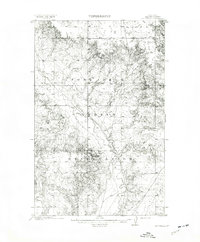
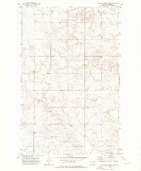
(153)- 1909 Map of Smoke Creek, 1964 Print
 1909 Smoke Creek1964 Print · USGSNortheastern Montana was still an expansive frontier at the turn of the century, dominated by the Fort Peck Indian Reservation. Researchers can trace early land use and water sources through the West Ranch and the winding course of Smoke Creek.
 - 1912 Map of Hay Creek
 1912 Hay Creek1912 Print · USGSNortheastern Montana rangeland is captured here just before the Great War, during a period of early ranching and reservation administration. Genealogists and historians can locate Kerns Ranch and trace the original course of the Poplar River and Hay creek.2 unique versions available
 - 1912 Map of Poplar
 1912 Poplar1912 Print · USGSThe High Plains of northeastern Montana are captured here just before the first World War, centered on the confluence of two major waterways. Genealogists and historians can trace early railroad siding stops like Sprole and Arthur along the Great Northern line and through the Fort Peck Indian Reservation.
 - 1912 Map of Smoke Creek
 1912 Smoke Creek1912 Print · USGSThe eastern reaches of the Fort Peck Indian Reservation are captured here in the years following the turn of the century. Genealogists and researchers can trace the early livestock era at Wests Ranch or the natural hydrology of Smoke Creek and Manning Lake.
 - 1914 Map of Brockton
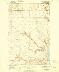
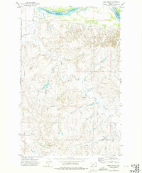
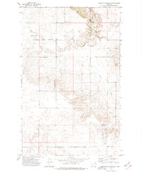
 1914 Brockton1914 Print · USGSNortheastern Montana ranching and rail life are frozen in time just before the First World War. Trace the early layout of Brockton and find local landmarks like Armstrongs Ranch, Schoolhouse Coulee, and the path of the Great Northern R R.3 unique versions available
 - 1950 Map of Coyote Coulee, 1952 Print
 1950 Coyote Coulee1952 Print · USGSRoosevelt County ranching and reservation life are captured here in the early fifties during the Missouri River Basin development era. Genealogists and historians can trace the remote Schnitzler Ranch or the winding paths of Coyote Coulee and Smoke Creek.2 unique versions available
 - 1950 Map of Calais, 1952 Print
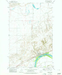
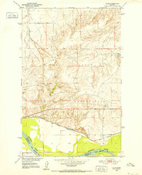 1950 Calais1952 Print · USGSNortheastern Montana's river valley and high plains come into focus at mid-century, where the reservation meets the winding Missouri. Genealogists and historians can trace the Great Northern rail line through Calais or locate the Alton Mine and Bertino Res.2 unique versions available
 - 1954 Map of Wolf Point, 1967 Print
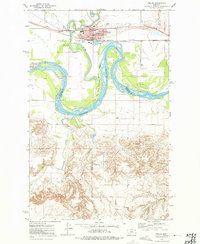
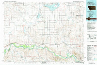
 1954 Wolf Point1967 Print · USGSNortheastern Montana and the North Dakota borderlands are shown here in the mid-fifties, dominated by the Missouri River and the Fort Peck Indian Reservation. Genealogists and historians can trace the Great Northern rail line through river towns like Poplar and Culbertson or locate northern border outposts like the U S Custom Office at Raymond.2 unique versions available
 - 1958 Map of Wolf Point
 1958 Wolf Point1958 Print · USGSNortheastern Montana is shown during the mid-fifties, featuring the extensive Fort Peck Indian Reservation and the Missouri River valley. Researchers can trace the Great Northern railroad through Wolf Point or locate sites like Slab Crossing and the Coal Mine near Medicine Lake.
 - 1972 Map of Poplar, 1975 Print
 1972 Poplar1975 Print · USGSThe confluence of the Missouri and Poplar Rivers is captured in the early seventies, centered on the hub of Poplar within the reservation. Trace the Burlington Northern rail line and local landmarks like the Arthur Sch and the Poplar Airport.2 unique versions available
 - 1972 Map of Poplar NE, 1975 Print
 1972 Poplar NE1975 Print · USGSRoosevelt County in the early seventies shows an active energy landscape within the Fort Peck Indian Reservation. Genealogists and historians can trace the network of the East Poplar Oil Field and the winding course of the Poplar River.
 - 1972 Map of Frog Coulee, 1975 Print
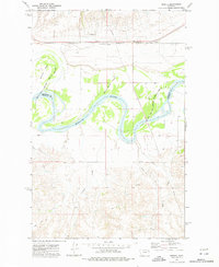
 1972 Frog Coulee1975 Print · USGSThe Missouri River breaks the high plains in the early seventies, marking the edge of the Fort Peck Indian Reservation. Genealogists and local historians can locate remote landmarks like St Bernards Ch, Lynn Cem, and Land Promised Coulee.2 unique versions available
 - 1972 Map of Mortarstone Bluff, 1975 Print
 1972 Mortarstone Bluff1975 Print · USGSThe Missouri River breaks through the high plains of eastern Montana in the early 1970s, marking the edge of the Fort Peck Indian Reservation. Local researchers can trace the tracks of the Burlington Northern and find specific community sites like Riverside Ch and the Fisher Cem.2 unique versions available
 - 1972 Map of Badger Creek, 1975 Print
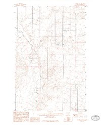
 1972 Badger Creek1975 Print · USGSRoosevelt County in the early seventies shows a landscape defined by the Poplar River and the expanding East Poplar Oil Field. Researchers can trace old resource extraction sites, from several Oil Wells to the Crandall Reservoir and the Little Badger Spr.
 - 1972 Map of Brockton, 1975 Print
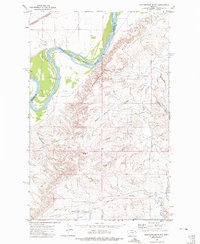
 1972 Brockton1975 Print · USGSBrockton and the Missouri River corridor are captured here during the 1970s, showcasing the town's agricultural and rail infrastructure. Genealogists and local historians can locate specific landmarks like the Ruffatto Sch, Twomile Hall, and the town's original Rodeo Ground.2 unique versions available
 - 1972 Map of Sprole, 1976 Print
 1972 Sprole1976 Print · USGSThe Missouri River valley at the Roosevelt and Richland county line is captured here in the early 1970s. Trace the rural rail-and-river economy through landmarks like the Sprole Storage Bins, the Burlington Northern line, and White Shield Island.2 unique versions available
 - 1973 Map of Pleasant Prairie, 1976 Print
 1973 Pleasant Prairie1976 Print · USGSNortheastern Montana ranching country is captured here in the early 1970s within the Fort Peck Indian Reservation. Genealogists and local historians can trace the community around Pleasant Prairie Ch, the Cem, and the Westby School Center.
 - 1973 Map of Pleasant Prairie NW, 1976 Print
 1973 Pleasant Prairie NW1976 Print · USGSDaniels County is shown in the early seventies, capturing the sparsely populated prairie where the reservation meets the High Plains. Genealogists and local historians can locate Orville Cem and trace the paths of Smoke Creek and Eagle Creek.
 - 1973 Map of Pleasant Prairie SW, 1976 Print
 1973 Pleasant Prairie SW1976 Print · USGSRoosevelt and Daniels counties are shown during the 1970s, featuring the open prairie landscape of the Fort Peck Indian Reservation. Researchers can trace landforms like Square Butte, Pole Hill, and the course of Out Give Creek.
 - 1973 Map of Pleasant Prairie NE, 1977 Print
 1973 Pleasant Prairie NE1977 Print · USGSNortheast Montana at the beginning of the 1970s shows a landscape of wide-open ranching country and tribal lands. Researchers can locate the Fort Peck Indian Reservation Boundary, the community gathering point at Wolf Creek Hall, and several Storage Bins scattered near Eagle Creek.
 - 1982 Map of Culbertson, 1983 Print
 1982 Culbertson1983 Print · USGSNortheastern Montana at the start of the 1980s reveals a high-plains landscape defined by the Missouri River and the rail lines that served its valley. Genealogists and researchers can trace the townships surrounding Culbertson, Bainville, and the Fort Union Trading Post.
 - 1983 Map of Hay Creek NW
 1983 Hay Creek NW1983 Print · USGSThe Fort Peck Indian Reservation landscape in the early eighties is defined by the winding Poplar River and its many tributaries. Researchers can trace the drainage patterns and land contours of Roosevelt County through features like Swank Coulee and Lone Tree Creek.
 - 1983 Map of Smoke Creek SW
 1983 Smoke Creek SW1983 Print · USGSNortheastern Montana's high plains are captured here in the early eighties within the Fort Peck Indian Reservation. Local history researchers can trace the natural drainage of Lake Creek across the township lines of T30N and T29N.
 - 1983 Map of Long Creek East
 1983 Long Creek East1983 Print · USGSNortheastern Montana's high plains within the Fort Peck Indian Reservation are captured here as they appeared in the early eighties. Local historians and land researchers can trace the drainages of the Poplar River and find agricultural landmarks like Grain Bins.
 - 1983 Map of Geddart Lake
 1983 Geddart Lake1983 Print · USGSRoosevelt County's northern plains are captured here in the early eighties, centered on the winding Poplar River. Researchers can trace the path of a local Pipe Line and locate essential agricultural markers like Geddart Lake and Grain Bins.2 unique versions available
Showing maps 1-25 of 153
Top cities near Brockton District
Top neighborhoods of Brockton District
- Anderson historical maps
- Biem historical maps
- Pleasant Prairie historical maps
- Sprole historical maps
- Brockton historical maps
Frequently asked questions
- What are the different types of historical maps available for Brockton District?
- What is the oldest map of Brockton District?
- Where can I purchase historical maps of Brockton District for my home or office?
- Where can I download high-res historical maps of Brockton District?
- Are there historical topographic maps available for Brockton District?
- Is there historical aerial imagery available for Brockton District?
- Where are historical maps of Brockton District sourced from?