1800s (19th Century) Maps of Niagara County, New York
Explore 9 historic maps of Niagara County from the 1800s (19th Century). These maps offer a rare glimpse into what life looked like during the 1800s — showing old roads, neighborhoods, homes, and landmarks that have changed or disappeared over time.
Whether you're researching your family's past, planning a metal detecting trip, or studying how Niagara County's landscape evolved across the 1800s, these high-resolution maps are a powerful tool for exploring the history of this region.
- Focus on a specific era: All maps on this page are from the 1800s, giving you a focused view of this time period.
- See what’s changed: Compare century-old streets, trails, and buildings to today's modern landscape using overlays and satellite layers.
- Research with precision: Use these maps for genealogy, historical research, land use analysis, or educational projects.
- View, download, or print: Maps are fully viewable online in high resolution, and can be downloaded or printed for your own records.
Start exploring Niagara County's history through authentic maps from the 1800s. This is your window into the past.
Niagara County, NY maps
(9)- 1894 Map of Niagara Falls
 1894 Niagara Falls1894 Print · USGSThe Niagara frontier in the early 1890s shows a landscape of strategic forts and burgeoning rail power. Trace the international border from Fort Niagara past the Brock Monument to the rail hubs at Suspension Bridge.
 - 1894 Map of Wilson
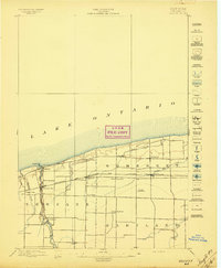
 1894 Wilson1894 Print · USGSNiagara County's lakefront comes alive in the late nineteenth century as a thriving coastal and rail corridor. Genealogists can trace family lands near Wilson, North Wilson, and the Rome Watertown and Ogdensburg Station.2 unique versions available
 - 1896 Map of Niagara Falls
 1896 Niagara Falls1896 Print · USGSThe Niagara frontier at the close of the nineteenth century was a landscape of international boundaries and massive engineering. Trace the complex rail networks through Suspension Bridge or the historic fortifications at Fort Niagara and Fort Massassauga.2 unique versions available
 - 1897 Map of Tonawanda
 1897 Tonawanda1897 Print · USGSNiagara and Erie counties thrived at the close of the nineteenth century as vital corridors of commerce. Genealogists and historians can trace the early rail networks through Pekin or locate riverside landmarks like Sour Spring Grove and the Erie Canal.
 - 1897 Map of Olcott
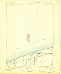
 1897 Olcott1897 Print · USGSNiagara County's lakefront and agricultural interior are captured here in the late 1890s as the rail era reached its peak. Genealogists can trace family lands near Newfane or locate early infrastructure like the Olcott L.H. and the Rome Watertown and Ogdensburg R.R. line.6 unique versions available
 - 1897 Map of Medina
 1897 Medina1897 Print · USGSWestern New York at the close of the nineteenth century reveals a landscape defined by the Erie Canal and the Tonawanda Indian Reservation. Researchers can trace the early rail-and-water economy through settlements like Medina, Akron, and the vanished stops of Smithville Sta.7 unique versions available
 - 1897 Map of Lockport
 1897 Lockport1897 Print · USGSNiagara County was a powerhouse of canal and rail commerce during the 1890s, centered on the engineering marvels at Lockport. Genealogists and historians can trace the early foundations of Clarence Center, locate Swifts Mills, or follow the original path of the Erie Canal past Raynales Basin.
 - 1897 Map of Ridgeway
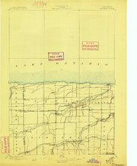 1897 Ridgeway1897 Print · USGSOrleans and Niagara Counties are captured here in the late 1890s, where the bustling ERIE CANAL and the Rome Watertown and Ogdensburg R. R. define the local economy. Genealogists and historians can trace family-named sites along the Ridge Road and locate long-standing hamlets like Lyndonville and Kuckville.5 unique versions available
 - 1899 Map of Niagara
 1899 Niagara1899 Print · USGSThe Niagara Frontier is mapped here in the late nineteenth century as a bustling corridor of trade and transport. Researchers can trace the path of the Erie Canal through Lockport or locate early rural settlements like Ransomville and the Tuscarora Indian Reservation.6 unique versions available
End of results
Showing maps 1-9 of 9
Top cities of Niagara County
- Niagara Falls historical maps
- North Tonawanda historical maps
- Lockport historical maps
- Lockport historical maps
- Wheatfield historical maps
- Lewiston historical maps
See more
Frequently asked questions
- What are the different types of historical maps available for Niagara County?
- What is the oldest map of Niagara County?
- Where can I purchase historical maps of Niagara County for my home or office?
- Where can I download high-res historical maps of Niagara County?
- Are there historical topographic maps available for Niagara County?
- Is there historical aerial imagery available for Niagara County?
- Where are historical maps of Niagara County sourced from?