Old Maps of North Carolina
Explore 2,300 old maps of North Carolina, spanning from 1886 to today. These high-resolution historic maps reveal how streets, neighborhoods, landmarks, and natural features evolved over time — perfect for genealogy, metal detecting, research, and local history exploration.
What you can do with these maps:
- See how North Carolina changed over time: Compare historical maps to modern-day views to trace roads, homesites, rail lines & more.
- View detailed metadata: Each map includes creators, publishers, year, scale, and archive source.
- Overlay maps with satellite & LiDAR: Visualize the past alongside modern tools to explore terrain & human change.
- Trusted historical sources: Maps sourced from the USGS, Library of Congress, and other archives.
- Access maps your way: View online, download high-res files, or order prints for personal or research use.
Start exploring old maps of North Carolina to uncover forgotten places, hidden landmarks, and the deep history beneath your feet.
North Carolina maps
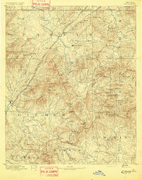
(2,300)- 1886 Map of Knoxville
 1886 Knoxville1886 Print · USGSCovers North Carolina, including Knoxville, Maryville, and other nearby areas
 - 1886 Map of Dahlonega
 1886 Dahlonega1886 Print · USGSCovers North Carolina, including Dahlonega, Cornelia, and other nearby areas
 - 1886 Map of Walhalla
 1886 Walhalla1886 Print · USGSCovers North Carolina, including Toccoa, Walhalla, and other nearby areas
 - 1888 Map of Ellijay
 1888 Ellijay1888 Print · USGSCovers North Carolina, including Dahlonega, Ellijay, and other nearby areas
 - 1889 Map of Hillsville
 1889 Hillsville1889 Print · USGSCovers North Carolina, including Mount Airy, Galax, and other nearby areas
 - 1889 Map of Wytheville
 1889 Wytheville1889 Print · USGSCovers North Carolina, including Wytheville, Marion, and other nearby areas2 unique versions available
 - 1889 Map of Wilkesboro, 1960 Print
 1889 Wilkesboro1960 Print · USGSCovers North Carolina, including North Wilkesboro, Wilkesboro, and other nearby areas
 - 1891 Map of Cowee
 1891 Cowee1891 Print · USGSCovers North Carolina, including Waynesville, Cullowhee, and other nearby areas
 - 1891 Map of Roan Mountain
 1891 Roan Mountain1891 Print · USGSCovers North Carolina, including Johnson City, Kingsport, and other nearby areas
 - 1891 Map of Abingdon
 1891 Abingdon1891 Print · USGSCovers North Carolina, including Abingdon, Marion, and other nearby areas
 - 1891 Map of Wilkesboro, 1940 Print
 1891 Wilkesboro1940 Print · USGSCovers North Carolina, including North Wilkesboro, Wilkesboro, and other nearby areas
 - 1891 Map of Yadkinville, 1964 Print
 1891 Yadkinville1964 Print · USGSCovers North Carolina, including Mount Airy, Yadkinville, and other nearby areas
 - 1892 Map of Dahlonega
 1892 Dahlonega1892 Print · USGSCovers North Carolina, including Dahlonega, Cornelia, and other nearby areas2 unique versions available
 - 1892 Map of Walhalla
 1892 Walhalla1892 Print · USGSCovers North Carolina, including Toccoa, Walhalla, and other nearby areas8 unique versions available
 - 1892 Map of Ellijay
 1892 Ellijay1892 Print · USGSCovers North Carolina, including Dahlonega, Ellijay, and other nearby areas2 unique versions available
 - 1892 Map of Greeneville
 1892 Greeneville1892 Print · USGSCovers North Carolina, including Johnson City, Kingsport, and other nearby areas
 - 1892 Map of Hillsville
 1892 Hillsville1892 Print · USGSCovers North Carolina, including Mount Airy, Galax, and other nearby areas
 - 1892 Map of Knoxville
 1892 Knoxville1892 Print · USGSCovers North Carolina, including Knoxville, Maryville, and other nearby areas
 - 1892 Map of Wytheville, 1897 Print
 1892 Wytheville1897 Print · USGSCovers North Carolina, including Wytheville, Marion, and other nearby areas6 unique versions available
 - 1893 Map of Cranberry
 1893 Cranberry1893 Print · USGSCovers North Carolina, including Boone, Mountain City, and other nearby areas
 - 1893 Map of Virginia Beach
 1893 Virginia Beach1893 Print · USGSCovers North Carolina, including Virginia Beach, Carova, and other nearby areas
 - 1893 Map of Mt Guyot
 1893 Mt Guyot1893 Print · USGSCovers North Carolina, including Sevierville, Waynesville, and other nearby areas3 unique versions available
 - 1893 Map of Murphy
 1893 Murphy1893 Print · USGSCovers North Carolina, including Madisonville, Englewood, and other nearby areas5 unique versions available
 - 1893 Map of Statesville, 1934 Print
 1893 Statesville1934 Print · USGSCovers North Carolina, including Kannapolis, Mooresville, and other nearby areas2 unique versions available
 - 1893 Map of Yadkinville, 1944 Print
 1893 Yadkinville1944 Print · USGSCovers North Carolina, including Mount Airy, Yadkinville, and other nearby areas
Showing maps 1-25 of 2,300
Top cities of North Carolina
- Charlotte historical maps
- Raleigh historical maps
- Greensboro historical maps
- Durham historical maps
- Winston-Salem historical maps
- Fayetteville historical maps
See more
Top counties of North Carolina
- Mecklenburg County historical maps
- Wake County historical maps
- Guilford County historical maps
- Forsyth County historical maps
- Cumberland County historical maps
- Durham County historical maps
See more
Frequently asked questions
- What are the different types of historical maps available for North Carolina?
- What is the oldest map of North Carolina?
- Where can I purchase historical maps of North Carolina for my home or office?
- Where can I download high-res historical maps of North Carolina?
- Are there historical topographic maps available for North Carolina?
- Is there historical aerial imagery available for North Carolina?
- Where are historical maps of North Carolina sourced from?