1970s Maps of North Carolina
Explore 396 historic maps of North Carolina from the 1970s. These maps offer a rare glimpse into what life looked like during the 1970s — showing old roads, neighborhoods, homes, and landmarks that have changed or disappeared over time.
Whether you're researching your family's past, planning a metal detecting trip, or studying how North Carolina's landscape evolved across the 1970s, these high-resolution maps are a powerful tool for exploring the history of this region.
- Focus on a specific era: All maps on this page are from the 1970s, giving you a focused view of this time period.
- See what’s changed: Compare century-old streets, trails, and buildings to today's modern landscape using overlays and satellite layers.
- Research with precision: Use these maps for genealogy, historical research, land use analysis, or educational projects.
- View, download, or print: Maps are fully viewable online in high resolution, and can be downloaded or printed for your own records.
Start exploring North Carolina's history through authentic maps from the 1970s. This is your window into the past.
North Carolina maps
(396)- 1970 Map of Kure Beach, 1972 Print
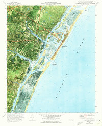
 1970 Kure Beach1972 Print · USGSThe Lower Cape Fear region in the early seventies shows a landscape defined by military logistics and coastal history. Researchers can trace the layout of the Military Ocean Terminal Sunny Point or locate the Fort Fisher State Historic Site and The Rocks along the river.2 unique versions available
 - 1970 Map of Enochville, 1972 Print
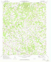
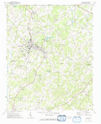
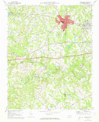
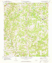
 1970 Enochville1972 Print · USGSRowan and Cabarrus counties in the early seventies reveal a landscape of rural congregations and emerging utility networks. Researchers can trace family history through numerous landmarks like St Pauls Ch, McKnight Sch, and the community at Enochville.
 - 1970 Map of Hiddenite, 1972 Print
 1970 Hiddenite1972 Print · USGSAlexander County’s rolling hills and river valleys are captured here in the early 1970s, centered on the community of Hiddenite. Researchers can locate numerous rural landmarks including Linneys Grove Ch, the Quarry at Rocky Face, and the Zion Chapel Cem.
 - 1970 Map of Mount Holly, 1972 Print
 1970 Mount Holly1972 Print · USGSGaston County’s textile and rail corridor thrives in the early seventies, centered on the Catawba River and the bustling hub of Mount Holly. Genealogists can trace family landmarks like Hillcrest Cem and Belmont Abbey College or follow the path of the Seaboard Coast Line.
 - 1970 Map of Banoak, 1972 Print
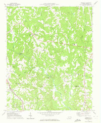
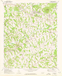
 1970 Banoak1972 Print · USGSCatawba and Lincoln counties are shown here in the early seventies, a landscape of rolling Piedmont ridges and family farms. Researchers can trace local heritage through dozens of country landmarks like Cat Square, Hulls Crossroads, and the North Brook Sch No 3.
 - 1970 Map of Lake Norman South, 1972 Print
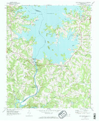 1970 Lake Norman South1972 Print · USGSMecklenburg County enters the seventies as a newly created lakeside community following the damming of the Catawba River. Genealogists and historians can trace the local landscape through landmarks like Triangle Sch, the Seaboard Coast Line rail, and Allison Ferry.2 unique versions available
 - 1970 Map of Lincolnton East, 1972 Print
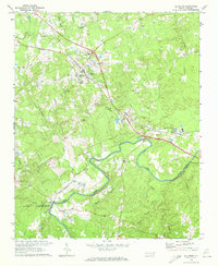
 1970 Lincolnton East1972 Print · USGSEastern Lincoln County at the start of the 1970s shows a landscape of textile towns and busy rail corridors. Researchers can trace family roots through City Memorial Gardens, locate old neighborhood schools like Asbury Sch, or map the industrial reach of the SOUTHERN railroad.2 unique versions available
 - 1970 Map of China Grove, 1972 Print
 1970 China Grove1972 Print · USGSRowan and Cabarrus counties are captured here during a period of significant growth along the Southern railway corridor. Genealogists and local historians can trace the evolution of China Grove and Landis, or locate landmarks like Bostian Sch and Millers Chapel.2 unique versions available
 - 1970 Map of Cornelius, 1972 Print
 1970 Cornelius1972 Print · USGSMecklenburg County enters a new era in the early seventies as Lake Norman emerges alongside established rail towns. Local historians can trace old community hubs like Smithville and Caldwell or locate family sites at Mt Zion Ch Cem and Ramah Ch.2 unique versions available
 - 1970 Map of Cape Fear, 1972 Print
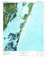
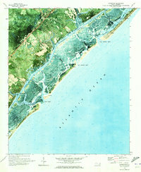
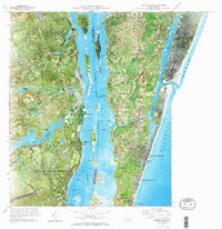
 1970 Cape Fear1972 Print · USGSThe North Carolina coast at the dawn of the seventies is preserved in this orthophotomap of the Cape Fear point. Maritime historians and researchers can study the intricate Tidal Flat systems, the historic Bald Head Lighthouse, and the reaching Frying Pan Shoals.
 - 1970 Map of Goldston, 1972 Print
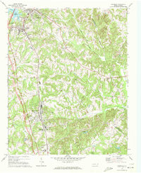
 1970 Goldston1972 Print · USGSChatham and Moore counties meet along the Deep River in the early seventies, where rail lines and river bends shaped local life. Genealogists can trace family footprints at Walters Sch, Mt Herman Ch, and the rural community of Goldston.3 unique versions available
 - 1970 Map of Maiden, 1972 Print
 1970 Maiden1972 Print · USGSMaiden and its surrounding Catawba County countryside appear in the early seventies as a thriving rail-centered community. Genealogists and local historians can trace family roots through numerous landmarks like Ivey Memorial Ch, Pumpkin Center, and the Providence Mill.2 unique versions available
 - 1970 Map of Lowesville, 1972 Print
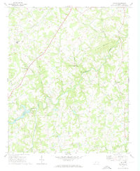
 1970 Lowesville1972 Print · USGSThe rural landscape of Lincoln and Gaston Counties is captured here in the early seventies, just as modern infrastructure began to weave through established farming communities. Genealogists can trace family landmarks like Tuckers Grove Ch Cem, Keever Cem, and the old rail stop at Alexis.
 - 1970 Map of Cleveland, 1972 Print
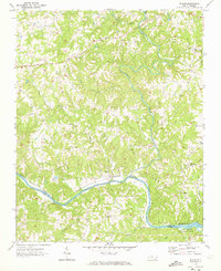
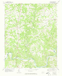
 1970 Cleveland1972 Print · USGSRowan County in the early seventies centers on the rail-side community of Cleveland and the rural crossroads of Mount Ulla. Genealogists and historians can trace the foundations of the community through Thyatira Ch, Mill Bridge, and Knox Chapel.2 unique versions available
 - 1970 Map of Lake Norman North, 1972 Print
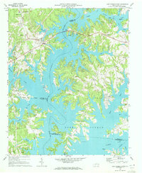 1970 Lake Norman North1972 Print · USGSThe northern reaches of Lake Norman are shown just years after the reservoir's creation, where you can trace the flooded Catawba River valley. Genealogists will find Webbs Chapel, Motto Grove Church, and the Brawley School.3 unique versions available
 - 1970 Map of Hampstead, 1972 Print
 1970 Hampstead1972 Print · USGSCoastal Pender County at the start of the 1970s reveals a landscape of quiet sounds and growing shoreline communities. Genealogists and local historians can trace the foundations of Hampstead or locate family markers near Topsail Beach and Mallory.2 unique versions available
 - 1970 Map of Gastonia North, 1972 Print
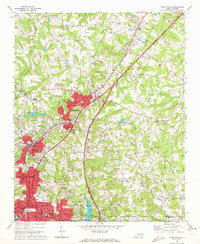
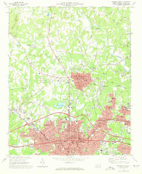 1970 Gastonia North1972 Print · USGSGaston County enters a period of significant suburban growth in the early seventies, centered on the expansion of Gastonia and Dallas. Researchers can trace local genealogy at Hollywood Cem or locate vanished landmarks like the Ashley High Sch and the original Gaston Memorial Hospital.
 - 1970 Map of Wrightsville Beach, 1972 Print
 1970 Wrightsville Beach1972 Print · USGSCoastal New Hanover County comes into focus in the early seventies, showing the development of beach communities and mainland neighborhoods. Researchers can locate the University of North Carolina at Wilmington and trace waterways like Banks Channel and the Intracoastal Waterway.
 - 1970 Map of Gibsonville, 1973 Print
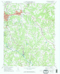
 1970 Gibsonville1973 Print · USGSThe Guilford and Alamance county line meets at the height of the Vietnam era, capturing the development of Gibsonville and Elon College. Researchers can trace rural community roots through numerous landmarks like Brick Ch, St Marks Ch, and Whitsett.2 unique versions available
 - 1970 Map of Kimesville, 1973 Print
 1970 Kimesville1973 Print · USGSThe rural tri-county border area of Guilford, Alamance, and Randolph was a landscape of small churches and local airfields in the early 1970s. Researchers can trace family sites like Greene Sch and the Hornaday Pleasant Union Ch Cem or locate Causey Airfield.2 unique versions available
 - 1970 Map of Carolina Beach, 1973 Print
 1970 Carolina Beach1973 Print · USGSThe Cape Fear River and the Atlantic coast meet in this 1970s orthophoto, showing the region during a period of significant military and coastal development. Genealogists and historians can trace family-named sites like Freeman Cem or explore the grounds of Orton Plantation and Snows Cut.2 unique versions available
 - 1970 Map of Pleasant Garden, 1973 Print
 1970 Pleasant Garden1973 Print · USGSThe Piedmont countryside of Guilford and Randolph Counties is captured here in the early seventies as rural life and new growth intersected. Local historians can trace old homesteads near Burnetts Chapel, the railroad tracks through Pleasant Garden, and the winding Deep River.2 unique versions available
 - 1970 Map of Siloam, 1973 Print
 1970 Siloam1973 Print · USGSSurry County and Yadkin County are shown here in the early seventies, centered on the river-bend communities and the busy rail corridor. Researchers can trace rural lineages through the many cemeteries and country churches like Pine Hill Ch and Stanford Ch near the banks of the Ararat River.
 - 1970 Map of Copeland, 1973 Print
 1970 Copeland1973 Print · USGSSurry County and the northern banks of the Yadkin River are captured here during the early 1970s. Local researchers can trace the rail-and-river geography of settlements like Rockford and Crutchfield or locate country landmarks such as Bear Creek Ch and Level Cross.2 unique versions available
 - 1970 Map of Watson, 1973 Print
 1970 Watson1973 Print · USGSUnion County, North Carolina, is depicted here in the early seventies as a landscape of small farming communities and winding creeks. Genealogists and local historians can trace family roots through numerous sites like Shiloh Ch, Fairfield, and the Williams Cem.2 unique versions available
Showing maps 1-25 of 396
Top cities of North Carolina
- Charlotte historical maps
- Raleigh historical maps
- Greensboro historical maps
- Durham historical maps
- Winston-Salem historical maps
- Fayetteville historical maps
See more
Top counties of North Carolina
- Mecklenburg County historical maps
- Wake County historical maps
- Guilford County historical maps
- Forsyth County historical maps
- Cumberland County historical maps
- Durham County historical maps
See more
Frequently asked questions
- What are the different types of historical maps available for North Carolina?
- What is the oldest map of North Carolina?
- Where can I purchase historical maps of North Carolina for my home or office?
- Where can I download high-res historical maps of North Carolina?
- Are there historical topographic maps available for North Carolina?
- Is there historical aerial imagery available for North Carolina?
- Where are historical maps of North Carolina sourced from?