1980s Maps of North Carolina
Explore 287 historic maps of North Carolina from the 1980s. These maps offer a rare glimpse into what life looked like during the 1980s — showing old roads, neighborhoods, homes, and landmarks that have changed or disappeared over time.
Whether you're researching your family's past, planning a metal detecting trip, or studying how North Carolina's landscape evolved across the 1980s, these high-resolution maps are a powerful tool for exploring the history of this region.
- Focus on a specific era: All maps on this page are from the 1980s, giving you a focused view of this time period.
- See what’s changed: Compare century-old streets, trails, and buildings to today's modern landscape using overlays and satellite layers.
- Research with precision: Use these maps for genealogy, historical research, land use analysis, or educational projects.
- View, download, or print: Maps are fully viewable online in high resolution, and can be downloaded or printed for your own records.
Start exploring North Carolina's history through authentic maps from the 1980s. This is your window into the past.
North Carolina maps
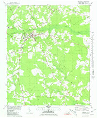
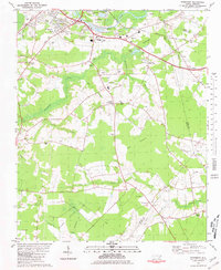
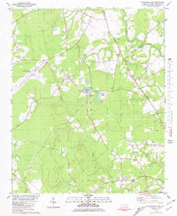
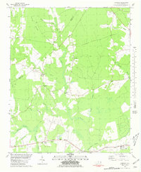
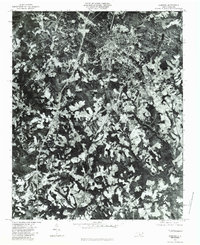
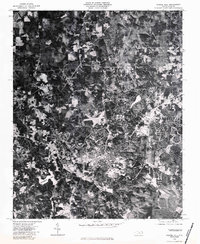
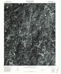
(287)- 1980 Map of Seven Springs
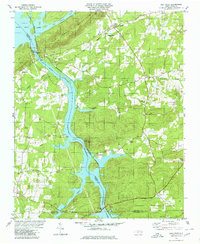
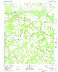 1980 Seven Springs1980 Print · USGSCoastal plain life in eastern North Carolina comes into focus during the late seventies, centered on the oxbows of the Neuse River. Genealogists and historians can trace community roots at Outlaws Bridge, Husseys Crossroads, and the grounds of New Jerusalem Ch.
 - 1980 Map of Summerlins Crossroads
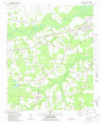
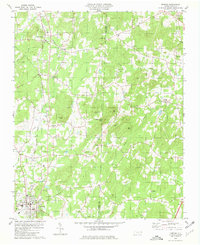
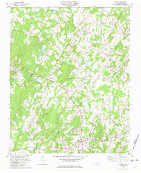
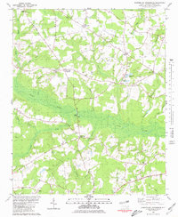 1980 Summerlins Crossroads1980 Print · USGSDuplin County rural life is preserved here in the era just before the 1980s, centered on the wetlands of Goshen Swamp. Genealogists can trace family landmarks at Summerlins Crossroads, Scotts Store, and the Alum Springs Cem.
 - 1980 Map of Richlands
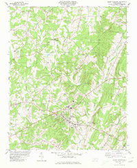
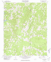
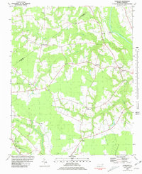
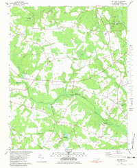
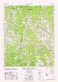 1980 Richlands1980 Print · USGSRichlands and the rural borders of Onslow, Duplin, and Jones counties are captured here at a time of deep-rooted community life. Researchers can trace family history through sites like Potters Hill Sch, Sandhill Baptist Church, and the settlement at Gregory Crossroads.
 - 1980 Map of Handy
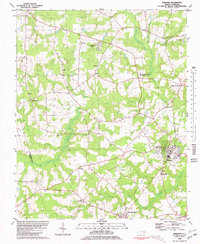
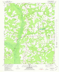
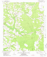
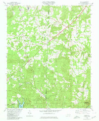 1980 Handy1980 Print · USGSThe rural borderlands of Davidson and Randolph counties come into focus during the late 1970s, as small settlements and the Uwharrie National Forest define the landscape. Researchers can trace family roots through numerous sites like Siloam Ch, Handy, and the waters of Badin Lake.
 - 1980 Map of High Rock
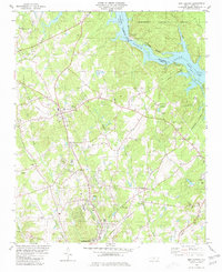
 1980 High Rock1980 Print · USGSThe Yadkin River corridor in the early eighties serves as a hub for small rural communities and sprawling reservoirs. Researchers can locate family landmarks like Newsom Cem, the Antioch Ch, and the riverside settlement of Poletown.2 unique versions available
 - 1980 Map of Mount Pleasant
 1980 Mount Pleasant1980 Print · USGSThe Piedmont landscape of Cabarrus County is captured here in the late seventies as the town of Mount Pleasant grew. Local historians can trace old community landmarks like Watts Crossroads, Victory Temple, and the Quarries along Buffalo Creek.
 - 1980 Map of New London
 1980 New London1980 Print · USGSStanly County life in the late seventies centers on the industrial and rail corridors between New London and the Yadkin River. Researchers can trace old family sites and rural landmarks like Parker Memorial Ch, Halls Ferry Jct, and the Claypits near Isenhour.2 unique versions available
 - 1980 Map of Johnson City, 1981 Print
 1980 Johnson City1981 Print · USGSEast Tennessee in the early eighties shows a landscape of mountain ridges and growing valley towns. Trace local history through Washington College and the Andrew Johnson National Cemetery, or find sites like David Crockett Birthplace State Park.
 - 1980 Map of Pink Hill, 1981 Print
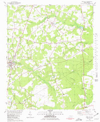 1980 Pink Hill1981 Print · USGSThe rural crossroads of Duplin and Lenoir counties are captured in the early eighties as agricultural traditions met modern aviation. Researchers can trace family history through sites like Lawsons Mill, Whaleys Chapel, and the community at Jonestown.
 - 1980 Map of Kenansville, 1981 Print
 1980 Kenansville1981 Print · USGSKenansville and its surrounding agricultural reaches are captured here in the early eighties, centered on the county seat. Genealogists can trace family names and local landmarks through sites like James Sprunt Institute, Big Zion Ch, and the outlying settlement at Theodore.
 - 1980 Map of Deep Run, 1981 Print
 1980 Deep Run1981 Print · USGSCoastal plain farming and river life define Lenoir County in the early eighties. Genealogists and local historians can trace family-named sites like Albrittons and Bucklesberry, or locate historic gathering places like Tulls Mill and Webbs Chapel.
 - 1980 Map of Triple Springs, 1981 Print
 1980 Triple Springs1981 Print · USGSNorth Carolina’s Piedmont borderlands are shown here in the late seventies, just after the creation of the reservoir. Researchers can trace rural life through the locations of Denny Store, the Olive Branch Ch, and the waters of Mayo Reservoir.
 - 1980 Map of Pinetops, 1981 Print
 1980 Pinetops1981 Print · USGSEdgecombe County was a landscape of established rail towns and rural church communities in the late 1970s. Trace family roots and local history through landmarks like Temperance Hall, the streets of Pinetops, and centers of worship such as Morning Star Ch.
 - 1980 Map of Rivermont, 1981 Print
 1980 Rivermont1981 Print · USGSSoutheast of Kinston in the late 1970s, the rural reaches of Lenoir County remain defined by the winding Neuse River and the deep wetlands of the Pocosin. Researchers can trace family-named sites like Parrott Fork and Loftins Crossroads or locate Patterson Chapel and Southview Cem.
 - 1980 Map of Denton, 1981 Print
 1980 Denton1981 Print · USGSDenton and the rural communities of southern Davidson County appear here in the early 1980s as the regional rail network and small-town commerce remained central to local life. Researchers can trace family sites near Silver Valley, Cid, and New Jerusalem Ch.
 - 1980 Map of Falkland, 1981 Print
 1980 Falkland1981 Print · USGSPitt County's rural landscape is captured here in the late seventies, centered on the river-bend settlement of Falkland. Researchers can trace old family sites and community centers like Sharp Point, Dupree Landing, and Kings Crossroads.2 unique versions available
 - 1980 Map of Albertson, 1981 Print
 1980 Albertson1981 Print · USGSCoastal plain wetlands and rural settlements define the Duplin County landscape in the early eighties. Genealogists and local historians can trace family roots through numerous small communities like Albertson and Kornegay, alongside several community landmarks such as Grady High Sch and Piney Grove Ch.
 - 1980 Map of Catherine Lake, 1981 Print
 1980 Catherine Lake1981 Print · USGSCoastal North Carolina's rural landscape comes into focus in the early 1980s as the area around Catherine Lake balances traditional community life with modern transit. Researchers can trace several generations of local history through sites like Union Chapel Ch, St Mary Ch, and the sprawling Albert J Ellis Airport.
 - 1980 Map of Locust, 1981 Print
 1980 Locust1981 Print · USGSThe border of Stanly and Cabarrus counties is captured here in the late seventies, centered on the growing communities of Locust and Stanfield. Genealogists and historians can trace numerous rural landmarks, from the Reed Gold Mine to old gathering places like Barriers Mill and Meadow Creek Ch.2 unique versions available
 - 1980 Map of Williams, 1981 Print
 1980 Williams1981 Print · USGSCoastal plain settlements and river bottomlands define this Wayne and Duplin County border region during the early eighties. Genealogists can trace family-named sites like Whitfields Pond or visit historic gathering places such as Indian Springs, Best Chapel, and Spring Creek Sch.2 unique versions available
 - 1980 Map of Potters Hill, 1981 Print
 1980 Potters Hill1981 Print · USGSThe coastal plain of North Carolina comes alive in the late seventies, showing the rural communities of Duplin and Jones counties. Genealogists can trace family names through landmarks like Quinns Store, Baysden Chapel, and the settlement at Potters Hill.
 - 1980 Map of Comfort, 1981 Print
 1980 Comfort1981 Print · USGSJones and Lenoir County rural life in the late seventies centers on the meandering Trent River and its surrounding wetlands. Genealogists and local historians can trace family-named sites and historic congregations like Quaker House Ch, Taylors Corner, and Pleasant Hill.
 - 1980 Map of Sanford, 1983 Print
 1980 Sanford1983 Print · USGSSanford and the surrounding Lee County countryside are revealed in detailed aerial photography from the early 1980s. Trace the rural-to-urban transition between Sanford and smaller settlements like Tramway, Lemon Springs, and Cool Springs.
 - 1980 Map of Chapel Hill, 1983 Print
 1980 Chapel Hill1983 Print · USGSChapel Hill at the start of the 1980s is captured in high-resolution aerial imagery, showing the town's expansion into the surrounding Orange County woodlands. Trace the development of the university community near University Lake and the rural reaches of Eubanks.
 - 1980 Map of Asheboro, 1983 Print
 1980 Asheboro1983 Print · USGSAsheboro and its surrounding Piedmont landscape are captured in high-resolution detail at the dawn of the 1980s. Trace the literal layout of Asheboro and Ulah, or find family landmarks near Farlows Lake and Back Creek Mountain.
Showing maps 1-25 of 287
Top cities of North Carolina
- Charlotte historical maps
- Raleigh historical maps
- Greensboro historical maps
- Durham historical maps
- Winston-Salem historical maps
- Fayetteville historical maps
See more
Top counties of North Carolina
- Mecklenburg County historical maps
- Wake County historical maps
- Guilford County historical maps
- Forsyth County historical maps
- Cumberland County historical maps
- Durham County historical maps
See more
Frequently asked questions
- What are the different types of historical maps available for North Carolina?
- What is the oldest map of North Carolina?
- Where can I purchase historical maps of North Carolina for my home or office?
- Where can I download high-res historical maps of North Carolina?
- Are there historical topographic maps available for North Carolina?
- Is there historical aerial imagery available for North Carolina?
- Where are historical maps of North Carolina sourced from?