1930s Maps of North Carolina
Explore 169 historic maps of North Carolina from the 1930s. These maps offer a rare glimpse into what life looked like during the 1930s — showing old roads, neighborhoods, homes, and landmarks that have changed or disappeared over time.
Whether you're researching your family's past, planning a metal detecting trip, or studying how North Carolina's landscape evolved across the 1930s, these high-resolution maps are a powerful tool for exploring the history of this region.
- Focus on a specific era: All maps on this page are from the 1930s, giving you a focused view of this time period.
- See what’s changed: Compare century-old streets, trails, and buildings to today's modern landscape using overlays and satellite layers.
- Research with precision: Use these maps for genealogy, historical research, land use analysis, or educational projects.
- View, download, or print: Maps are fully viewable online in high resolution, and can be downloaded or printed for your own records.
Start exploring North Carolina's history through authentic maps from the 1930s. This is your window into the past.
North Carolina maps
(169)- 1930 Map of Independence
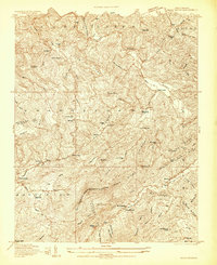
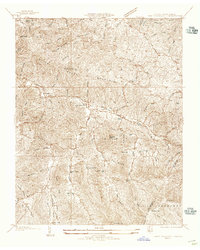
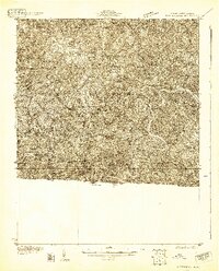 1930 Independence1930 Print · USGSGrayson County and the North Carolina borderlands are captured here during the 1930s, showing a landscape of high ridges and deep river bends. Genealogists can trace family names through landmarks like Moyers Store, Bennington Mill, and numerous river crossings like Moore Ferry.
 - 1931 Map of Stuart
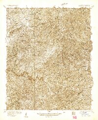
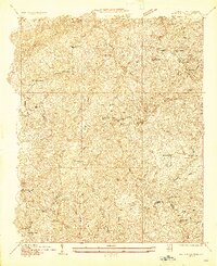
 1931 Stuart1931 Print · USGSThe Blue Ridge plateau meets the Piedmont in the late 1920s, showing a landscape of mountain farming and river-driven milling. Genealogists can trace family roots through numerous local landmarks like Meadows of Dan, Stonewall Jackson Sch, and Three Forks Mill.3 unique versions available
 - 1931 Map of Galax
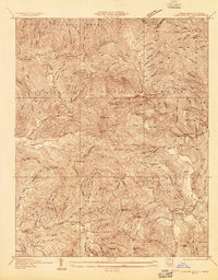
 1931 Galax1931 Print · USGSThe Blue Ridge foothills of Virginia and North Carolina come into focus during the early 1930s as the rail-and-river economy develops. Genealogists and researchers can trace family landmarks like Bishop Cem, McKnights Mill, and the early river crossings at Blair Ferry.
 - 1933 Map of Haw Knob
 1933 Haw Knob1933 Print · USGSThe Tennessee-North Carolina borderlands come alive in this early 1930s survey, showing the deep creek valleys and high peaks of the southern mountains. Researchers can find old community hubs like Tallassee Sch, Ballplay Ch, and the remote Hemlock Lookout.2 unique versions available
 - 1933 Map of Whiteoak Flats
 1933 Whiteoak Flats1933 Print · USGSThe Tennessee and North Carolina borderlands come into focus in the early 1930s, showing the high ridges and creek valleys before modern development. Genealogists and hikers can trace old routes near Pleasant Grove Church, Jeffrey, and the summits of the Unicoi Mountains.
 - 1933 Map of Independence
 1933 Independence1933 Print · USGSGrayson County in the early thirties is captured here as a landscape of river crossings and mountain settlements. Genealogists and local historians can trace family roots through numerous landmarks like Boyer Ferry, Grayson Mill, and Cox Chapel.3 unique versions available
 - 1933 Map of Bryson
 1933 Bryson1933 Print · USGSThe mountain valleys of Swain County are captured in the early 1930s, showing the early settlement patterns of the Great Smoky Mountains. Genealogists and historians can trace community roots through schoolhouses like Lands Creek Sch and Indian Creek Sch.
 - 1933 Map of Galax
 1933 Galax1933 Print · USGSCarroll County and the surrounding Blue Ridge highlands are captured in the early 1930s, showing a landscape defined by river ferries and rail spurs. Genealogists can trace early homesteads and community hubs like Pipers Gap PO, Lambsburg, and the Dixon Ferry crossing on the New River.3 unique versions available
 - 1933 Map of Bald River Falls
 1933 Bald River Falls1933 Print · USGSMonroe County, Tennessee, is shown in the mid-1930s as a high-altitude mountain landscape where early forest management and rural education intersect. Researchers can locate the Waucheesi Lookout Tower and old school sites like Blackankle Sch and Waucheesi Sch among the winding creeks.
 - 1933 Map of Bushnell
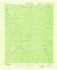
 1933 Bushnell1933 Print · USGSSwain County high country in the late 1920s is defined by a remote landscape of steep ridges and small mountain schools. Researchers can trace the locations of Mill Creek Sch and School No 2 or identify family landmarks like Loudermilk Ridge and Welch Bald.
 - 1934 Map of Valle Crucis
 1934 Valle Crucis1934 Print · USGSThe North Carolina high country is captured here during the mid-1930s, showing a network of mountain settlements and river valleys. Researchers can trace family names at Jestes Cemetery or follow the narrow-gauge ET & WNC RR through Jestes Siding.2 unique versions available
 - 1934 Map of Murphy
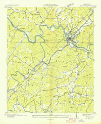 1934 Murphy1934 Print · USGSCherokee County at the height of the mid-thirties TVA era reveals a landscape shaped by river junctions and dual rail lines. Genealogists and local historians can trace rural family life through landmarks like Rogers Chapel, Martin Creek Sch, and the industrial activity at the Talc Mine.
 - 1934 Map of Persimmon Creek
 1934 Persimmon Creek1934 Print · USGSCherokee County, North Carolina, appears here in the mid-1930s as a landscape of mountain ridges and narrow river valleys. Genealogists and historians can locate rural landmarks like Suit Cem, Harris Chapel, and the community of Postell.
 - 1934 Map of Micaville
 1934 Micaville1934 Print · USGSThe forks of the Toe River and the Clinchfield rail line define the Yancey and Mitchell County border in the mid-1930s. Researchers can trace ancestral locations like Double Island School, Hootowl Mine, and the many cemeteries including Rebels Creek Cem.
 - 1934 Map of McDaniel Bald
 1934 McDaniel Bald1934 Print · USGSThe North Carolina and Tennessee borderlands appear here in the mid-1930s, showing a network of high-elevation gaps and remote mountain schools. Genealogists can locate family landmarks like Bryson Cem, Ebenezer, and schools including Owl Creek Sch and Davis Creek Sch.
 - 1934 Map of Spruce Pine
 1934 Spruce Pine1934 Print · USGSMitchell County industrial and mountain life are captured in the mid-1930s as the local mining economy thrived. Genealogists and historians can trace families near Spruce Pine, locate the Prison Camp, and identify remote sites like Wolfden Mine and Hunter Chapel.
 - 1934 Map of Unaka
 1934 Unaka1934 Print · USGSCherokee County at the height of the New Deal era reveals a mountain landscape defined by the winding Hiwassee River and remote forest settlements. Genealogists can locate family landmarks such as Buckberry Sch, Bethel Cem, and the depression-era CCC Camp No F 11.
 - 1934 Map of Parts Of Celo And Black Brothers
 1934 Parts Of Celo And Black Brothers1934 Print · USGSYancey County's high-country settlements and forest boundaries are meticulously detailed in this mid-1930s survey. Researchers can locate community hubs like Harvard Sch and Edges Store or trace the steep terrain of Mt Mitchell.
 - 1934 Map of White Rocks Mtn
 1934 White Rocks Mtn1934 Print · USGSRoan Mountain and the high ridges of the Tennessee-North Carolina border are captured here in the mid-thirties as the local economy followed the rails. Genealogists can locate family sites near the Isaacs Cem and several community schools including Hampton Creek Sch.
 - 1934 Map of Bakersville
 1934 Bakersville1934 Print · USGSBakersville and its surrounding Mitchell County peaks are captured in the mid-1930s, showing a landscape of remote mountain gaps and rail-side settlements. Genealogists can trace early homesteads near Loafers Glory, Toecane, and schools like Bad Creek Sch.2 unique versions available
 - 1934 Map of Iron Mtn Gap
 1934 Iron Mtn Gap1934 Print · USGSThe Tennessee and North Carolina borderlands in the mid-1930s reveal a landscape of isolated mountain communities and early forest conservation. Genealogists can trace family names at Cochran Store and located remote school sites like Tiger Creek Sch or McKinney Sch.
 - 1934 Map of Parts Of Old Fort and Montreat
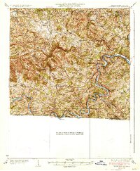
 1934 Parts Of Old Fort and Montreat1934 Print · USGSThe Black Mountains reached a turning point in the mid-1930s as state and national parklands began to formalize. You can trace the early Blue Ridge Parkway, find the remote Loftis Cabin, and locate the Green Knob Fire Tower.
 - 1934 Map of Elk Park
 1934 Elk Park1934 Print · USGSHigh-elevation settlements and mountain rail lines define this Avery County landscape in the mid-1930s. Genealogists can trace family roots at Little Elk Ch or locate historic structures like the Grandfather Orphanage and Elk Park School.
 - 1934 Map of Linville Falls
 1934 Linville Falls1934 Print · USGSAvery County mountain life in the mid-thirties centered on the North Toe River and its rugged ridges. Genealogists can locate family landmarks like Walnut Grove Ch, Brushy Creek Sch, and the Hemphill Mine near the crossing at Heffner Gap.
 - 1934 Map of Carvers Gap
 1934 Carvers Gap1934 Print · USGSThe high peaks of the Blue Ridge meet the industrial activity of Mitchell and Avery counties in the mid-1930s. Genealogists can trace early mountain life through landmarks like Yellow Mountain Church, Glen Ayre, and mineral operations such as the Jackson Mine.
Showing maps 1-25 of 169
Top cities of North Carolina
- Charlotte historical maps
- Raleigh historical maps
- Greensboro historical maps
- Durham historical maps
- Winston-Salem historical maps
- Fayetteville historical maps
See more
Top counties of North Carolina
- Mecklenburg County historical maps
- Wake County historical maps
- Guilford County historical maps
- Forsyth County historical maps
- Cumberland County historical maps
- Durham County historical maps
See more
Frequently asked questions
- What are the different types of historical maps available for North Carolina?
- What is the oldest map of North Carolina?
- Where can I purchase historical maps of North Carolina for my home or office?
- Where can I download high-res historical maps of North Carolina?
- Are there historical topographic maps available for North Carolina?
- Is there historical aerial imagery available for North Carolina?
- Where are historical maps of North Carolina sourced from?