1910s Maps of North Carolina
Explore 17 historic maps of North Carolina from the 1910s. These maps offer a rare glimpse into what life looked like during the 1910s — showing old roads, neighborhoods, homes, and landmarks that have changed or disappeared over time.
Whether you're researching your family's past, planning a metal detecting trip, or studying how North Carolina's landscape evolved across the 1910s, these high-resolution maps are a powerful tool for exploring the history of this region.
- Focus on a specific era: All maps on this page are from the 1910s, giving you a focused view of this time period.
- See what’s changed: Compare century-old streets, trails, and buildings to today's modern landscape using overlays and satellite layers.
- Research with precision: Use these maps for genealogy, historical research, land use analysis, or educational projects.
- View, download, or print: Maps are fully viewable online in high resolution, and can be downloaded or printed for your own records.
Start exploring North Carolina's history through authentic maps from the 1910s. This is your window into the past.
North Carolina maps
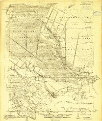
(17)- 1911 Map of Ellijay
 1911 Ellijay1911 Print · USGSNorth Georgia and the Tennessee border are captured here at the turn of the century, showing a mountain landscape of river ferries and early rail. Genealogists can locate family landmarks like Higdons Store, the Pisgah church, or crossings at Bakers Ferry and Shallow Ford.4 unique versions available
 - 1911 Map of Abingdon
 1911 Abingdon1911 Print · USGSSouthwest Virginia's rugged corridors are captured here during the height of the mountain rail era. Genealogists and historians can trace old homesteads and local landmarks such as Whites Mill, Valley Church, and the County Farm near Abingdon.5 unique versions available
 - 1911 Map of Lincolnton, 1944 Print
 1911 Lincolnton1944 Print · USGSLincoln and Gaston Counties at the peak of the rail era show a landscape of growing textile hubs and rural crossroads. Genealogists can trace family footprints through sites like Double Chimney School, Snapp Cem, and the industry at Beam Mill.
 - 1912 Map of Mt Guyot
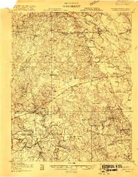
 1912 Mt Guyot1912 Print · USGSThe Tennessee and North Carolina borderlands come into focus in the early twentieth century, prior to the creation of the Great Smoky Mountains National Park. Trace ancestral locations like Cataloochee and Smokemont or follow the Southern RR to Newport.5 unique versions available
 - 1914 Map of Belhaven
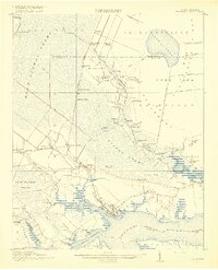
 1914 Belhaven1914 Print · USGSIn the decade before the Great War, the North Carolina coast was a landscape of timber trams and swamp landings. Researchers can trace the John L. Roper Lumber Co. Tram and locate family landmarks like Morrisons Store and Lower Pungo School.
 - 1914 Map of Murphy
 1914 Murphy1914 Print · USGSThe Tennessee-North Carolina borderlands come to life in this early twentieth-century survey, showcasing a landscape of mountain ridges and river-driven commerce. Researchers can trace the Louisville and Nashville Railroad to old stops like Apalachia Sta or locate the historic Prince Ferry and White Cliff Springs.3 unique versions available
 - 1914 Map of Kinston
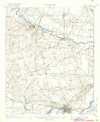
 1914 Kinston1914 Print · USGSBefore the onset of the First World War, the rural landscape of eastern North Carolina was a dense network of railroad sidings, country schools, and pocosin wetlands. Genealogists can trace family landmarks and forgotten settlements like Hookerton, Suggs Siding, and Saints Delight Church.3 unique versions available
 - 1914 Map of Gastonia
 1914 Gastonia1914 Print · USGSGaston and Lincoln counties are captured here just before the First World War, when the textile industry and rail lines shaped every community. Researchers can locate long-standing landmarks like Loray Mills, Belmont Abby, and the old County House near Dallas.2 unique versions available
 - 1916 Map of Gastonia
 1916 Gastonia1916 Print · USGSGaston and Lincoln counties are captured here just as the textile industry was transforming the Piedmont landscape. Trace the rail-and-river economy through landmarks like the Loray Mill, the Rehoboth Furnace, and the early village of McAdenville.2 unique versions available
 - 1916 Map of Belhaven
 1916 Belhaven1916 Print · USGSCoastal Beaufort County comes to life in the years before World War I, when the Pungo River landings were essential hubs. Genealogists can trace family roots through rural schools like Haslin School and rail stops like Bishops Cross or Pungo P.O.3 unique versions available
 - 1916 Map of Back Bay
 1916 Back Bay1916 Print · USGSThe Virginia-North Carolina coast and the shallow reaches of Back Bay appear here in the early twentieth century. Researchers can trace the line of coastal outposts like the False Cape Life Saving Sta. and the early layout of Knotts Island.
 - 1916 Map of Kinston
 1916 Kinston1916 Print · USGSThe Neuse River and Contentnea Creek basins are shown here during the mid-1910s, capturing the transition of eastern North Carolina's rural landscape. Genealogists can locate family landmarks like Suggs School, Beulah Church, and Mewborns Crossroads.3 unique versions available
 - 1919 Map of Suffolk
 1919 Suffolk1919 Print · USGSCoastal Virginia and the North Carolina borderlands are defined by the convergence of six major railroads at Suffolk during the late teens. Genealogists can trace family landmarks like Pauls Branch Church and the Franklin Grove School along the edge of the Dismal Swamp.3 unique versions available
 - 1919 Map of White Plains
 1919 White Plains1919 Print · USGSSouthern Virginia and the North Carolina borderlands are captured here at the close of the Great War. Genealogists can trace early twentieth-century communities through family-named landmarks like Vincents Store, Hicks Mill, and Holly Springs Church.
 - 1919 Map of Boykins
 1919 Boykins1919 Print · USGSSouthampton County's borderlands are captured here at the end of the Great War, showing a landscape defined by river transport and rail. Genealogists can trace family footprints at Sandy Hill School, Smiths Mill, or Zion Hill Church.
 - 1919 Map of Emporia
 1919 Emporia1919 Print · USGSSouthern Virginia and the North Carolina borderlands are captured here at the height of the railroad era. Researchers can trace family roots through rural landmarks like Hopeville (Post Store), Squire School, and the Hitchcock Quarry.3 unique versions available
 - 1919 Map of Arringdale
 1919 Arringdale1919 Print · USGSSouthampton and Greensville Counties appear at the end of the Great War, showing a landscape defined by the winding Meherrin River. Researchers can trace the legacy of family farms and rural industry through sites like Jordan Crocker Mill, Haleys Bridge, and White Meadow Store.
End of results
Showing maps 1-17 of 17
Top cities of North Carolina
- Charlotte historical maps
- Raleigh historical maps
- Greensboro historical maps
- Durham historical maps
- Winston-Salem historical maps
- Fayetteville historical maps
See more
Top counties of North Carolina
- Mecklenburg County historical maps
- Wake County historical maps
- Guilford County historical maps
- Forsyth County historical maps
- Cumberland County historical maps
- Durham County historical maps
See more
Frequently asked questions
- What are the different types of historical maps available for North Carolina?
- What is the oldest map of North Carolina?
- Where can I purchase historical maps of North Carolina for my home or office?
- Where can I download high-res historical maps of North Carolina?
- Are there historical topographic maps available for North Carolina?
- Is there historical aerial imagery available for North Carolina?
- Where are historical maps of North Carolina sourced from?