1940s Maps of North Carolina
Explore 296 historic maps of North Carolina from the 1940s. These maps offer a rare glimpse into what life looked like during the 1940s — showing old roads, neighborhoods, homes, and landmarks that have changed or disappeared over time.
Whether you're researching your family's past, planning a metal detecting trip, or studying how North Carolina's landscape evolved across the 1940s, these high-resolution maps are a powerful tool for exploring the history of this region.
- Focus on a specific era: All maps on this page are from the 1940s, giving you a focused view of this time period.
- See what’s changed: Compare century-old streets, trails, and buildings to today's modern landscape using overlays and satellite layers.
- Research with precision: Use these maps for genealogy, historical research, land use analysis, or educational projects.
- View, download, or print: Maps are fully viewable online in high resolution, and can be downloaded or printed for your own records.
Start exploring North Carolina's history through authentic maps from the 1940s. This is your window into the past.
North Carolina maps
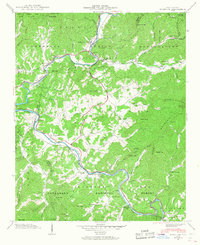
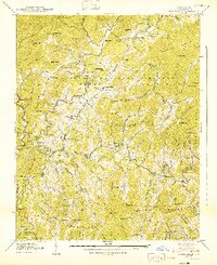
(296)- 1940 Map of Burnsville
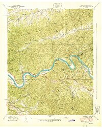
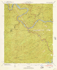
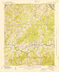 1940 Burnsville1940 Print · USGSYancey County in the late Depression era shows a landscape of tightly knit mountain communities and early state infrastructure. Researchers can locate family landmarks like the Clearmont Cem, the State Prison Camp, and the remote Day Book post office.2 unique versions available
 - 1940 Map of Barco
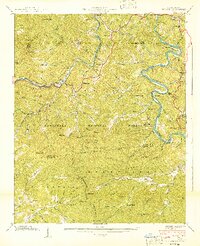
 1940 Barco1940 Print · USGSThe Currituck Banks and mainland North Carolina appear here during the early 1940s, highlighting a landscape of remote maritime villages and essential coastal navigation. Researchers can trace the Inland Waterway past Coinjock or locate early landmarks like the Currituck Beach Lighthouse and Poyner Hill C. G. Sta.2 unique versions available
 - 1940 Map of Wesser
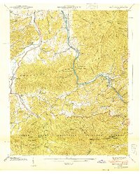
 1940 Wesser1940 Print · USGSThe Nantahala Gorge and the winding Little Tennessee River define this high-country landscape as it appeared in the early 1940s. Genealogists can trace family footprints at Watia Ch, Tabor Cem, and mountain schools like Hightower Sch.2 unique versions available
 - 1940 Map of Hartford
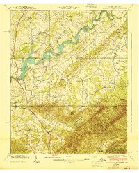
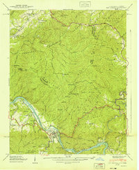
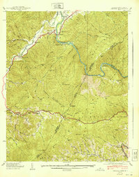
 1940 Hartford1940 Print · USGSThe Pigeon River valley comes to life in this 1940s survey of the Tennessee and North Carolina border. Genealogists can locate family names at Shultz Cem and Mcmillan Cem or trace the original route of the Appalachian Trail.6 unique versions available
 - 1940 Map of Kitty Hawk
 1940 Kitty Hawk1940 Print · USGSThe Outer Banks are captured here in the early 1940s, showing a landscape defined by maritime history and the early years of flight commemoration. Trace the grounds of the Wright Monument and locate small coastal settlements like Eagleton and Sound Landing.2 unique versions available
 - 1940 Map of Paint Rock
 1940 Paint Rock1940 Print · USGSThe French Broad River valley at the Tennessee-North Carolina border is captured here during the 1940s, showing a landscape of mountain gaps and riverside rail settlements. Family historians can locate family plots and early rural schools like Mooneyham Cem, Justis Cem, and the Fugate Sch.4 unique versions available
 - 1940 Map of Robbinsville
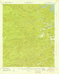
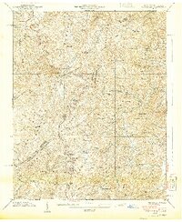
 1940 Robbinsville1940 Print · USGSGraham County is documented here at the start of the 1940s, showing the early development of Robbinsville and the surrounding mountain gaps. Genealogists can locate family landmarks such as Rice Cem, Massey Cem, and the Snowbird Cherokee Indian School.8 unique versions available
 - 1940 Map of Hertford
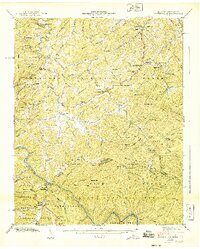
 1940 Hertford1940 Print · USGSThe coastal necks of Perquimans County are caught here in the early 1940s, showing a landscape defined by its deep relationship with the Albemarle Sound. Researchers can trace the waterfront history of Hertford or locate rural sites like the Durants Neck P O and Pleasant Grove Church.2 unique versions available
 - 1940 Map of Powells Point
 1940 Powells Point1940 Print · USGSThe North Carolina coast at the start of the 1940s shows the Currituck peninsula just as the Wright Memorial Bridge opened it to more travel. Trace family roots and old landings in Jarvisburg, Powells Point, and Sawyers Lodge.2 unique versions available
 - 1940 Map of Davy Crockett Lake
 1940 Davy Crockett Lake1940 Print · USGSGreene County, Tennessee, is captured here in the early 1940s just as the Nolichucky River valley was being reshaped by the waters of Lake Davy Crockett. Trace family roots and local history through features like Cove Creek Mill, Price Cem, and the Orphanage.
 - 1940 Map of Sams Gap
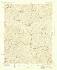 1940 Sams Gap1940 Print · USGSThe high ridges of Madison County were still dominated by small-scale farming and forest life when this survey was completed. Genealogists can trace family footprints across Sams Gap through landmarks like the Robinson Cem, Higgins Chapel, and Halls Store.
 - 1940 Map of Whittier
 1940 Whittier1940 Print · USGSWestern North Carolina's high mountain valleys and Cherokee lands are meticulously documented in the years before mid-century. Genealogists and local historians can trace family locations near Whittier, the Cherokee Indian Sch, and numerous mountain burial sites like Union Hill Cem.2 unique versions available
 - 1940 Map of Hot Springs
 1940 Hot Springs1940 Print · USGSMadison County and the Tennessee borderlands are captured here in the early 1940s, showing the intersection of mountain life and federal work projects. Researchers can trace family history through sites like CCC Camp No F 7, Hurricane Chapel, and the riverfront settlement at Stackhouse.6 unique versions available
 - 1940 Map of Santeetlah Creek
 1940 Santeetlah Creek1940 Print · USGSGraham County's wilderness is shown here in the 1940s, just as the landscape was being defined by federal forests and the waters of Santeetlah Lake. Researchers can locate family landmarks like John Teeseteska or trace the early paths to Mt Nebo Ch and Snowbird Sch.6 unique versions available
 - 1940 Map of Waterville
 1940 Waterville1940 Print · USGSThe Tennessee and North Carolina borderlands come into focus in the 1940s, where three major national forests and parks converge. Genealogists and historians can trace high-country family sites like Ball Cem, Andrews Chapel, and the isolated Waterville Sch.6 unique versions available
 - 1940 Map of White Rock
 1940 White Rock1940 Print · USGSMadison County's mountain communities are captured here just before the mid-century, showing a landscape defined by creekside settlements and family-named landmarks. Researchers can trace the exact locations of Rice Sch, Rice Mill, and numerous family burial grounds like Belva Cem.2 unique versions available
 - 1940 Map of Mouth of Wilson
 1940 Mouth of Wilson1940 Print · USGSGrayson County's high ridges and river valleys were home to a dense network of mountain communities in the 1930s. Genealogists and historians can trace long-gone rural institutions like the COUNTY HOME, Cornell Store, and schools such as Razor Ridge Sch or Bethel Sch.3 unique versions available
 - 1940 Map of Chestoa
 1940 Chestoa1940 Print · USGSThe Tennessee and North Carolina borderlands come alive in the late 1930s, where the river and rail cut through the Unaka range. Researchers can trace the Clinchfield RR corridor through mountain hamlets like Chestoa, Unaka Springs, and the isolated Lost Cove.
 - 1940 Map of Beckford
 1940 Beckford1940 Print · USGSNortheastern North Carolina in the early 1940s was a land of timbered swamps and essential river crossings. Genealogists and historians can trace old homesteads and transport hubs near Cannon Ferry, Merchants Millpond, and the Beckford Junction rail crossing.2 unique versions available
 - 1940 Map of Lemon Gap
 1940 Lemon Gap1940 Print · USGSThe Tennessee and North Carolina borderlands come into focus in the 1940s, showing the high ridges of the Bald Mountains and the Appalachian Trail. Genealogists and hikers can trace old mountain routes like the Jack Trail to family sites including Joe (PO), Ebbs Mill, and Balding Chapel.5 unique versions available
 - 1940 Map of Judson
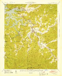
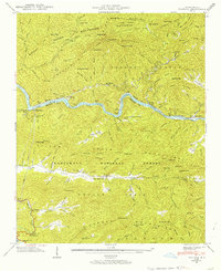
 1940 Judson1940 Print · USGSSwain County's river valleys appear here just before the completion of the Fontana Dam transformed the landscape. Genealogists can locate family landmarks like Woody Cem and Monteith Cem or trace the old Southern Railway through the now-submerged town of Judson.
 - 1940 Map of Fontana, 1956 Print
 1940 Fontana1956 Print · USGSThe Great Smoky Mountains and Nantahala National Forest meet here just before the era of massive dam projects changed the valley forever. Researchers can trace the Appalachian Trail through the ridges or find the Fontana Copper Mine and Rymer Ferry.2 unique versions available
 - 1940 Map of Tapoco, 1956 Print
 1940 Tapoco1956 Print · USGSThe Tennessee and North Carolina borderlands come alive in the 1940s as hydroelectric power and federal forest conservation reshape the mountains. Trace historic family sites and early infrastructure including Orr Cemetery, Beers School, and the Calderwood Dam.5 unique versions available
 - 1940 Map of Bryson, 1957 Print
 1940 Bryson1957 Print · USGSSwain County's river valleys and ridgelines are captured here just as Fontana Lake was reshaping the landscape. Researchers can locate family landmarks like Watkins Cem, the Southern Railway line, and the Cherokee Indian Reservation Qualla Tract.
 - 1940 Map of Greens Creek, 1957 Print
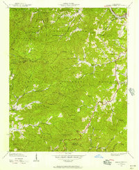 1940 Greens Creek1957 Print · USGSIn the early 1940s, these North Carolina mountain communities were connected by high gaps and winding creek forks. Local historians can trace the foundations of Pumpkintown or locate rural landmarks like Greens Creek Sch and the Lookout Tower on Cowee Bald.6 unique versions available
Showing maps 1-25 of 296
Top cities of North Carolina
- Charlotte historical maps
- Raleigh historical maps
- Greensboro historical maps
- Durham historical maps
- Winston-Salem historical maps
- Fayetteville historical maps
See more
Top counties of North Carolina
- Mecklenburg County historical maps
- Wake County historical maps
- Guilford County historical maps
- Forsyth County historical maps
- Cumberland County historical maps
- Durham County historical maps
See more
Frequently asked questions
- What are the different types of historical maps available for North Carolina?
- What is the oldest map of North Carolina?
- Where can I purchase historical maps of North Carolina for my home or office?
- Where can I download high-res historical maps of North Carolina?
- Are there historical topographic maps available for North Carolina?
- Is there historical aerial imagery available for North Carolina?
- Where are historical maps of North Carolina sourced from?