2020s Maps of Dallas, Texas
Explore 20 historic maps of Dallas from the 2020s. These maps offer a rare glimpse into what life looked like during the 2020s — showing old roads, neighborhoods, homes, and landmarks that have changed or disappeared over time.
Whether you're researching your family's past, planning a metal detecting trip, or studying how Dallas's landscape evolved across the 2020s, these high-resolution maps are a powerful tool for exploring the history of this region.
- Focus on a specific era: All maps on this page are from the 2020s, giving you a focused view of this time period.
- See what’s changed: Compare century-old streets, trails, and buildings to today's modern landscape using overlays and satellite layers.
- Research with precision: Use these maps for genealogy, historical research, land use analysis, or educational projects.
- View, download, or print: Maps are fully viewable online in high resolution, and can be downloaded or printed for your own records.
Start exploring Dallas's history through authentic maps from the 2020s. This is your window into the past.
Dallas, TX maps
(20)- 2022 Map of Lavon, 2022 Print
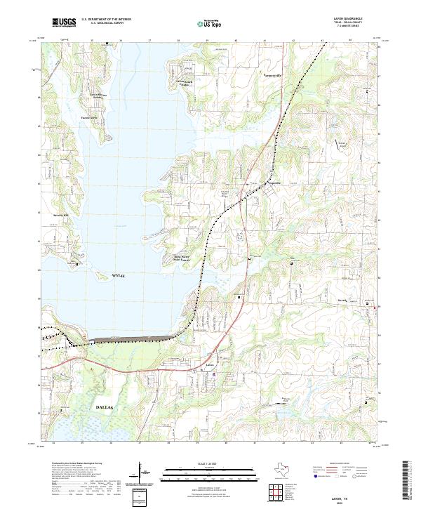 2022 Lavon2022 Print · USGSCollin County's transition from rural farming roots to a lakeside residential hub is visible in this contemporary look at the Lavon area. Genealogists can locate several local burial grounds like Backbone Cem and Nevada Cem near the shores of Lavon Lake.
 - 2022 Map of Lancaster, 2022 Print
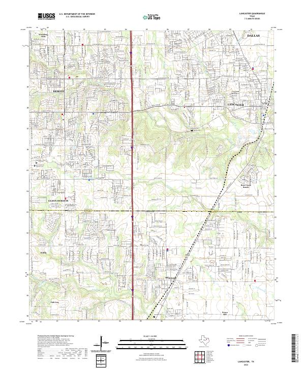 2022 Lancaster2022 Print · USGSThe Dallas-Ellis County line comes alive in this contemporary survey of a rapidly evolving Texas landscape. Researchers can locate family landmarks like the Rawlins Cem, Edgewood Cem, and the sprawling grounds of Bear Creek Ranch.
 - 2022 Map of Ferris, 2022 Print
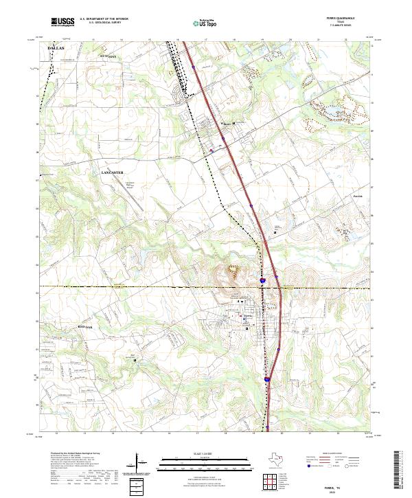 2022 Ferris2022 Print · USGSSpanning the Dallas and Ellis county line in the early 2020s, this area shows the persistent rural-urban mix of North Texas. Researchers can trace family plots at Bluff Springs Cem and Trinity Cem or locate regional landmarks like the Lancaster Regional Airport.
 - 2022 Map of Seagoville, 2022 Print
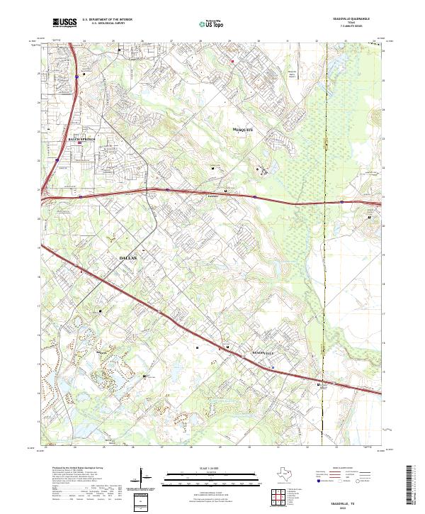 2022 Seagoville2022 Print · USGSSeagoville and the Trinity River floodplain are captured in this recent survey, showing the expansion of the Dallas metro area. Genealogists can locate several family burial grounds, including the Newton Family Cem, Lee Cem, and Potter Cem.
 - 2022 Map of Hutchins, 2022 Print
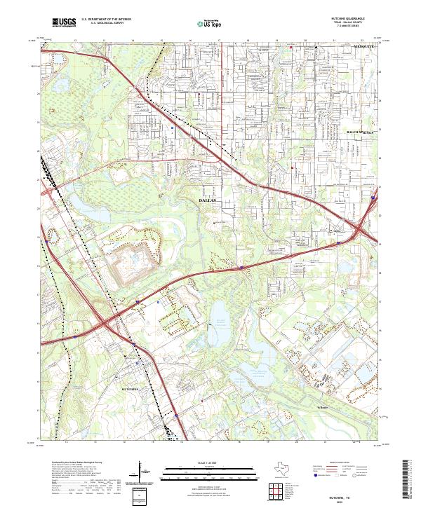 2022 Hutchins2022 Print · USGSSoutheastern Dallas County appears here in the early 2020s, showcasing the transition from suburban neighborhoods to the Trinity River floodplains. Researchers can locate family sites at Hutchins Cem or Albert Carver Cem and trace the wetlands near the Fin and Feather Club Lake.
 - 2022 Map of Garland, 2022 Print
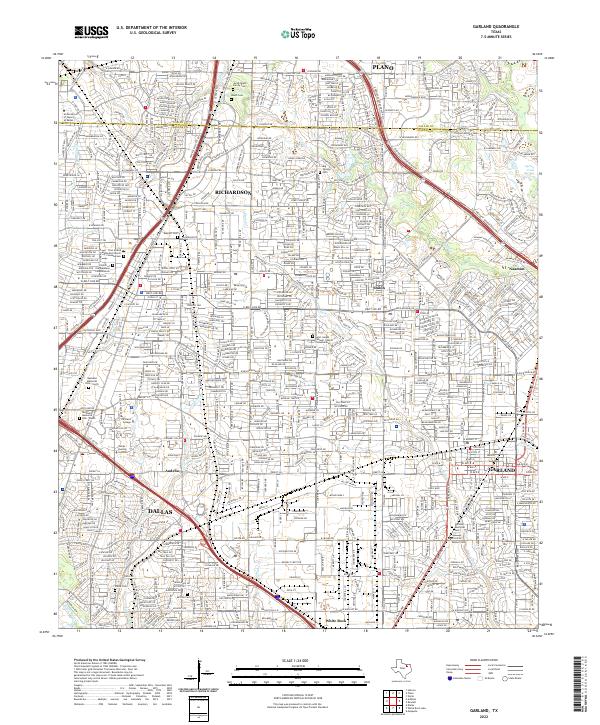 2022 Garland2022 Print · USGSGarland and Richardson are shown at a peak of suburban development in the early 2020s, dominated by major highway corridors and dense residential grids. Researchers can trace local history through family sites like the Jacob Routh Family Cem or locate community hubs such as Richland College and the First United Methodist Church.
 - 2022 Map of Rowlett, 2022 Print
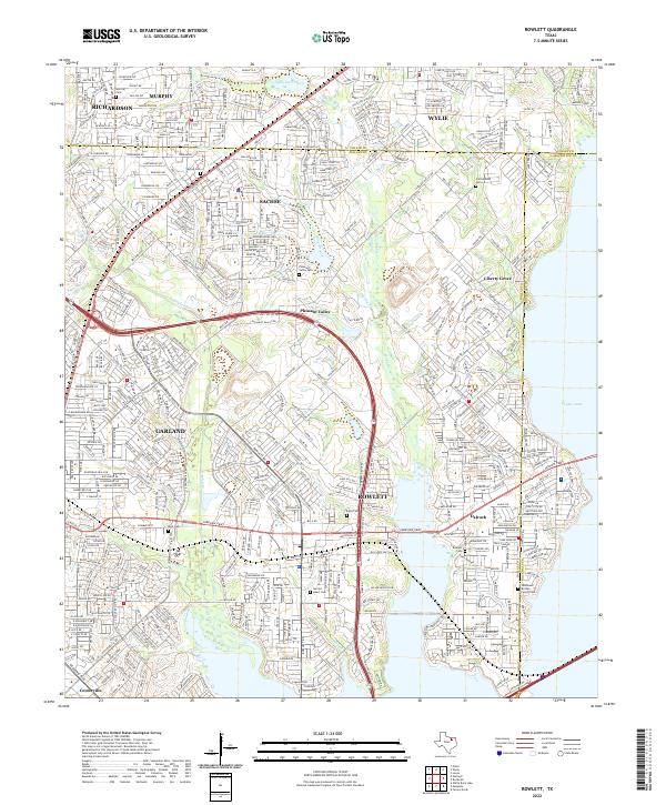 2022 Rowlett2022 Print · USGSThe suburban expansion northeast of Dallas is shown here in detail during the early 2020s. Researchers can locate several family and community landmarks, from the Rowlett Cem to the Jones and McShan Family Cem and the waters of Corder Lake.
 - 2022 Map of Duncanville, 2022 Print
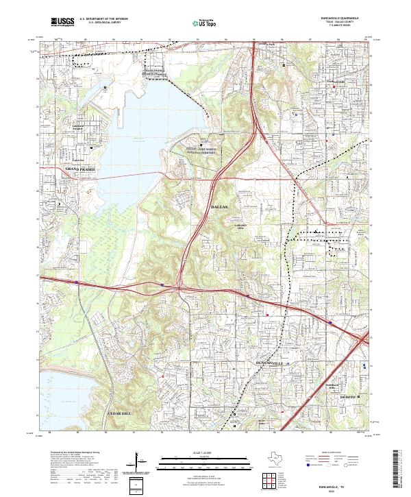 2022 Duncanville2022 Print · USGSThe Duncanville and Grand Prairie corridor is shown here during a period of dense suburban growth between the local lakes. Genealogists and historians can trace family sites like Fugitt Cem and Daniel Cem near the historic Chalk Hill and the Dallas Naval Air Station.
 - 2022 Map of Carrollton, 2022 Print
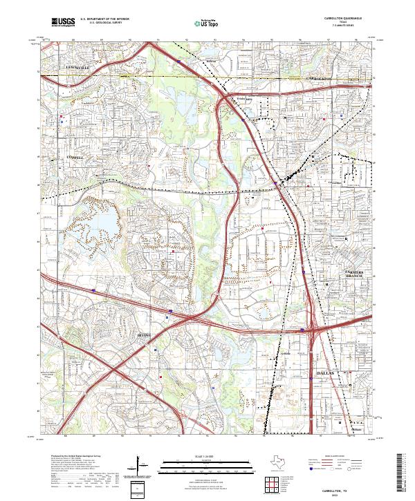 2022 Carrollton2022 Print · USGSThe northern Dallas suburbs come into focus during this era of rapid growth and transit expansion. Genealogists can locate several family burial grounds including Parrish Family Cem, Keenan Cem, and the historic Carrollton Black Cem.
 - 2022 Map of Dallas, 2022 Print
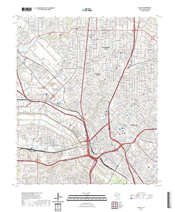 2022 Dallas2022 Print · USGSDallas and its northern park cities are shown at a peak of urban development during the early twenty-first century. Researchers can trace historic burial sites like La Reunion Cem and landmarks such as Southern Methodist University and the Trinity River.
 - 2022 Map of Forney North, 2022 Print
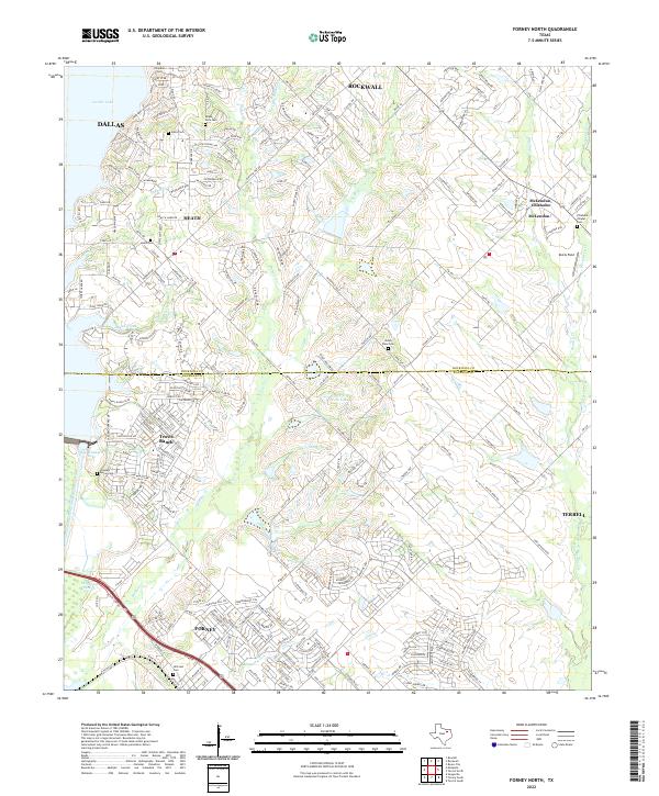 2022 Forney North2022 Print · USGSNorth Texas suburban growth meets historic pioneer roots in this recent survey of the Rockwall and Kaufman county lines. Genealogists can trace family heritage at Hillcrest Cem and Heath Cem while exploring the modern shores of Ray Hubbard Lake.
 - 2022 Map of Oak Cliff, 2022 Print
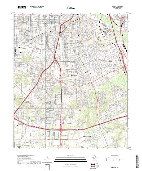 2022 Oak Cliff2022 Print · USGSSouthern Dallas and the Oak Cliff neighborhood are captured here in the early 2020s, showing a landscape of dense residential growth and historic cemeteries. Researchers can find family-named sites like Miller Family Cem or trace the grounds of Paul Quinn College and Laurel Land Memorial Park.
 - 2022 Map of Cedar Hill, 2022 Print
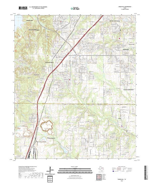 2022 Cedar Hill2022 Print · USGSThe suburbs south of Dallas were undergoing rapid growth in the early 2020s as residential tracts filled in the spaces between established towns. Genealogists and local historians can trace modern landmarks alongside historic sites like Shiloh Cem, Ovilla Cem, and Inspiration Point.
 - 2022 Map of White Rock Lake, 2022 Print
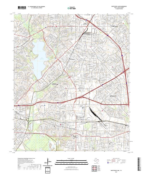 2022 White Rock Lake2022 Print · USGSDallas and its eastern suburbs are captured here in the early 2020s, centered on the recreational waters of White Rock Lake. Researchers can trace local history through a high concentration of cemeteries and landmarks like Zacha Junction, Warren Angus Ferris Cem, and Reinhardt.
 - 2022 Map of Mesquite, 2022 Print
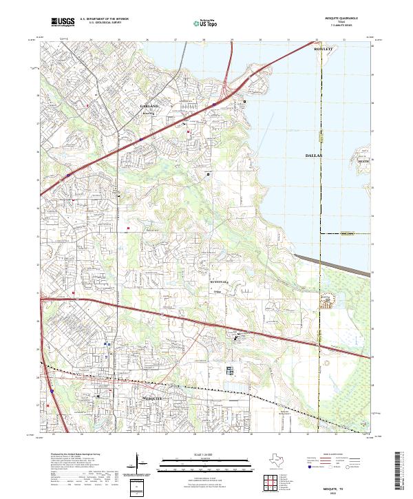 2022 Mesquite2022 Print · USGSThe eastern Dallas suburbs and the Trinity River floodplains come to life in this contemporary study of growth and local heritage. Researchers can trace family sites at Mesquite Cem, Lyons Cem, and the historic community of Tripp.
 - 2022 Map of Irving, 2022 Print
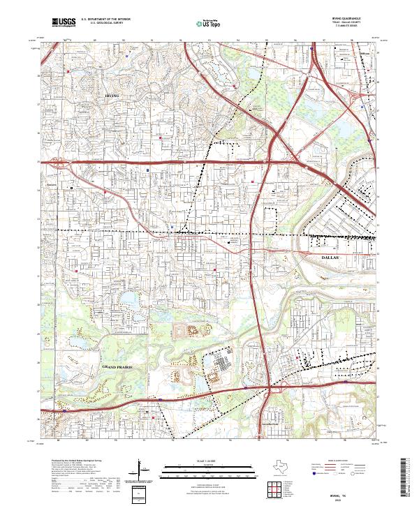 2022 Irving2022 Print · USGSThe Trinity River forks and the sprawling suburbs of Dallas County define this modern landscape. Genealogists and local researchers can pinpoint significant sites like Sowers Cem, Oak Grove Memorial Gardens, and the Jordan-Hight Cem.
 - 2022 Map of Britton, 2022 Print
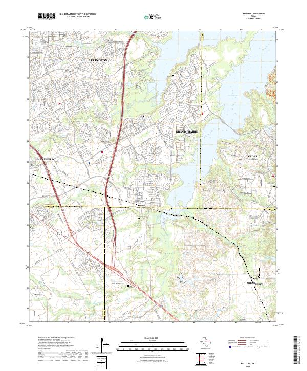 2022 Britton2022 Print · USGSFour North Texas counties meet at the crossroads of Britton in this recent survey of the suburbanizing landscape south of Arlington. Researchers can trace the sprawling shores of Joe Pool Lake and locate several community landmarks like Britton Cem and Saint Paul Cem.
 - 2023 Map of Addison, 2023 Print
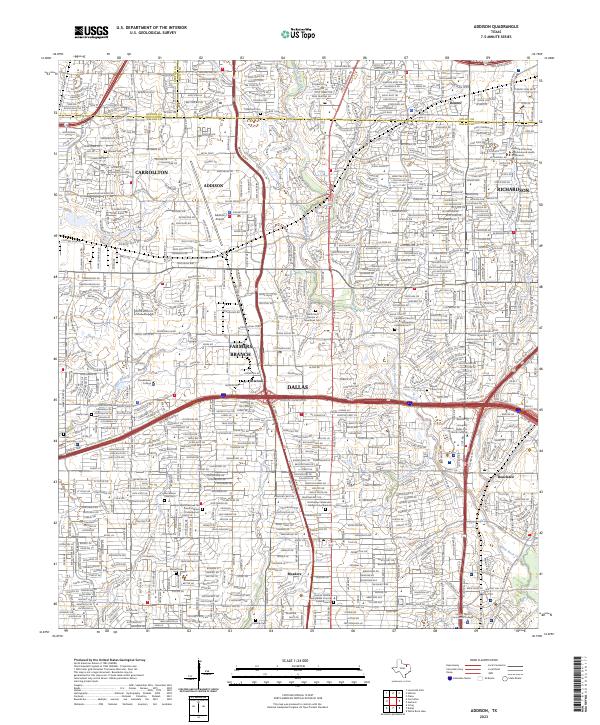 2023 Addison2023 Print · USGSThe North Dallas suburbs of ADDISON and FARMERS BRANCH show their modern density in this 2023 survey. Researchers can locate historic sites like Frankford Cem alongside contemporary landmarks like Addison Airport and Brookhaven College.
 - 2023 Map of Rockwall, 2023 Print
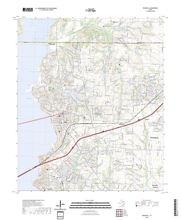 2023 Rockwall2023 Print · USGSRockwall and its eastern suburbs are shown in their modern state, highlighting the intersection of rapid growth and historical preservation. Genealogists can locate family burial sites such as Rockwall Memorial Cem and Parker Cem alongside landmarks like the Rockwall County Courthouse.
 - 2023 Map of Hebron, 2023 Print
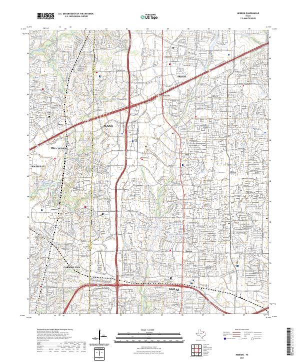 2023 Hebron2023 Print · USGSThe rapid suburbanization of North Texas is on full display here, where the booming cities of Plano and Frisco meet. Genealogists can locate small family plots like Baccus Cem and Bridges Cem tucked between the Sam Rayburn Tollway and Air Park-Dallas Airport.
End of results
Showing maps 1-20 of 20
Top cities near Dallas
- Plano historical maps
- Irving historical maps
- Garland historical maps
- Grand Prairie historical maps
- Mesquite historical maps
- Carrollton historical maps
See more
Top neighborhoods of Dallas
- Renner historical maps
- Inwood historical maps
- Gribble historical maps
- Cole historical maps
- Kenwood historical maps
- Ledbetter Hills historical maps
See more
Frequently asked questions
- What are the different types of historical maps available for Dallas?
- What is the oldest map of Dallas?
- Where can I purchase historical maps of Dallas for my home or office?
- Where can I download high-res historical maps of Dallas?
- Are there historical topographic maps available for Dallas?
- Is there historical aerial imagery available for Dallas?
- Where are historical maps of Dallas sourced from?