1990s Maps of Duchesne County, Utah
Explore 42 historic maps of Duchesne County from the 1990s. These maps offer a rare glimpse into what life looked like during the 1990s — showing old roads, neighborhoods, homes, and landmarks that have changed or disappeared over time.
Whether you're researching your family's past, planning a metal detecting trip, or studying how Duchesne County's landscape evolved across the 1990s, these high-resolution maps are a powerful tool for exploring the history of this region.
- Focus on a specific era: All maps on this page are from the 1990s, giving you a focused view of this time period.
- See what’s changed: Compare century-old streets, trails, and buildings to today's modern landscape using overlays and satellite layers.
- Research with precision: Use these maps for genealogy, historical research, land use analysis, or educational projects.
- View, download, or print: Maps are fully viewable online in high resolution, and can be downloaded or printed for your own records.
Start exploring Duchesne County's history through authentic maps from the 1990s. This is your window into the past.
Duchesne County, UT maps
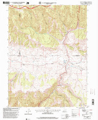
(42)- 1990 Map of Whiterocks Lake, 1995 Print
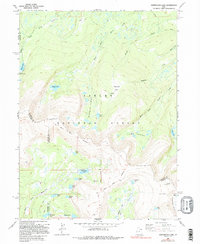 1990 Whiterocks Lake1995 Print · USGSThe high Uinta Mountains are captured here in the late twentieth century, showing a landscape defined by the Old Indian Treaty Boundary and the Ashley National Forest. Researchers can trace old survey lines like the Uintah Special Meridian and find remote landmarks such as Whiterocks Lake and Mount Untermann.
 - 1991 Map of Mirror Lake
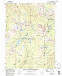 1991 Mirror Lake1991 Print · USGSThe high Uintas in the early 1970s reveal a landscape of alpine lakes and early forest service outposts. You can trace the historic Indian Treaty Boundary and locate backcountry landmarks like the Mirror Lake Guard Sta and Notch Mountain.
 - 1996 Map of Chepeta Lake, 1999 Print
 1996 Chepeta Lake1999 Print · USGSThe high basins of the Uintas are captured here during the late twentieth century, showing where three northern Utah counties converge. Hikers and researchers can trace remote alpine routes through North Pole Pass to landmarks like Spirit Lake Lodge and Chepeta.
 - 1996 Map of Heller Lake, 1999 Print
 1996 Heller Lake1999 Print · USGSThe Uintah Basin high country is captured here during the 1990s, where tribal lands meet national forest boundaries. Researchers can trace remote landmarks and vital water sources like the Dry Gulch Guard Station (Indian), Washs Nipple, and Heller Lake.
 - 1996 Map of Rasmussen Lakes, 1999 Print
 1996 Rasmussen Lakes1999 Print · USGSHigh-altitude basins and wilderness hydrology define this Duchesne County landscape in the late nineties. Trace trails through the High Uintas Wilderness to remote landmarks like Pole Creek Lake, Goose Egg Peak, and Rasmussen Lakes.
 - 1996 Map of Kidney Lake, 1999 Print
 1996 Kidney Lake1999 Print · USGSThe High Uintas wilderness and the Ashley National Forest meet in this late-twentieth-century study of the Duchesne backcountry. Trace the alpine hydrology of Brown Duck Basin and find remote sites like the Paint Mine and Lake Fork Guard Station.
 - 1996 Map of Lance Canyon, 1999 Print
 1996 Lance Canyon1999 Print · USGSDuchesne County during the late nineties reveals a high-country landscape of steep canyons and national forest land. Researchers can trace remote routes like Sowers Canyon Road and locate water sources such as West Lance Spring or Cripple Creek.
 - 1996 Map of Avintaquin Canyon, 1999 Print
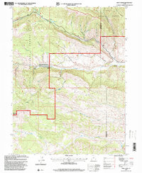
 1996 Avintaquin Canyon1999 Print · USGSHigh desert ranching and forest lands meet in this Duchesne County landscape during the late twentieth century. Genealogists and historians can locate established family outposts like Remund Ranch and Pearross Ranch along the banks of Avintaquin Creek.
 - 1996 Map of Mount Lovenia, 1999 Print
 1996 Mount Lovenia1999 Print · USGSThe High Uintas at the end of the twentieth century show a remote landscape of intersecting national forests and alpine peaks. Researchers can trace the high-altitude divide at Mount Lovenia and Squaw Pass or follow the glacial headwaters of the Middle Fork Blacks Fork.
 - 1996 Map of Whiterocks Lake, 1999 Print
 1996 Whiterocks Lake1999 Print · USGSThe High Uintas wilderness appears in detail during the late nineties, showcasing the complex glacial hydrology at the junction of three Utah counties. Trace remote alpine landmarks like Chepeta, the Sheep Creek Canal, and the high waters of Whiterocks Lake.
 - 1996 Map of Matts Summit, 1999 Print
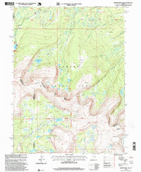
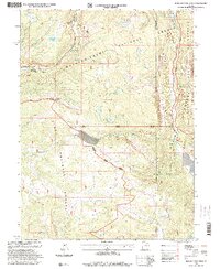
 1996 Matts Summit1999 Print · USGSThe high Utah plateau country comes into sharp focus in the late nineties, where the Carbon and Duchesne county lines meet. Researchers can trace the rugged topography of Meridian Ridge, locate Little Boulder Dam, and find family-named landmarks like Mathis Canyon.
 - 1996 Map of Lake Fork Mountain, 1999 Print
 1996 Lake Fork Mountain1999 Print · USGSDuchesne County is captured here in the mid-1990s as the high wilderness meets the reservation and forest lands. Researchers can trace irrigation history through the Farnsworth Canal and find local landmarks like the Lake Fork Corral and Twin Pots Reservoir.
 - 1996 Map of Jones Hollow, 1999 Print
 1996 Jones Hollow1999 Print · USGSDuchesne County is shown in the mid-1990s as a high-altitude landscape of deep canyons and forest plateaus. Local historians can trace cattle-ranching and surveying markers like the Corral, the Twelvemile Trail, and the prominent Bad Land Cliffs.
 - 1996 Map of Anthro Mountain, 1999 Print
 1996 Anthro Mountain1999 Print · USGSThe high desert canyons of Duchesne County are captured here in the mid-1990s, showing a landscape defined by ranching and energy exploration. Researchers can locate remote sites like Cracker Grove, Mine Hollow Spring, and the Bad Land Cliffs.
 - 1996 Map of Wood Canyon, 1999 Print
 1996 Wood Canyon1999 Print · USGSThe high plateau country along the Duchesne and Carbon County border is captured here in the mid-1990s. Genealogists and historians can trace the steep drainages of Nine Mile Creek and Argyle Creek or locate the northern boundary of the Ashley National Forest.
 - 1996 Map of Fox Lake, 1999 Print
 1996 Fox Lake1999 Print · USGSThe High Uintas backcountry in the 1990s reveals a high-altitude wilderness of alpine lakes and mountain passes. Trace remote routes through Corral Meadows, cross the Shale Creek Bridge, and navigate the terrain around Thompson Peak.
 - 1996 Map of Kings Peak, 1999 Print
 1996 Kings Peak1999 Print · USGSThe High Uintas were a strictly managed wilderness in the late nineties, centered on the state's highest summits. Hikers and historians can trace the routes through Gunsight Pass or locate alpine landmarks like Kings Peak and Lake George Beard.
 - 1996 Map of Anthro Mountain NE, 1999 Print
 1996 Anthro Mountain NE1999 Print · USGSDuchesne County is shown here in the mid-1990s, where deep canyon drainages define the high mountain terrain. Trace energy exploration sites like Gilsonite Draw and an Oil Well near the Bad Land Cliffs.
 - 1996 Map of Paradise Park, 1999 Print
 1996 Paradise Park1999 Print · USGSThe Uinta Mountains wilderness is captured here in the mid-1990s, highlighting alpine water systems and forest management. Researchers can trace the layout of the Paradise Guard Station and mountain landmarks like Paradise Peak and Cliff Lake.
 - 1996 Map of Hayden Peak, 2000 Print
 1996 Hayden Peak2000 Print · USGSThe High Uintas were a pristine wilderness frontier in the mid-1990s, where three national forests meet at the county divide. Hikers and historians can trace high-altitude routes like the Highline Trail and name dozens of alpine waters from Kamas Lake to Amethyst Lake.
 - 1996 Map of Grandaddy Lake, 2000 Print
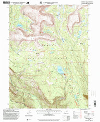
 1996 Grandaddy Lake2000 Print · USGSDuchesne County’s high alpine wilderness is captured here in the mid-1990s as a landscape of recreation and water management. Trace the trails to Defas Dude Ranch, the engineering of the Stillwater Tunnel, and the shores of Grandaddy Lake.
 - 1996 Map of Dry Mountain, 2000 Print
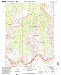
 1996 Dry Mountain2000 Print · USGSThe Uintah and Ouray Indian Reservation meets the Ashley National Forest in this late-century survey of the Utah high country. Genealogists and historians can trace high-mountain travel routes through Mountain Sheep Pass and locate remote sites like the Indian Ranger Station and Summit Lake.
 - 1996 Map of Wolf Creek, 2000 Print
 1996 Wolf Creek2000 Print · USGSThe Wasatch and Duchesne county borderlands are shown in the late nineties as a rugged intersection of national forests and high-mountain drainages. Researchers can trace forest management boundaries and old livestock infrastructure like the Corral near Sand Creek and the remote Blue Lake.
 - 1996 Map of Farm Creek Peak, 2000 Print
 1996 Farm Creek Peak2000 Print · USGSHigh mountain terrain and early irrigation systems define this part of Duchesne County during the late twentieth century. Researchers can trace the complex water networks of the Tabby Canal and find remote landmarks like Round Grove and Rock Lake.
 - 1996 Map of Iron Mine Mountain, 2000 Print
 1996 Iron Mine Mountain2000 Print · USGSThe high Uinta backcountry is captured here in the mid-1990s at the intersection of three national forests. Outdoor historians and researchers can trace the industrial legacy of the Iron Mine or locate early water projects like the Duchesne Tunnel and Spruce Springs Reservoir.
Showing maps 1-25 of 42
Top cities of Duchesne County
- Roosevelt historical maps
- Duchesne historical maps
- Myton historical maps
- Altamont historical maps
- Tabiona historical maps
Frequently asked questions
- What are the different types of historical maps available for Duchesne County?
- What is the oldest map of Duchesne County?
- Where can I purchase historical maps of Duchesne County for my home or office?
- Where can I download high-res historical maps of Duchesne County?
- Are there historical topographic maps available for Duchesne County?
- Is there historical aerial imagery available for Duchesne County?
- Where are historical maps of Duchesne County sourced from?