Old Maps of Spanish Valley, Utah for Academic Research
Study the evolution of Spanish Valley with 17 high-resolution historic maps. Whether you're teaching, researching, or modeling changes in land use, these maps provide essential visual documentation of urban, environmental, and geographic change.
- Analyze long-term change: Track patterns in development, transportation, and natural features.
- Ideal for environmental or urban studies: Support academic projects with primary historical map data.
- Use in the classroom or lab: Educators and researchers rely on these maps to bring historical context to life.
These maps are a powerful tool for teaching, research, and visualizing how Spanish Valley has changed over the decades.
Spanish Valley, UT maps
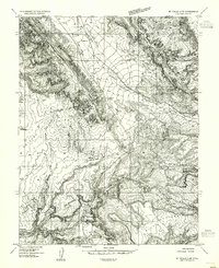
(17)- 1885 Map of La Sal
 1885 La Sal1885 Print · USGSSoutheast Utah in the mid-1880s remains a frontier of dramatic river canyons and high mountain peaks. Genealogists and historians can trace the early footprints of Moab and Plainfield or locate the high summits of Mt Peale and the path of the Green River.6 unique versions available
 - 1954 Map of Mt Peale 2 NW, 1955 Print
 1954 Mt Peale 2 NW1955 Print · USGSSoutheast Utah at the height of the mid-century uranium and oil boom reveals a landscape of high mesas and deep canyons. Researchers can trace early aviation and mining infrastructure at the Grand County Airport and the Star Mine.
 - 1954 Map of Mt Peale 2 NE, 1956 Print
 1954 Mt Peale 2 NE1956 Print · USGSSan Juan and Grand Counties are captured here during a mid-century era of mountain extraction and ranching. Researchers can trace the layout of the Yellow Circle Mines, the M4 Ranch settlement, and early access routes through La Sal Pass.
 - 1954 Map of La Sal Junction, 1957 Print
 1954 La Sal Junction1957 Print · USGSSan Juan and Grand Counties appear as a high-altitude wilderness during the mid-fifties, before modern expansion altered the access to the La Sal Mountains. Trace early uranium exploration and ranching outposts like the Yellow Circle Mines, M4 Ranch, and La Sal Junction.4 unique versions available
 - 1956 Map of Moab, 1972 Print
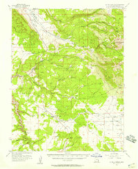
 1956 Moab1972 Print · USGSThe Colorado Plateau and La Sal Mountains appear here in the mid-fifties, just as the uranium boom and energy exploration were reshaping the Four Corners. Researchers can trace the Denver and Rio Grande Western through Cisco or locate the remote outpost of Uravan and Looking Glass Rock.3 unique versions available
 - 1959 Map of Moab
 1959 Moab1959 Print · USGSSoutheast Utah and Western Colorado are mapped here in the late fifties, just as the uranium boom was transforming the remote canyon lands. Genealogists and historians can trace the foundations of Moab and Nucla, or locate mining sites and landmarks like Uravan and Dead Horse Point.
 - 1960 Map of Moab
 1960 Moab1960 Print · USGSThe canyonlands and high plateaus of the Utah-Colorado border are shown here during the mid-century uranium boom. Researchers can trace the river-and-rail corridors of the Colorado River and the Denver and Rio Grande Western near Moab and Uravan.3 unique versions available
 - 1962 Map of Moab
 1962 Moab1962 Print · USGSThe canyon country of southeastern Utah and western Colorado is captured here in the early sixties, showing the reach of the Denver and Rio Grande Western through the desert. Researchers can trace the layout of mining settlements like Uravan and old railroad stops at Cisco and Sagers Station.
 - 1964 Map of Moab
 1964 Moab1964 Print · USGSThe canyonlands of eastern Utah and western Colorado are captured here in the mid-1960s, a time when uranium mining shaped the local economy. Researchers can trace the river-and-rail network through Sinbad Valley and locate mining outposts like Uravan and Vancorum.
 - 1965 Map of Moab
 1965 Moab1965 Print · USGSSoutheast Utah and Western Colorado are mapped here in the mid-sixties, showcasing a landscape of high plateaus and deep river canyons. Genealogists and historians can trace the mining-era towns of Uravan and Paradox or locate remote landmarks like Castleton and Dead Horse Point.
 - 1982 Map of La Sal, 1983 Print
 1982 La Sal1983 Print · USGSThe high desert of southeastern Utah meets the Colorado border in the early eighties, showing a landscape defined by deep canyons and mining. Trace the industrial operations at Lisbon Mine or explore the early mapping of The Needles and Island in the Sky.2 unique versions available
 - 1987 Map of Mount Tukuhnikivatz
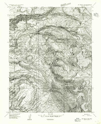
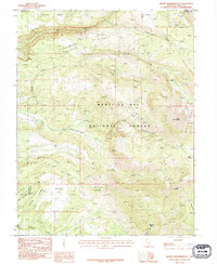 1987 Mount Tukuhnikivatz1987 Print · USGSThe high peaks of the La Sal Mountains are captured in the late twentieth century, showing a remote landscape of mining prospects and alpine basins. Researchers can trace historic access routes through La Sal Pass and locate early mineral work at Gold Basin or Slaughter Flats.2 unique versions available
 - 1987 Map of Kane Springs
 1987 Kane Springs1987 Print · USGSSan Juan County and the southern edge of the Moab area are captured here in the late eighties, showing the transition from valley floor to high mesa. Trace local landmarks like the Kane Springs Roadside Park, Kens Lake, and the expansive Behind the Rocks terrain.2 unique versions available
 - 1996 Map of Kane Springs, 2002 Print
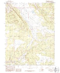
 1996 Kane Springs2002 Print · USGSSpanish Valley and the high mesas of the San Juan county line are captured here in the mid-nineties. Detail-oriented researchers can locate the Landing Strip, trace the water systems around Kens Lake, and identify numerous adits across Bridger Jack Mesa.
 - 2001 Map of Mount Tukuhnikivatz, 2004 Print
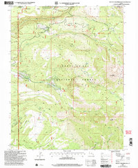 2001 Mount Tukuhnikivatz2004 Print · USGSThe high peaks and deep canyons of the La Sal Mountains are captured here at the turn of the millennium. Researchers can locate historical mining sites like the Yellow Circle Mines or trace high-altitude routes through La Sal Pass and Brumley Ridge.
 - 2023 Map of Mount Tukuhnikivatz, 2023 Print
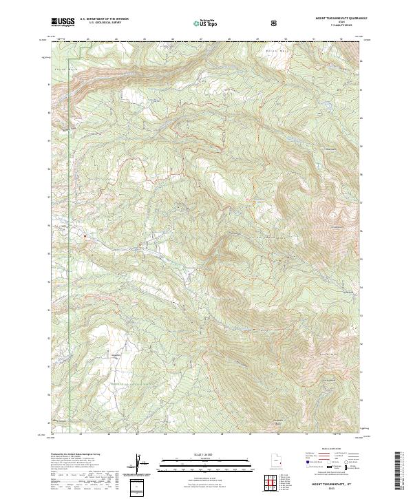 2023 Mount Tukuhnikivatz2023 Print · USGSThe high alpine peaks of San Juan County are documented here as they appeared in 2023, showing the intricate trail systems and water sources of the southern La Sal range. Researchers can trace the routes through Geyser Pass or locate remote sites like Gold Basin and Tukuhnikivatz Spring.
 - 2023 Map of Kane Springs, 2023 Print
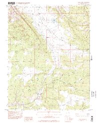
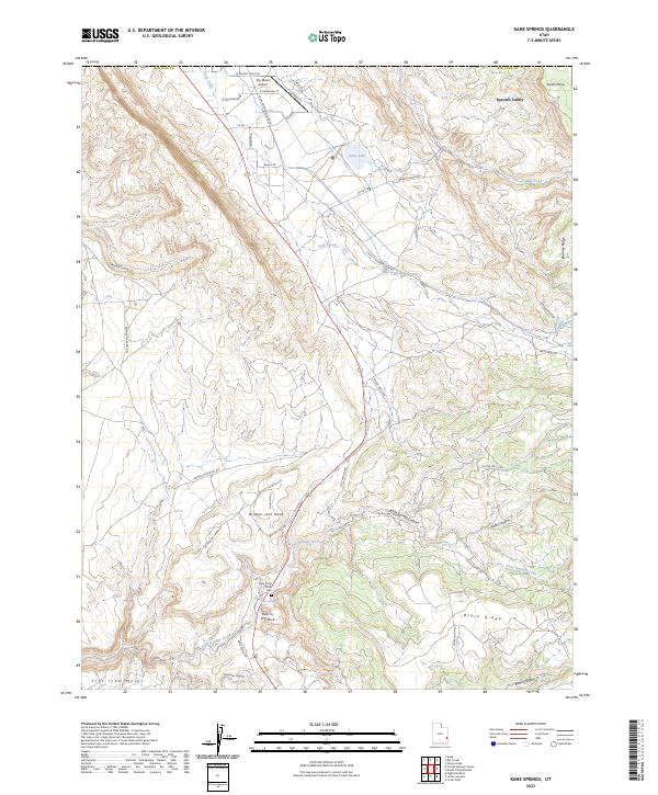 2023 Kane Springs2023 Print · USGSSpanish Valley and the high desert mesas of San Juan County are mapped here in the early twenty-first century. Researchers can trace land use around Sky Ranch Airport or find local heritage sites like Hole-in-the-Rock and the Hole in the Rock Cem.
End of results
Showing maps 1-17 of 17
Top cities near Spanish Valley
Frequently asked questions
- What are the different types of historical maps available for Spanish Valley?
- What is the oldest map of Spanish Valley?
- Where can I purchase historical maps of Spanish Valley for my home or office?
- Where can I download high-res historical maps of Spanish Valley?
- Are there historical topographic maps available for Spanish Valley?
- Is there historical aerial imagery available for Spanish Valley?
- Where are historical maps of Spanish Valley sourced from?