Old Maps of Gillette, Wyoming for Genealogy
Trace your family roots with 14 historic maps of Gillette. These high-res maps reveal old neighborhoods, homesites, landmarks, and streets — helping you uncover where your ancestors lived and how the area evolved over time.
- Explore historic neighborhoods: Identify where your relatives may have lived in the 1800s or 1900s.
- Compare maps over time: Trace the changes in streets, buildings, and landmarks for multi-generational research.
- Perfect for genealogy & ancestry research: Used by family historians and researchers to map out lineage and migration.
These maps are an incredible resource for exploring your personal connection to Gillette's past.
Gillette, WY maps
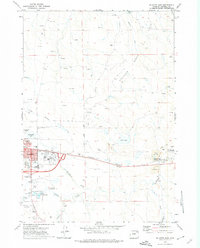
(14)- 1954 Map of Gillette, 1975 Print
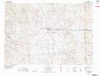
 1954 Gillette1975 Print · USGSGillette and the northeast Wyoming ranching country are captured here in the mid-1950s as coal and bentonite mining shaped the local economy. Genealogists can trace family landmarks like the Bethlehem Church, Wellman School, and early settlements along the Chicago Burlington and Quincy RR.
 - 1955 Map of Gillette, 1976 Print
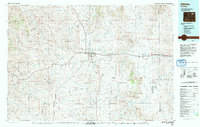
 1955 Gillette1976 Print · USGSNortheastern Wyoming in the mid-twentieth century is captured here as the energy and ranching landscape began to shift. Genealogists and historians can trace the foundations of local communities through sites like Wyodak, the Pleasantdale Community Building, and landmarks like Devils Tower National Monument.
 - 1958 Map of Gillette
 1958 Gillette1958 Print · USGSNortheastern Wyoming and the Black Hills are captured here in the late fifties, showcasing a landscape of high-plains ranching and emerging energy production. Researchers can trace the rail-side growth of Gillette and find historic rural landmarks like the Wyodak Coal Mine, Bethlehem Church, and Devils Tower National Monument.2 unique versions available
 - 1962 Map of Gillette
 1962 Gillette1962 Print · USGSHigh plains ranching and coal mining dominate the Powder River Basin in the early sixties. Genealogists can trace rural communities through landmarks like the Bethlehem Church, Lake School, and settlements such as Moorcroft and Sundance.
 - 1971 Map of Gillette East, 1974 Print
 1971 Gillette East1974 Print · USGSGillette and the surrounding Campbell County prairies are shown here in the early seventies during a significant era of energy development. Researchers can trace the town's early footprint and locate industrial sites like the Wyodak Strip Mine and Mt Pisgah Cemetery.3 unique versions available
 - 1971 Map of The Gap, 1974 Print
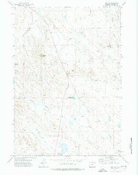 1971 The Gap1974 Print · USGSCampbell County ranching country is captured here in the early seventies, centered on the dramatic landform of The Gap. Genealogists and historians can locate the rural Gap Sch and trace water sources like Mary Alice Reservoir and Duck Nest Creek.2 unique versions available
 - 1971 Map of Appel Butte, 1974 Print
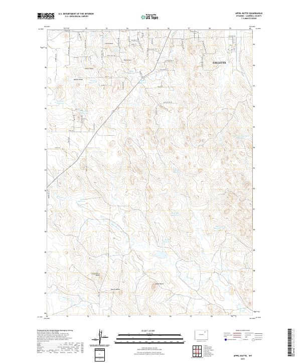
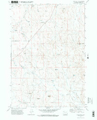 1971 Appel Butte1974 Print · USGSCampbell County ranching and water management are on full display in the early 1970s, showing a landscape carved by seasonal draws and high buttes. Researchers can trace land use through landmarks like Appel Butte, Lake Bed Reservoir, and the paths of Bone Pile Creek.2 unique versions available
 - 1971 Map of Gillette West, 1975 Print
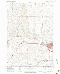 1971 Gillette West1975 Print · USGSGillette and the surrounding Campbell County high plains are captured here in the early seventies during a period of industrial expansion. Researchers can trace the development of the Oriva Gas Field or locate local landmarks like the County Fairground and Jr High Sch.2 unique versions available
 - 1972 Map of Gillette, 1975 Print
 1972 Gillette1975 Print · USGSGillette and the surrounding Campbell County prairies are shown during a decade of intense energy expansion in the 1970s. Researchers can trace the early footprint of the Wyodak Strip Mines and locate rural landmarks like Antelope Butte and Rozet.
 - 1974 Map of Gillette, 1993 Print
 1974 Gillette1993 Print · USGSGillette and the Powder River Basin are captured here in the mid-seventies during a pivotal era of energy development. Genealogists and historians can trace the early footprint of the Wyodak Strip Mines and the rail-side growth of Rozet and Wyodak.
 - 2021 Map of Appel Butte, 2021 Print
 2021 Appel Butte2021 Print · USGSGillette and its southwestern outskirts are documented in the early twenty-first century as suburban growth encroaches on traditional Wyoming ranchland. Trace land use through numerous private water sources like Sibul Reservoir and landmarks such as Schoolhouse Butte.
 - 2021 Map of Gillette East, 2021 Print
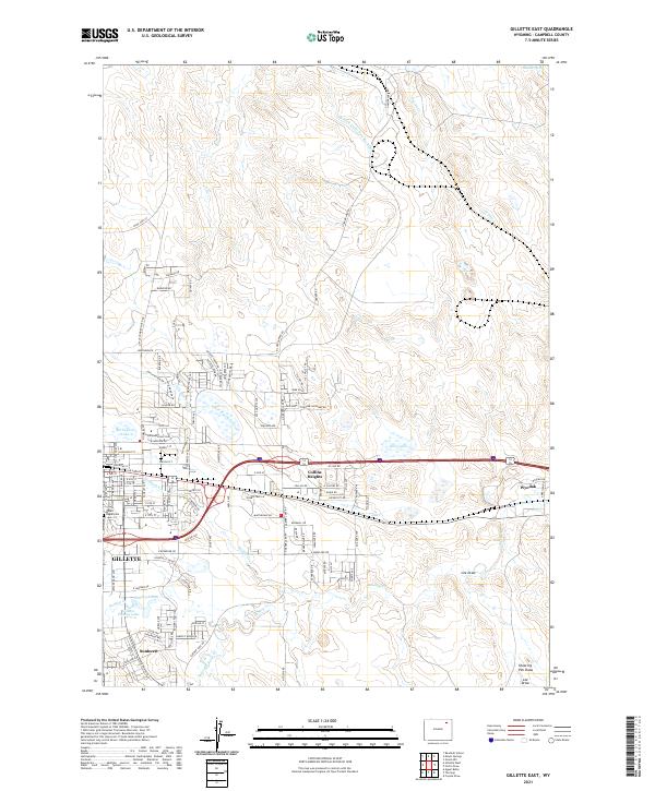 2021 Gillette East2021 Print · USGSGillette and its eastern suburbs are captured here during a period of steady growth into the Campbell County plains. Trace family history at Mount Pisgah Cem or explore the drainage systems of Donkey Creek and Little Rawhide Creek.
 - 2021 Map of The Gap, 2021 Print
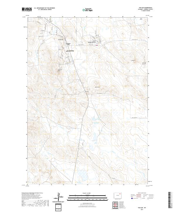 2021 The Gap2021 Print · USGSSuburban development meets the high plains south of Gillette in the early twenty-first century. Researchers can trace the layout of growing communities like Sleepy Hollow and Antelope Valley alongside landmarks like The Gap and Antelope Butte.
 - 2021 Map of Gillette West, 2021 Print
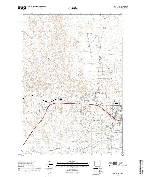 2021 Gillette West2021 Print · USGSGillette's modern western expansion is documented here as the city moves across the high plains. Researchers can trace the layout of contemporary neighborhoods and institutions like Gillette College, Mount Pisgah Cem, and the Campbell County Courthouse.
End of results
Showing maps 1-14 of 14
Top cities near Gillette
Frequently asked questions
- What are the different types of historical maps available for Gillette?
- What is the oldest map of Gillette?
- Where can I purchase historical maps of Gillette for my home or office?
- Where can I download high-res historical maps of Gillette?
- Are there historical topographic maps available for Gillette?
- Is there historical aerial imagery available for Gillette?
- Where are historical maps of Gillette sourced from?