Old Maps of Green River, Wyoming for Genealogy
Trace your family roots with 31 historic maps of Green River. These high-res maps reveal old neighborhoods, homesites, landmarks, and streets — helping you uncover where your ancestors lived and how the area evolved over time.
- Explore historic neighborhoods: Identify where your relatives may have lived in the 1800s or 1900s.
- Compare maps over time: Trace the changes in streets, buildings, and landmarks for multi-generational research.
- Perfect for genealogy & ancestry research: Used by family historians and researchers to map out lineage and migration.
These maps are an incredible resource for exploring your personal connection to Green River's past.
Green River, WY maps
(31)- 1954 Map of Rock Springs, 1969 Print
 1954 Rock Springs1969 Print · USGSSouthern Wyoming at the peak of the mid-century energy boom is defined by the vital rail corridor and the high desert of the Red Desert Basin. Trace the development of mining towns like Superior and Reliance alongside the Union Pacific RR and historical landmarks like Pilot Butte.2 unique versions available
 - 1957 Map of Mc Kinnon Junction, 1959 Print
 1957 Mc Kinnon Junction1959 Print · USGSSweetwater County ranching and river basins are captured here in the late fifties, showing the complex meanders of the Blacks Fork River. Researchers can trace old family holdings like Bonoma Ranch and Holmes Ranch or locate the site of Massacre Hill.
 - 1957 Map of Firehole Basin, 1959 Print
 1957 Firehole Basin1959 Print · USGSThe Green River corridor in Sweetwater County is shown here in the late fifties, shortly before the landscape was altered by the Flaming Gorge project. Researchers can trace remote homesteads like Kincaid Ranch and unique riverside features including Whiskey Bend and Slippery Jim Bottom.
 - 1958 Map of Rock Springs
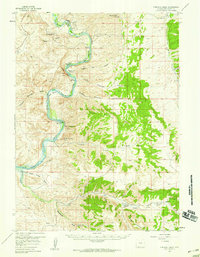
 1958 Rock Springs1958 Print · USGSThe high desert of Sweetwater County comes into focus during the mid-1950s, centered on the rail-and-road corridor through Rock Springs. Genealogists and historians can trace family landholdings and infrastructure at Barnhart Ranch, Little America, and the Union Pacific line.2 unique versions available
 - 1961 Map of Peru, 1964 Print
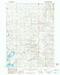
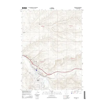
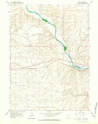 1961 Peru1964 Print · USGSThe high desert of Sweetwater County comes into focus in the early sixties as the railroad and river shape local industry. Researchers can trace the path of the Overland Trail or locate family landmarks like Shaul Ranch and the community of James Town.3 unique versions available
 - 1961 Map of Green River, 1965 Print
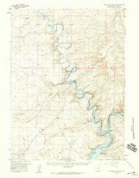
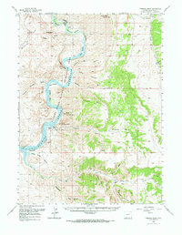
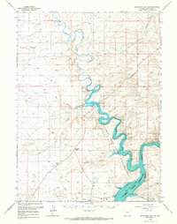
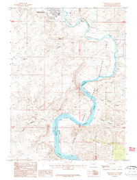
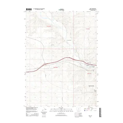
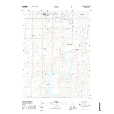
 1961 Green River1965 Print · USGSThe railroad hub of Green River is shown in the early 1960s, framed by the river's sheer canyon walls. Researchers can trace the Overland Trail or locate local landmarks like Lincoln High Sch and Riverview Cem.4 unique versions available
 - 1962 Map of Rock Springs
 1962 Rock Springs1962 Print · USGSThe high desert of Sweetwater County in the early 1960s reveals a rugged ranching and energy landscape centered on Rock Springs. Genealogists can trace family holdings like the Erikson-Kent Ranch and Barnhart Ranch alongside the Union Pacific line.
 - 1966 Map of Firehole Basin, 1967 Print
 1966 Firehole Basin1967 Print · USGSThe Green River canyons in the mid-1960s reveal a landscape being reshaped by the rising waters of the Flaming Gorge Reservoir. Trace the old river bottoms and landmarks like North Chimney Rock, Whiskey Bend, and the remote Sage Creek Ranch.
 - 1966 Map of Mc Kinnon Junction, 1967 Print
 1966 Mc Kinnon Junction1967 Print · USGSSweetwater County in the mid-sixties shows the dramatic rise of the Flaming Gorge Reservoir across the desert. Researchers can trace the legacy of early ranching and modern infrastructure at Bonomo Ranch, Mc Kinnon Junction, and Massacre Hill.
 - 1980 Map of Firehole Canyon, 1993 Print
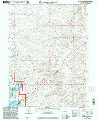
 1980 Firehole Canyon1993 Print · USGSSweetwater County and the tri-state border region are mapped here in the early eighties as the reservoir system reshaped the high desert. Researchers can trace remote settlements like McKinnon and landforms such as Massacre Hill and the Red Creek Badlands.2 unique versions available
 - 1981 Map of Rock Springs
 1981 Rock Springs1981 Print · USGSSweetwater County at the start of the 1980s shows a landscape of industrial energy and historic routes. Trace the path of the Emigrant Trail past Little America or explore mining sites like Westvaco Shaft No 1.
 - 1987 Map of Blacks Fork Bridge
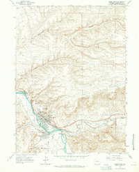
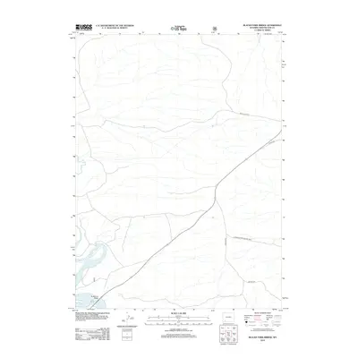
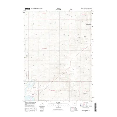
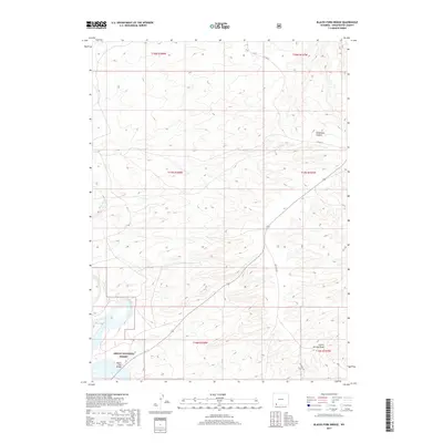
 1987 Blacks Fork Bridge1987 Print · USGSSweetwater County during the late eighties shows a landscape shaped by utility corridors and the expansive Flaming Gorge Reservoir. Researchers can trace the path of Lost Dog Road and locate the historic river crossing at Blacks Fork Bridge.
 - 1987 Map of Whalen Butte
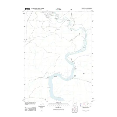
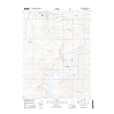
 1987 Whalen Butte1987 Print · USGSThe Green River canyons of Sweetwater County are captured here in the 1980s just as the reservoir reshaped the valley. Researchers can trace historic river bottoms and landmarks like Whalen Butte, Whiskey Bend, and the Green River Airport.
 - 1996 Map of Blacks Fork Bridge, 1999 Print
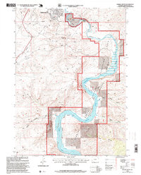
 1996 Blacks Fork Bridge1999 Print · USGSSweetwater County during the late twentieth century reveals a landscape defined by federal land management and water reclamation. Trace the intersection of the Ashley National Forest and Flaming Gorge Reservoir near the Blacks Fork Bridge.
 - 1996 Map of Whalen Butte, 1999 Print
 1996 Whalen Butte1999 Print · USGSThe high desert south of Green River comes into focus during the mid-1990s as the river winds through deep canyons and protected forest lands. Researchers can trace the rugged topography of Whalen Butte and the remote river reaches at Whiskey Bend or Slippery Jim Bottom.
 - 2012 Map of Blacks Fork Bridge, 2012 Print
 2012 Blacks Fork Bridge2012 Print · USGSCovers Green River, including Sweetwater County, United States, and other nearby areas
 - 2012 Map of Whalen Butte, 2012 Print
 2012 Whalen Butte2012 Print · USGSCovers Green River, including Sweetwater County, United States, and other nearby areas
 - 2012 Map of Green River, 2012 Print
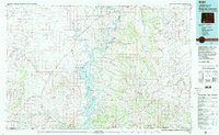
 2012 Green River2012 Print · USGSCovers Green River, including Sweetwater County, United States, and other nearby areas
 - 2012 Map of Peru, 2012 Print
 2012 Peru2012 Print · USGSCovers Green River, including James Town, Sweetwater County, and other nearby areas
 - 2015 Map of Whalen Butte, 2015 Print
 2015 Whalen Butte2015 Print · USGSCovers Green River, including Sweetwater County, United States, and other nearby areas
 - 2015 Map of Peru, 2015 Print
 2015 Peru2015 Print · USGSCovers Green River, including James Town, Sweetwater County, and other nearby areas
 - 2015 Map of Blacks Fork Bridge, 2015 Print
 2015 Blacks Fork Bridge2015 Print · USGSCovers Green River, including Sweetwater County, United States, and other nearby areas
 - 2015 Map of Green River, 2015 Print
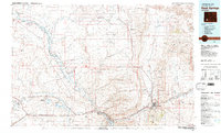
 2015 Green River2015 Print · USGSCovers Green River, including Sweetwater County, United States, and other nearby areas
 - 2017 Map of Whalen Butte, 2017 Print
 2017 Whalen Butte2017 Print · USGSCovers Green River, including Sweetwater County, United States, and other nearby areas
 - 2017 Map of Blacks Fork Bridge, 2017 Print
 2017 Blacks Fork Bridge2017 Print · USGSCovers Green River, including Sweetwater County, United States, and other nearby areas
Showing maps 1-25 of 31
Top cities near Green River
- Rock Springs historical maps
- North Rock Springs historical maps
- Clearview Acres historical maps
- James Town historical maps
- Purple Sage historical maps
Frequently asked questions
- What are the different types of historical maps available for Green River?
- What is the oldest map of Green River?
- Where can I purchase historical maps of Green River for my home or office?
- Where can I download high-res historical maps of Green River?
- Are there historical topographic maps available for Green River?
- Is there historical aerial imagery available for Green River?
- Where are historical maps of Green River sourced from?