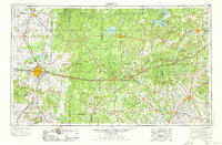
1954 Map of Abilene
USGS Topo · Published 1976About this map
Abilene serves as the focal point of this mid-century landscape, a major transit hub where the Texas and Pacific RR and the Atchison Topeka and Santa Fe RR converge. The presence of Dyess AFB west of the city and the preserved Fort Phantom Hill Ruins to the north highlight the area's dual role in modern defense and frontier history. The terrain is defined by the Callahan Divide and prominent elevations like Eagle Mountain and Steamboat Mtn, which overlook a network of creek systems including Jim Ned Creek and Pecan Bayou.
Find a feature on this map
136 named features on this map. Tap any name to fly to it.
Don’t see what you’re looking for? This feature index may not catch every label — zoom into the map to look around manually.
Map Details
Editions of this 1954 Abilene Map
2 editions found

Other maps of this area

1887 · Coleman
USGS Topo · 1:125,000

1888 · Hamilton
USGS Topo · 1:125,000

1888 · Meridian
USGS Topo · 1:125,000

1889 · Granbury
USGS Topo · 1:125,000

1889 · Brownwood
USGS Topo · 1:125,000

1889 · Coleman
USGS Topo · 1:125,000

1890 · Stephenville
USGS Topo · 1:125,000

1890 · Breckenridge
USGS Topo · 1:125,000

1890 · Abilene
USGS Topo · 1:125,000

1891 · Weatherford
USGS Topo · 1:125,000