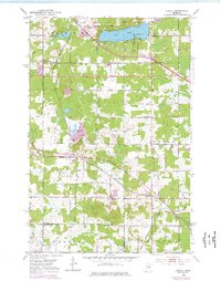
1953 Map of Adolph
USGS Topo · Published 1976About this map
The intersection of rail and rural settlement in St. Louis County is clearly visible on this mid-century survey, photorevised in the early 1970s. The landscape is defined by the heavy rail infrastructure of the Duluth Missabe and Iron Range and the Duluth Winnipeg and Pacific, which converge near the small community of Adolph. These corridors represent the vital transport links for Minnesota's iron ore and timber industries during this era.
Find a feature on this map
31 named features on this map. Tap any name to fly to it.
Don’t see what you’re looking for? This feature index may not catch every label — zoom into the map to look around manually.
Map Details
Editions of this 1953 Adolph Map
5 editions found
Other maps of this area

1895 · Duluth
USGS Topo · 1:62,500

1915 · Superior
USGS Topo · 1:48,000

1917 · Superior
USGS Topo · 1:62,500

1953 · Twig
USGS Topo · 1:24,000

1953 · Saginaw
USGS Topo · 1:24,000

1953 · Adolph
USGS Topo · 1:24,000

1953 · Duluth Heights
USGS Topo · 1:24,000

1953 · Fredenberg
USGS Topo · 1:24,000

1953 · Independence
USGS Topo · 1:24,000

1953 · Duluth
USGS Topo · 1:62,500