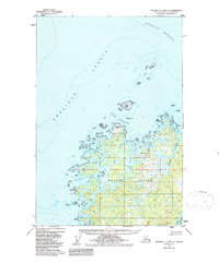
1952 Map of Afognak C-2 and C-3
USGS Topo · Published 1987About this map
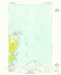
Shuyak Island dominates this northern maritime landscape of the Kodiak Archipelago, where a labyrinth of inlets and passages meets the open waters of the Shelikof Strait. The coastline is defined by complex seafaring landmarks like Party Cape and Eagle Cape, while the surrounding waters are punctuated by hazardous clusters such as Latax Rocks and Starr Rocks. The northern edge of the island is deeply carved by Wonder Bay and Western Inlet, protected from the Stevenson Entrance by Dark Island. This topography suggests a territory shaped by the sea, where interior access was likely entirely dependent on tidal waterways like Carry Inlet and Skiff Passage. To the south, Shuyak Harbor and Neketa Bay provide sheltered anchorages amidst a landscape devoid of roads or trails, as it appeared when photogrammetric methods first mapped this region in the early 1950s.
Find a feature on this map
24 named features on this map. Tap any name to fly to it.
Don’t see what you’re looking for? This feature index may not catch every label — zoom into the map to look around manually.
Map Details
Editions of this 1952 Afognak C-2 and C-3 Map
3 editions found
Other maps of this area

1952 · Afognak
USGS Topo · 1:250,000

1952 · Afognak C-1 and C-2
USGS Topo · 1:63,360
1952 · Afognak C-2 and C-3
USGS Topo · 1:63,360

1952 · Afognak B-2
USGS Topo · 1:63,360

1954 · Afognak B-3
USGS Topo · 1:63,360
1954 · Afognak C-2 and C-3
USGS Topo · 1:63,360

1954 · Afognak B-2
USGS Topo · 1:63,360
1954 · Afognak C-1 and C-2
USGS Topo · 1:63,360
2021 · Afognak B-2 NE
USGS Topo · 1:25,000
2021 · Afognak B-3 NE
USGS Topo · 1:25,000