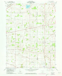
1960 Map of Alvada
USGS Topo · Published 1973About this map
The Old Indian Treaty Boundary slices diagonally across this rural landscape, marking a historical division that still influenced local land lines and township borders during this 1960 survey. Concentrated around the intersection of Hancock and Seneca Counties, the map documents several established agricultural communities, including West Independence, Alvada, and Springville. The era's mid-century character is evident in the presence of the Drive-in Theater and the Radio Towers (WFOB) situated just south of the industrial hub of Fostoria.
Find a feature on this map
30 named features on this map. Tap any name to fly to it.
Don’t see what you’re looking for? This feature index may not catch every label — zoom into the map to look around manually.
Map Details
Editions of this 1960 Alvada Map
2 editions found

Other maps of this area

1901 · Fostoria
USGS Topo · 1:62,500

1903 · Fostoria
USGS Topo · 1:62,500

1903 · Findlay
USGS Topo · 1:62,500

1905 · Arlington
USGS Topo · 1:62,500

1907 · Arlington
USGS Topo · 1:24,000

1907 · Upper Sandusky
USGS Topo · 1:62,500

1950 · Marion
USGS Topo · 1:250,000

1956 · Toledo
USGS Topo · 1:250,000

1960 · Bloomdale
USGS Topo · 1:24,000
1960 · Bascom
USGS Topo · 1:24,000