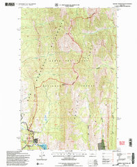
1995 Map of Arsenic Mountain
USGS Topo · Published 1997About this map
Medicine Springs and the northern reaches of the Sun River Game Preserve define this section of the Rocky Mountain Front in the mid-1990s. The landscape transitions from the high peaks of the Sawtooth Range and the Bob Marshall Wilderness down toward the Gibson Reservoir on the Sun River. This 1995 revision reveals a mix of remote high-country infrastructure and recreational outposts, including the K-L Ranch and the JJJ Wilderness Ranch. Traceable historical markers include the White Cabin (Site) and a Gaging Sta near the river, illustrating the importance of water management in this drainage. The drainage network is complex, with Arsenic Creek flowing off the flanks of Arsenic Mountain to join the South Fork Teton River in the north, while Mortimer Gulch and Big George Gulch carve the southeastern slopes.
Find a feature on this map
42 named features on this map. Tap any name to fly to it.
Don’t see what you’re looking for? This feature index may not catch every label — zoom into the map to look around manually.
Map Details
Editions of this 1995 Arsenic Mountain Map
2 editions found
Other maps of this area

1903 · Saypo
USGS Topo · 1:125,000

1955 · Choteau
USGS Topo · 1:250,000

1957 · Choteau
USGS Topo · 1:250,000

1958 · Choteau
USGS Topo · 1:250,000

1958 · Ear Mountain
USGS Topo · 1:24,000

1958 · Our Lake
USGS Topo · 1:24,000

1958 · Sawtooth Ridge
USGS Topo · 1:24,000

1958 · Glenn Creek
USGS Topo · 1:24,000

1958 · Pretty Prairie
USGS Topo · 1:24,000

1958 · Gates Park
USGS Topo · 1:24,000