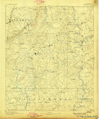
1891 Map of Ashland
USGS Topo · Published 1898About this map
The ridge-and-valley landscape of east-central Alabama is defined here by the parallel rises of the Talladega Mts. and Shinbone Ridge. In the final decade of the 19th century, this area of Clay and Tallapoosa counties was characterized by an economy dependent on the Tallapoosa River and its tributaries, with numerous crossings such as Louina Ferry and Denney Ferry providing essential transit before the era of modern bridges. The Anniston and Atlantic R. R. skirts the northwestern corner near Ironaton, while the interior remains a network of wagon roads connecting the county seat at Ashland with outlying settlements like Lineville, Enitachopco, and Mellow Valley. Many labels preserve the names of early industry and social centers, including Hillabee Mill, Forester Chapel, and the distinctively named Graphite and Idaho mining or prospecting locales.
Find a feature on this map
144 named features on this map. Tap any name to fly to it.
Don’t see what you’re looking for? This feature index may not catch every label — zoom into the map to look around manually.
Map Details
Editions of this 1891 Ashland Map
5 editions found
Other maps of this area

1889 · Tallapoosa
USGS Topo · 1:125,000

1889 · Springville
USGS Topo · 1:125,000

1890 · Talladega
USGS Topo · 1:125,000

1891 · Ashland
USGS Topo · 1:125,000

1892 · Springville
USGS Topo · 1:125,000

1892 · Talladega
USGS Topo · 1:125,000

1892 · Tallapoosa
USGS Topo · 1:125,000

1897 · Tallapoosa
USGS Topo · 1:125,000

1899 · Wedowee
USGS Topo · 1:125,000

1900 · Anniston
USGS Topo · 1:125,000