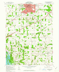
1961 Map of Ashland South
USGS Topo · Published 1963About this map
Ashland dominates the northern portion of this early 1960s survey, showing a thriving community centered around its historic Courthouse and Ashland College. The urban core is well-defined by the Ashland City Bdy, with the Erie Lackawanna Railroad cutting through the center of town. To the south, the landscape shifts into a patchwork of rural townships like Vermillion and Mifflin, where smaller settlements such as Hayesville and Widowville serve as local hubs.
Find a feature on this map
66 named features on this map. Tap any name to fly to it.
Don’t see what you’re looking for? This feature index may not catch every label — zoom into the map to look around manually.
Map Details
Editions of this 1961 Ashland South Map
4 editions found
Other maps of this area

1906 · West Salem
USGS Topo · 1:62,500

1908 · Ashland
USGS Topo · 1:62,500

1908 · West Salem
USGS Topo · 1:62,500

1912 · Loudonville
USGS Topo · 1:62,500

1912 · Perrysville
USGS Topo · 1:62,500

1914 · Loudonville
USGS Topo · 1:62,500

1915 · Perrysville
USGS Topo · 1:62,500

1943 · Loudonville
USGS Topo · 1:62,500

1944 · Perrysville
USGS Topo · 1:62,500

1950 · Marion
USGS Topo · 1:250,000