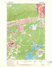
1962 Map of Aurora
USGS Topo · Published 1971About this map
Large-scale industrial mining and processing dominate the Mesabi Range landscape in this mid-century survey. Massive operations like the Erie Mine No 1 Pit and the Taconite Processing Plant define the terrain, carved by extensive rail networks including the Duluth Missabe and Iron Range Railroad Company. These extraction sites contrast with the planned residential layouts of Aurora and the newer development of Hoyt Lakes, which is shown bordering the Superior National Forest. Water management is central to the era's local industry, evidenced by the vast Tailings Pond north of town and the various pumping stations around Colby Lake and Whitewater Lake. Smaller mining landmarks such as the St James Mine and Knox Mine appear alongside community anchors like the Keefe Sch and Forest Hill Cemetery, providing a comprehensive look at an Iron Range company town ecosystem.
Find a feature on this map
45 named features on this map. Tap any name to fly to it.
Don’t see what you’re looking for? This feature index may not catch every label — zoom into the map to look around manually.
Map Details
Editions of this 1962 Aurora Map
4 editions found
Other maps of this area

1949 · Aurora
USGS Topo · 1:24,000

1949 · Isaac Lake
USGS Topo · 1:24,000

1949 · Allen
USGS Topo · 1:24,000

1949 · Embarrass
USGS Topo · 1:24,000

1950 · Isaac Lake
USGS Topo · 1:24,000

1950 · Embarrass
USGS Topo · 1:24,000

1950 · Allen
USGS Topo · 1:24,000

1950 · Aurora
USGS Topo · 1:24,000

1950 · Biwabik
USGS Topo · 1:24,000

1950 · Biwabik NE
USGS Topo · 1:24,000