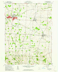
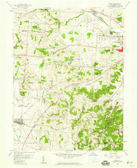
1961 Map of Baltimore
USGS Topo · Published 1962About this map
Baltimore sits at the intersection of Fairfield County’s agricultural traditions and its industrial past, marked by the distinctive path of the Ohio Canal (Abandoned) which once served as a vital artery for transport. By the early 1960s, the New York Central railroad defined the local transit corridor, connecting Thurston and Pleasantville across a landscape of rolling townships like Liberty and Walnut.
Find a feature on this map
41 named features on this map. Tap any name to fly to it.
Don’t see what you’re looking for? This feature index may not catch every label — zoom into the map to look around manually.
Map Details
Editions of this 1961 Baltimore Map
4 editions found
Other maps of this area

1907 · Logan
USGS Topo · 1:62,500

1907 · Lancaster
USGS Topo · 1:62,500

1907 · Thurston
USGS Topo · 1:62,500

1909 · Thornville
USGS Topo · 1:62,500

1909 · Lancaster
USGS Topo · 1:62,500

1909 · Logan
USGS Topo · 1:62,500

1909 · Thurston
USGS Topo · 1:62,500

1947 · Columbus
USGS Topo · 1:250,000

1958 · Carroll
USGS Topo · 1:24,000
1958 · Amanda
USGS Topo · 1:24,000