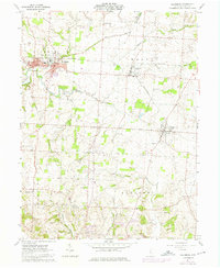
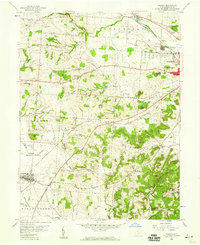
1961 Map of Baltimore
USGS Topo · Published 1975About this map
Walnut Creek and the long-since bypassed route of the Ohio Canal (Abandoned) define the lowlands of northwestern Fairfield County in this mid-century survey. The landscape is a mix of agricultural tracts and growing villages, where the Penn Central rail lines connect the hubs of Baltimore and Thurston. In the south, the terrain becomes more dissected by waterways like Fetters Run and Ewing Run, revealing a rural fabric dotted with historic family and parish burial grounds. Genealogists will find a high density of documented cemeteries, including Warner Cem, McNamee Cem, and the Floral Hills Memory Gardens. The presence of the High Sch in Baltimore and the development around Johnson Park reflect the local civic expansion during this era of photorevision.
Find a feature on this map
35 named features on this map. Tap any name to fly to it.
Don’t see what you’re looking for? This feature index may not catch every label — zoom into the map to look around manually.
Map Details
Editions of this 1961 Baltimore Map
4 editions found
Other maps of this area

1907 · Logan
USGS Topo · 1:62,500

1907 · Lancaster
USGS Topo · 1:62,500

1907 · Thurston
USGS Topo · 1:62,500

1909 · Thornville
USGS Topo · 1:62,500

1909 · Lancaster
USGS Topo · 1:62,500

1909 · Logan
USGS Topo · 1:62,500

1909 · Thurston
USGS Topo · 1:62,500

1947 · Columbus
USGS Topo · 1:250,000

1958 · Carroll
USGS Topo · 1:24,000
1958 · Amanda
USGS Topo · 1:24,000