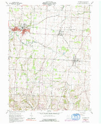
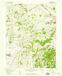
1961 Map of Baltimore
USGS Topo · Published 1992About this map
Settlement patterns in Fairfield County center on the interconnected villages of Baltimore, Thurston, and Pleasantville, all joined by the tracks of the Penn Central railroad. The landscape is a mix of agricultural plots and small industrial sites, including a Fish Hatchery and several Gravel Pit operations. Historically significant for its transit infrastructure, the map clearly identifies the (Abandoned) Canal and the remnants of the Ohio Canal corridor running parallel to the rail line. Numerous family and community burial grounds, such as Warner Cem and McNamee Cem, are scattered throughout the townships of Liberty and Walnut. The southern reaches transition toward more dramatic relief near Floral Hills Memory Gardens, where Fetters Run and Pleasant Run carve through the terrain before meeting Walnut Creek.
Find a feature on this map
40 named features on this map. Tap any name to fly to it.
Don’t see what you’re looking for? This feature index may not catch every label — zoom into the map to look around manually.
Map Details
Editions of this 1961 Baltimore Map
4 editions found
Other maps of this area

1907 · Logan
USGS Topo · 1:62,500

1907 · Lancaster
USGS Topo · 1:62,500

1907 · Thurston
USGS Topo · 1:62,500

1909 · Thornville
USGS Topo · 1:62,500

1909 · Lancaster
USGS Topo · 1:62,500

1909 · Logan
USGS Topo · 1:62,500

1909 · Thurston
USGS Topo · 1:62,500

1947 · Columbus
USGS Topo · 1:250,000

1958 · Carroll
USGS Topo · 1:24,000
1958 · Amanda
USGS Topo · 1:24,000