
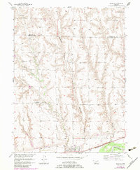
1956 Map of Bartley
USGS Topo · Published 1973About this map
Bartley sits at the southern edge of this mid-century landscape, positioned between the Republican River and the high-plateau farmland of Frontier and Red Willow Counties. The map reveals a transition in rural social infrastructure during the 1950s, recording several educational landmarks that had already ceased operation, such as Fair Hope Sch and Walnut Grove Sch. This pattern of consolidation is evident across the townships, though the Alliance Sch remains a focal point in the northern hills.
Find a feature on this map
24 named features on this map. Tap any name to fly to it.
Don’t see what you’re looking for? This feature index may not catch every label — zoom into the map to look around manually.
Map Details
Editions of this 1956 Bartley Map
3 editions found
Other maps of this area

1954 · McCook
USGS Topo · 1:250,000

1956 · Freedom
USGS Topo · 1:24,000

1956 · Cambridge
USGS Topo · 1:24,000

1956 · Medicine Creek Dam
USGS Topo · 1:24,000

1956 · Bartley NW
USGS Topo · 1:24,000

1956 · Bartley
USGS Topo · 1:24,000

1957 · McCook
USGS Topo · 1:250,000

1957 · Danbury NE
USGS Topo · 1:24,000

1958 · McCook
USGS Topo · 1:250,000

1958 · Danbury NE
USGS Topo · 1:24,000