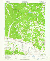
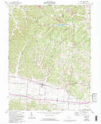
1961 Map of Beaver
USGS Topo · Published 1963About this map
The Beaver community serves as the central hub of this 1961 topographical survey, situated at the intersection of a prominent rail corridor and local highways. The landscape is defined by the heavy timber of the Wayne National Forest and the conservation boundaries of the Liberty Wildlife Area. Local life in the early 1960s centered on a network of country churches and family burial grounds, including Philadelphia Ch and Barton Cem.
Find a feature on this map
51 named features on this map. Tap any name to fly to it.
Don’t see what you’re looking for? This feature index may not catch every label — zoom into the map to look around manually.
Map Details
Editions of this 1961 Beaver Map
5 editions found
Other maps of this area

1906 · Waverly
USGS Topo · 1:62,500

1908 · Waverly
USGS Topo · 1:62,500

1911 · Sciotoville
USGS Topo · 1:62,500

1912 · Oak Hill
USGS Topo · 1:62,500

1913 · Sciotoville
USGS Topo · 1:62,500

1913 · Jackson
USGS Topo · 1:62,500

1944 · Jackson
USGS Topo · 1:62,500

1947 · Columbus
USGS Topo · 1:250,000

1957 · Huntington
USGS Topo · 1:250,000

1960 · Huntington
USGS Topo · 1:250,000