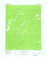
1956 Map of Black River D-2
USGS Topo · Published 1975About this map
Salmon Trout River flows through this remote reach of the Yukon-Koyukuk region, its waters winding through a landscape of high ridges and poorly drained lowlands. Based on 1955 aerial photography and field annotated in 1956, this record captures the drainage patterns of the Kevinjik Creek and David Creek watersheds before modern land use changes. The map depicts a territory largely defined by its natural topography and unsurveyed land lines predetermined by the Bureau of Land Management, offering a pristine look at the geography north of the Arctic Circle during the mid-twentieth century. Researchers can trace the exact course of the river and its tributaries across the Fairbanks Meridian, where swampy areas indicate the terrain's low-relief basins.
Find a feature on this map
3 named features on this map. Tap any name to fly to it.
Don’t see what you’re looking for? This feature index may not catch every label — zoom into the map to look around manually.
Map Details
Editions of this 1956 Black River D-2 Map
3 editions found
Other maps of this area

1951 · Black River
USGS Topo · 1:250,000

1951 · Coleen
USGS Topo · 1:250,000

1956 · Coleen
USGS Topo · 1:250,000

1956 · Black River D-3
USGS Topo · 1:63,360

1956 · Coleen A-1
USGS Topo · 1:63,360

1956 · Coleen A-3
USGS Topo · 1:63,360

1956 · Black River C-2
USGS Topo · 1:63,360

1956 · Black River D-2
USGS Topo · 1:63,360
1956 · Black River C-1
USGS Topo · 1:63,360
1956 · Black River D-1
USGS Topo · 1:63,360